UK Hydrographic Office
- ADMIRALTY
- Our role in government
- Cartographic and international training
- Copyright licensing
- Civil Hydrography Programme (CHP)
- Defence Maritime Geospatial Intelligence Centre (DMGIC)
- HM Nautical Almanac Office (HMNAO)
- UKHO Archive
- UK Maritime Limits and Law of the Sea
- UK Centre for Seabed Mapping (UK CSM)
Featured
News story
UK Hydrographic Office 2025-2026 Annual Report released
The UKHO’s Annual Report and Accounts for 2025 to 2026 is available to view and download

News story
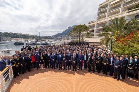
UKHO reflects on successful participation at IHO Assembly 4
The UK Hydrographic Office’s participation at the 4th International Hydrographic Organization Assembly (IHO), held in Monaco.
Press release
UKHO appoints Mark Barclay as Non-Executive Chair
The UKHO announces the appointment of Mark Barclay as its new Non-Executive Chair, bringing extensive defence and aerospace expertise to the role.

Press release
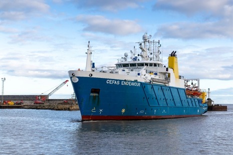
UK scientists unite for seabed survey off the south‑west coast
A four‑week seabed mapping survey will bring together scientists from 11 organisations to improve understanding of the marine environment.
News story
UKHO specialists recognised in New Year Honours
Fiona Bloor and Terry Thatcher from the UKHO have been recognised in the New Year Honours list for outstanding contributions to their respective fields.

News story
UKHO supports UK resilience in positioning, navigation and timing
The UK Hydrographic Office (UKHO) is working with government partners to improve the UK’s resilience in satellite-based Positioning, Navigation and Timing (PNT).
Latest from the UK Hydrographic Office
What we do
The UK Hydrographic Office (UKHO) is a world-leading centre for hydrography, delivering data and expertise to support safe, secure and thriving oceans.
UKHO is an executive agency, sponsored by the Ministry of Defence.
Follow us
Documents
Transparency and freedom of information releases
Our management


Contact UKHO
UK Hydrographic Office
Taunton
Somerset
TA1 2DN
United Kingdom
Main switchboard
+44 (0)1823 484444
Customer complaint handling procedure
Customer Services
+44 (0)1823 484444
Radio Navigational Warnings
Radio Navigational Warnings
+44 (0)1823 353 448
Archives and Research
Archives and Research
+(0)1823 483341
Vertical Offshore Reference Frame (VORF)
Copyright and Licensing
Direct Number
+44 (0)1823 483899
International Cartographic Training
Report a vulnerability on an UKHO system
Admiralty Way
Taunton
Somerset
TA12DN
United Kingdom
The UK Hydrographic Office (UKHO) takes the security of our systems seriously. If you believe you have found a vulnerability on any UKHO system, you can report it using the guidance and policy provided.
Make a Freedom of Information (FOI) request
- Read about the Freedom of Information (FOI) Act and how to make a request.
- Check our previous releases to see if we’ve already answered your question.
- Make a new request by contacting us using the details below.
Freedom of Information Requests
UK Hydrographic Office
Admiralty Way
Taunton
Somerset
TA1 2DN
United Kingdom
UKHO Secretariat
+44 (0)1823 484444 (direct line)
Also to be used for Environmental Information Requests.
UKHO FOIs are released under the MOD publication scheme following the FOI Code of Practice and ICO Guidelines.
High profile groups within UKHO
Corporate information
Jobs and contracts
Read our policy on Social media use. Find out About our services.