Flood and coastal erosion risk management report: 1 April 2019 to 31 March 2020
Updated 30 June 2026
Applies to England

© Crown copyright 2026
This publication is licensed under the terms of the Open Government Licence v3.0 except where otherwise stated. To view this licence, visit nationalarchives.gov.uk/doc/open-government-licence/version/3 or write to the Information Policy Team, The National Archives, Kew, London TW9 4DU, or email: psi@nationalarchives.gov.uk.
Where we have identified any third party copyright information you will need to obtain permission from the copyright holders concerned.
This publication is available at https://www.gov.uk/government/publications/flood-and-coastal-risk-management-national-report/flood-and-coastal-erosion-risk-management-report-1-april-2019-to-31-march-2020
This report summarises activities carried out by risk management authorities (RMAs) in England. This is for the period 1 April 2019 to 31 March 2020. RMAs are:
- the Environment Agency
- lead local flood authorities (LLFAs)
- district councils (where there is no unitary authority)
- internal drainage boards (IDBs)
- water and sewerage companies
- highways authorities
RMAs work together to reduce the risk of flooding and coastal erosion. The Environment Agency also works with the regional flood and coastal committees (RFCCs). The RFCCs:
- bring together RMAs and other local organisations to better understand flood and coastal erosion risks in their region
- ensure there are coherent plans to manage flood and coastal erosion risks across catchments and shorelines
- encourage efficient, targeted and risk-based investment that meets the needs of local communities
- assign funding through a local levy as set out in section 23 of the Flood and Water Management Act (FWMA) 2010
1. Flood risk
Over 5.2 million homes and businesses in England are at risk from flooding. You can check your flood risk using the long term flood risk service. This service gives information on the possible causes of flooding and how to manage the risk.
1.1 Properties at risk of flooding
Sources of flooding include:
- rivers
- the sea
- surface water
- groundwater
Some properties are at risk from more than one source of flooding.
Table 1: properties in areas at risk of flooding from rivers and the sea, and from surface water as of 31 March 2020
| Level of risk | Percentage annual likelihood of flooding | Total number of properties in areas at risk of flooding from rivers and the sea | Number of residential properties in areas at risk of flooding from rivers and the sea | Total number of properties in areas at risk of flooding from surface water | Number of residential properties in areas at risk of flooding from surface water |
|---|---|---|---|---|---|
| High | Greater than 3.3 | 198,000 | 120,000 | 326,000 | 241,000 |
| Medium | 1 to 3.3 | 654,000 | 444,000 | 499,000 | 391,000 |
| Low | 0.1 to 0.99 | 1,012,000 | 773,000 | 2,348,000 | 1,874,000 |
| Very low | Less than 0.1 | 626,000 | 522,000 | not assessed | not assessed |
| Total | not applicable | 2,490,000 | 1,859,000 | 3,173,000 | 2,506,000 |
During a significant flood there is also likely to be damage or disruption to transport services, energy or water infrastructure. As part of the Environment Agency’s long-term investment scenarios 2019 we worked with the University of Oxford to explore these impacts. The results show that for every person affected during a large flood about 16 more suffer knock-on effects from losses of utility services. Over two-thirds of properties in England are served by infrastructure sites and networks located in, or dependent on others located in, areas at risk of flooding.
1.2 Flooding between 1 April 2019 and 31 March 2020
England experienced many periods of prolonged heavy rain between 1 April 2019 and 31 March 2020. Several significant events took place that required a multi-agency response.
1.2.1 Wainfleet, Lincolnshire – June 2019
Between 10 and 12 June 2019, around 2.5 times the monthly average rainfall fell in parts of Lincolnshire. The 10 June was the wettest day ever recorded in the Wainfleet area. A total of 74.6 millimetres (mm) of rain fell in one day. The monthly average for June is 53.13mm. The sheer amount of water in the Steeping River catchment led to a breach in the Wainfleet relief channel.
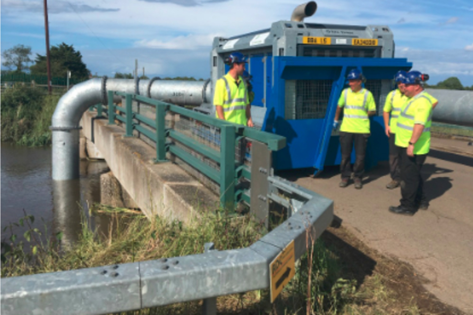
high volume water pump
An RAF Chinook helicopter was brought in to reinforce the bank with more than 340 tonnes of bagged sand. The Environment Agency used ultra-high volume pumps to help the flood water drain away. These pumps removed the volume of 5 Olympic swimming pools of water per hour. Permanent repairs to the breach were completed in August 2019. This included installing steel piles in the bank.
In the East Lindsey District area 88 properties were flooded. A Total of 580 homes were evacuated over 6 days which affected around 1,000 people.
The investigation into the flooding in Wainfleet in June 2019 was published in February 2020.
Immediately after the flooding, the Lincolnshire Floods and Water Management Partnership formed a steering group. The group looked at how flood risk is managed in the Steeping River catchment. The partnership included:
- the Environment Agency
- Lincolnshire County Council
- East Lindsey District Council
- National Farmers Union
- Lindsey Marsh Drainage Board
- Witham Fourth District Internal Drainage Board
The Steeping Catchment Action Plan was published in April 2020.
1.2.2 Wet weather – summer 2019
The summer of 2019 saw significant rainfall. The Met Office confirmed it as the seventh wettest summer (June, July and August) in the UK since 1910.
Thunderstorms caused flooding across parts of northern England at the end of July. On 30 July, 112 mm of rain fell in parts of Yorkshire in 3 hours, twice the average total rainfall for July. Almost 300 properties flooded. Roads and bridges were damaged, resulting in travel disruption. There were some landslips as well as flooding to farmland in areas of North Yorkshire.
Between 8 to 11 and 14 to 16 August a very unsettled spell brought persistent and often heavy rainfalls to northern Britain. Widespread transport disruption was caused by a combination of:
- associated surface water flooding
- landslides
- unseasonal high winds
1.2.3 Toddbrook reservoir – August 2019
At the end of July 2019, following a period of heavy sustained rainfall, water began to cascade down the auxiliary spillway of Toddbrook reservoir in Derbyshire. The reservoir is owned and managed by the Canal and River Trust (CRT). On 1 August 2019 this flow of water triggered the partial collapse of the concrete slabs forming the spillway chute. A major incident was declared. Over 1,500 people were evacuated from the nearby town. Emergency works started to prevent further damage and avoid any potential catastrophic failure of the dam wall. This was the first major incident involving a UK dam in over a decade.
The CRT, supported by a multi-agency team, worked to reduce the water levels in the reservoir. Over 500 one tonne bags of aggregate were installed to shore up and stabilise the spillway. This work meant people could return to their properties within a week.
In September 2019 government announced an independent review. The aim of the review was to ensure that learning from the incident is used to inform reservoir safety. The CRT commissioned a separate technical investigation into the incident. Both CRT report and Toddbrook reservoir independent review were published in March 2020.
1.2.4 Winter flooding - November 2019 to February 2020
Winter 2019 to 2020 was the fifth wettest winter on record in the UK. In November, persistent heavy rain, fell on already saturated catchments. It caused severe flooding from both the River Derwent in Derbyshire and the River Don in South Yorkshire. In December 2019, flooding occurred in the south of England. In February 2020, Storms Ciara, Dennis and Jorge caused widespread flooding.
February 2020 was the wettest February on record. It was also the fifth wettest of any calendar month since 1862. England received 154.9mm of rainfall, which is 258% above the average amount for February. During February 2020, peak river levels were the highest or second highest on record for 13 rivers.
Over 4,600 properties flooded across England between November 2019 and February 2020. The Environment Agency estimate that flood risk management schemes protected almost 130,000 properties in the same period. Our defences also helped to avoid significant economic damages. The economic losses from the winter 2019 to 2020 flooding are estimated to be about £333 million. But the economic damage avoided because of the protection provided is at least 14 times greater, at around £4.6 billion to £9.3 billion.
From satellite imagery we estimate that Storm Ciara impacted over 36,000 hectares of farmland. Storm Dennis impacted over 77,000 hectares.
The Environment Agency issued 19 severe flood warnings during February 2020. We issued 16 of these between 15 to 20 February. A record total of 632 warnings and alerts were issued on 16 February 2020.
Table 2 shows the estimated number of homes and businesses flooded from 1 April 2019 to 31 March 2020. The Environment Agency collates this data. We base it on information received from the public, our flood partners and our staff during a flood event. All figures are subject to change as we continue to confirm and update our records.
Table 2: notable floods from 1 April 2019 to 31 March 2020
| Period of flooding | Environment Agency areas affected | Number of properties flooded |
|---|---|---|
| 10 – 30 June 2019 | Kent, South London and East Sussex | 240 |
| 10 - 30 June 2019 | Lincolnshire and Northamptonshire | 190 |
| 30 July - 12 August 2019 | Yorkshire | 290 |
| 30 July - 12 August 2019 | East Midlands | 40 |
| 30 July - 12 August 2019 | Greater Manchester, Merseyside and Cheshire | 40 |
| 25 -26 October 2019 | West Midlands | 50 |
| 25 -26 October 2019 | Greater Manchester, Merseyside and Cheshire | 40 |
| 25 November – 6 December 2019 | Yorkshire | 540 |
| 25 November – 6 December 2019 | West Midlands | 180 |
| 25 November – 6 December 2019 | East Midlands | 160 |
| 25 November – 6 December 2019 | Lincolnshire and Northamptonshire | 100 |
| 19 – 27 December 2019 | Kent, South London and East Sussex | 60 |
| 19 – 27 December 2019 | Devon, Cornwall and the Isles of Scilly | 30 |
| 6 – 14 February 2020 (Storm Ciara) | Yorkshire | 990 |
| 6 – 14 February 2020 (Storm Ciara) | Cumbria and Lancaster | 200 |
| 6 – 14 February 2020 (Storm Ciara) | Greater Manchester, Merseyside and Cheshire | 140 |
| 14 – 18 February 2020 (Storm Dennis) | West Midlands | 1260 |
| 14 – 18 February 2020 (Storm Dennis) | East Midlands | 210 |
| 18 February – 11 March 2020 | West Midlands | 1200 |
| 18 February – 11 March 2020 | Yorkshire | 140 |
See a map of Environment Agency areas
1.2.5 Local flood investigations
Under section 19 of the FWMA 2010 LLFAs must, upon becoming aware of a flood in their area, investigate:
- which RMAs have the relevant flood risk functions
- whether each of those RMAs has exercised, or is proposing to exercise, those functions in response to the flood
The LLFA decides on the extent of each investigation by considering what is necessary or appropriate. Where an LLFA carries out an investigation, it must:
- publish the results
- notify any relevant RMAs
Between 1 April 2019 and 31 March 2020 LLFAs used the findings most frequently to:
- influence funding priorities
- increase awareness and resilience of local communities
- inform the local flood risk management strategy or action plan
You can request a copy of completed section 19 reports from the investigating LLFA.
1.3 Flood warning registrations
Being prepared for flooding helps reduce the impacts and enables faster recovery. The Environment Agency encourages people to register for its free flood warning service. Alerts and warnings enable the public to take action to protect themselves and their possessions.
The Environment Agency’s flood warning service covers:
- flooding from rivers and the sea
- some properties at risk of groundwater flooding
It does not cover flooding from surface water. LLFAs are responsible for flooding from surface water.
As of 31 March 2020, there were over 1.51 million properties registered to receive flood warnings. This compares to 1.42 million on 31 March 2019. The service will automatically add phone numbers registered in areas at risk of flooding. The Environment Agency is working with 4 major Mobile Network Operators. These are O2, Three, Vodafone and EE. We added Vodafone customers in high risk flood areas to the flood warning service in December 2019.
1.4 Flood alerts, flood warnings and severe flood warnings issued
From 1 April 2019 to 31 March 2020, the Environment Agency issued:
- 4,834 flood alerts
- 2,455 flood warnings
- 27 severe flood warnings
See the What to do in a flood page to see what the different types of warnings mean.
Table 3: number of flood alerts, flood warnings and severe flood warnings for the period 1 April 2019 to 31 March 2020
| Month / year | Flood alert | Flood warning | Severe flood warning |
|---|---|---|---|
| April 2019 | 18 | 0 | 0 |
| May 2019 | 7 | 0 | 0 |
| June 2019 | 219 | 45 | 0 |
| July 2019 | 109 | 73 | 0 |
| August 2019 | 162 | 20 | 1 |
| September 2019 | 472 | 152 | 0 |
| October 2019 | 553 | 258 | 0 |
| November 2019 | 678 | 404 | 7 |
| December 2019 | 665 | 203 | 0 |
| January 2020 | 392 | 61 | 0 |
| February 2020 | 1192 | 1035 | 19 |
| March 2020 | 367 | 199 | 0 |
Table 4: comparison of flood alerts, flood warnings and severe flood warnings issued each year between 2012 and 2020
| Year | Flood alert | Flood warning | Severe flood warning |
|---|---|---|---|
| 1 April 2012 to 31 March 2013 | 4527 | 2093 | 15 |
| 1 April 2013 to 31 March 2014 | 3832 | 1897 | 147 |
| 1 April 2014 to 31 March 2015 | 2154 | 343 | 0 |
| 1 April 2015 to 31 March 2016 | 3432 | 1285 | 103 |
| 1 April 2016 to 31 March 2017 | 2037 | 496 | 25 |
| 1 April 2017 to 31 March 2018 | 2263 | 421 | 0 |
| 1 April 2018 to 31 March 2019 | 1844 | 366 | 0 |
| 1 April 2019 to 31 March 2020 | 4834 | 2455 | 27 |
Since the 1 April 2018 to 31 March 2019 report was published, we have reviewed the flood alert, flood warning and severe flood warning data. There are small discrepancies in the data that have been corrected in the table above. In the:
- 1 April 2017 to 31 March 2018 report we reported 2,271 flood alerts - the correct figure is 2,263
- 1 April 2017 to 31 March 2018 report we reported 420 flood warnings - the correct figure is 421
- 1 April 2018 to 31 March 2019 report we reported 2,210 flood alerts - the correct figure is 1,844
- 1 April 2018 to 31 March 2019 report we reported 852 flood warnings - the correct figure is 366
1.4.1 Flood warning messages sent
From 1 April 2019 to 31 March 2020, the Environment Agency sent 10,713,780 flood warning messages to:
- the public
- partners
- media
The message tells customers about flooding in their area and the flood warning service they can receive. This includes messages sent via text, email and automated telephone call. This was the highest number of messages sent in a single year to date. The increase was as a result of significant flood events and having more users registered to receive our flood warnings.
Table 5: number of messages sent for the period 1 April 2019 to 31 March 2020
| Month / year | Total message attempts |
|---|---|
| Apr 2019 | 74,720 |
| May 2019 | 74,355 |
| Jun 2019 | 410,116 |
| Jul 2019 | 192,731 |
| Aug 2019 | 222,046 |
| Sep 2019 | 1,142,005 |
| Oct 2019 | 1,112,235 |
| Nov 2019 | 1,319,970 |
| Dec 2019 | 1,428,597 |
| Jan 2020 | 557,229 |
| Feb 2020 | 3,127,644 |
| Mar 2020 | 1,052,132 |
Table 6: comparison of messages sent each year between 2012 and 2019
| Years | Messages sent |
|---|---|
| 1 April 2012 to 31 March 2013 | 5,737,247 |
| 1 April 2013 to 31 March 2014 | 6,265,909 |
| 1 April 2014 to 31 March 2015 | 2,492,965 |
| 1 April 2015 to 31 March 2016 | 5,145,689 |
| 1 April 2016 to 31 March 2017 | 2,710,342 |
| 1 April 2017 to 31 March 2018 | 4,403,657 |
| 1 April 2018 to 31 March 2019 | 2,987,759 |
| 1 April 2019 to 31 March 2020 | 10,713,780 |
2. Coastal change
The Futurecoast data and the National Coastal Erosion Risk Map (NCERM) shows that about 1,800 kilometres (km) of open coast is eroding. In some places it’s eroding more than 2 metres per year. About a quarter is eroding at more than 10 centimetres per year. The NCERM indicates that by 2060 about 2,000 properties are at risk of being lost to coastal erosion. This assumes all current shoreline management plan (SMP) policies are implemented.
Coastal erosion causes permanent loss to property and infrastructure. This can have a significant impact on local economies in and outside the affected area.
Coast protection authorities (CPAs) have permissive powers. These powers allow them to carry out flood and coastal erosion risk management works. This includes projects to limit erosion, such as beach recharge or sandscaping.
Sandscaping involves using a large ship to pump sand on to the beach. The sand is then positioned using bulldozers.
Several CPAs on the east coast of England have helped to facilitate adaptation to future coastal change. In some areas CPAs have been unable to build or maintain coastal risk management structures. In these areas CPAs have offered support and guidance to those whose homes are at risk. Residents whose home is at risk from coastal erosion may be able to build a replacement home further inland. This is known as ‘rollback’. This is subject to conditions and residents will also need to apply for planning permission.
The government’s National Planning Policy Framework (NPPF) is clear about reducing the risk from coastal change by:
- avoiding inappropriate development in vulnerable areas
- not exacerbating the impacts of physical changes to the coast
Local planning authorities (LPAs) are encouraged to:
- ensure spatial plans embed local shoreline management plan policies
- identify coastal change management areas (CCMAs)
CCMAs are where rates of shoreline change are significant over the next 100 years, taking account of climate change.
CCMAs should make provision for any vulnerable properties and infrastructure that may need to be rolled back from the coastline in future.
2.1 Shoreline management plans
Shoreline management plans (SMPs) provide a framework for coastal adaptation, investment and spatial planning. They identify a sustainable management approach for each stretch of coastline in the:
- short-term (0 to 20 years)
- medium term (20 to 50 years)
- long term (50 to 100 years)
Over the last year there have been no changes to management policies set out in the SMPs. Coastal Groups and RFCCs continue to check and scrutinise progress against the SMP action plans. The actions range from:
- implementing projects in the 6 year investment programme
- ongoing engagement or monitoring activities
Discussions continue about:
- how to action the policies in these plans
- what contribution local businesses and communities can make
- when to make decisions about improving flood risk management assets or withdrawing investment
The government is working with coastal authorities to refresh the SMPs developed between 2006 and 2012. The Environment Agency is co-ordinating the £1 million project with support from the 7 coastal groups in England. Following on from meetings between October and December 2019, a series of ‘health check’ reports for each SMP were produced. We also developed a guidance package to supplement the Department for Environment, Food and Rural Affairs (Defra) 2005 guidance on SMP development.
The refresh will ensure that SMPs are up to date and using the best evidence for their recommendations. This will support planning and investment at the coast into the next century. It’s also an opportunity to ensure that:
- we are doing all we can to steer coastal management on a sustainable course
- coastal authorities have a properly resourced plan to achieve this
As part of the refresh, the Environment Agency is working with the North West Coastal Group to explore options to make SMP information more accessible online.
2.2 Coastal habitats
Flood and coastal erosion risk management (FCERM) schemes can sometimes cause loss of valuable coastal habitat. When building and maintaining FCERM assets the Environment Agency must compensate for:
- any lost habitats
- a loss in the quality of habitats
Most losses will arise from what is called coastal squeeze. This is where flood risk management assets prevent the natural landward migration of habitats. Compensation in these cases normally involves creating new habitat. We produce long-term forecasts for how much habitat we expect to lose from coastal squeeze.
Since the early 2000s, the Environment Agency has had a national Habitat Compensation Programme. This programme plays an important role in monitoring habitat gains and losses. It also supports the development of replacement habitat to overcome the losses and increase carbon storage.
The Environment Agency reports on habitat created to offset habitat lost in protected areas in England. We submitted our second report to Defra in January 2018. We will submit the next report in 2021. A copy of the 2018 report is available on request by contacting enquiries@environment-agency.gov.uk.
2.2.1 Inter-tidal saltmarsh and mudflats
The Habitats Regulations came into UK law in 1994. Inter-tidal saltmarsh and mudflat habitats are at most risk from coastal squeeze. The Environment Agency uses realignment schemes to restore saltmarshes and create new areas of habitat.
Our knowledge and engineering of saltmarsh restoration has improved significantly over time. Saltmarsh restoration is slow. It can take several decades for a restored marsh to operate as a natural marsh. However, restored saltmarshes can store carbon, filter out excess nutrients and provide other environmental benefits. These can happen within a few years of creation. Recent large-scale saltmarsh creation projects include Medmerry in West Sussex and Steart in Somerset.
Since the early 2000s, we have created over 900 hectares of inter-tidal habitat (saltmarsh and mud flats). This has provided compensation for internationally protected habitats. However, we expect to continue to lose coastal habitat as a result of sea level rise over time. We are monitoring long-term habitat change at a regional level. The programme also identifies potential sites for further habitat creation.
The Environment Agency is leading on the Restoring Meadows, Marsh and Reef initiative. This is a project to restore saltmarsh and other estuarine and coastal habitats beyond what is needed to compensate for habitat losses. It is still in its early stages with a focus on:
- facilitating funding
- guidance
- regulatory issues when undertaking estuarine and coastal restoration projects
In the future it aims to engage in more direct restoration work.
2.2.2 Other coastal habitats
Other protected habitats around the coast also experience pressure from FCERM activity. These include:
- saline lagoons and vegetated shingle
- freshwater habitats such as reed bed and coastal grazing marsh
The Environment Agency has created 600 hectares of these habitats since the early 2000s. These have compensated for losses associated with coastal erosion and coastal change. These are mainly reed bed and grazing marsh situated on the east and south-east coast. We need to continue to create these habitats as there are likely to be losses as a result of future schemes.
3. Measuring changes in flood and coastal risk over time
3.1 Changes in properties at risk from flooding and coastal change
Numbers of properties at risk from flooding and coastal change will fluctuate over time. This is due to a range of factors including:
- new development pressures
- changes to the natural environment
- the increasing impacts of climate change
- investment in building and maintaining flood and sea defences
- ageing defences that are not maintained or replaced
All these factors will influence the total number of properties at risk of flooding in any given year and in any given place.
The Environment Agency uses flood mapping and modelling to understand the risk of flooding at national and local levels. We developed our current National Flood Risk Assessment (NaFRA) tool in the early 2000s. It provides risk information on flooding from rivers and the sea. Since then we have significantly improved our:
- mapping and modelling
- understanding of flood risk from other sources such as surface water
In 2018 this led to a significant national scale update to our baseline for measuring changes in risk.
Table 7 shows the properties at medium or high risk from rivers and the sea over the last 5 years. A medium or high risk is equal to or greater than 1% annual likelihood of flooding. Our NaFRA tool indicates there are 47,000 fewer properties with a medium to high risk of flooding in 2019 to 2020 compared with 2015 to 2016. During the same period over 242,000 properties were better protected as a result of FCERM projects.
Table 7: properties at risk of flooding from 1 April to 31 March for each year
| Source of flooding | 2015 to 2016 | 2016 to 2017 | 2017 to 2018 | 2018 to 2019 | 2019 to 2020 |
|---|---|---|---|---|---|
| Rivers and the sea | 2.7 million | 2.7 million | 2.6 million | 2.5 million | 2.5 million |
| Rivers and the sea of which, medium/high risk | 899,000 | 897,000 | 897,000 | 872,000 | 852,000 |
| Surface water | 3 million | 3.2 million | 3.2 million | 3.2 million | 3.2 million |
| Rivers, the sea and surface water | 660,000 | 660,000 | 660,000 | 660,000 | 660,000 |
| Groundwater | 122,000 – 290,000 | 122,000 – 290,000 | 122,000 – 290,000 | 122,000 – 290,000 | 122,000 – 290,000 |
The figures for groundwater in table 7 may include properties at risk of flooding from surface water.
3.2 New national flood risk assessment
The Environment Agency is undertaking a project to identify how we can better track and assess changes in flood and coastal risk over time. Our understanding of measuring risk over time will be improved by a new National Flood Risk Assessment. It will provide a single picture of current and future flood risk from rivers, the sea and surface water. The new National Flood Risk Assessment will be available as open data. It will provide more accessible and trusted data for making good investment decisions. We expect to launch the new National Flood Risk Assessment by 2024.
4. Investing to manage risk
Understanding flood and coastal erosion risk allows us to identify and take appropriate actions to manage it.
4.1 Investment in FCERM
The current 6 year programme of FCERM schemes runs from 1 April 2015 to 31 March 2021. The government made a commitment to invest £2.6 billion over this period to better protect 300,000 homes. From 1 April 2015 to 31 March 2020, the government has invested about £2.2 billion of capital funding in FCERM. Of this, the Environment Agency has distributed £492 million to other RMAs. This includes LLFAs and IDBs who use the funding for FCERM schemes.
The government invested £501 million of capital funding in FCERM from 1 April 2019 to 31 March 2020. From 1 April 2015 to 31 March 2020, LLFAs have invested £137 million of capital local levy in FCERM. The local levy is a fund raised from LLFAs by the Environment Agency for RFCC local priority FCERM projects.
Funding for FCERM schemes is allocated through the government’s partnership funding policy. More funding is available for schemes that:
- better protect a greater number of homes
- better protect a greater number of homes in deprived areas
- provide wider economic benefits
- create or enhance habitats
Some schemes will not qualify for full funding from government. Partnership funding contributions supplement government funding so that it can go further. This gives more communities the opportunity to invest in and benefit from local FCERM measures that could not be funded by central government alone.
The Environment Agency reviews the programme of FCERM schemes each year to make sure that we:
- get the best value for money
- reach the target of 300,000 homes protected between 2015 and 2021
Investment is prioritised where the risk is highest. This is regardless of where it is in the country. Each scheme is carefully considered to identify where most people and property will benefit. The Environment Agency also ensures that funding is available for FCERM projects up to 2021. This means the amount of funding invested each year can vary.
Table 8: FCERM capital investment type from 1 April to 31 March for each year in £ millions
| Year | Central government (£millions) | Local levy (£millions) | Funding from other sources (£millions) |
|---|---|---|---|
| 2015 to 2016 | £391 | £16 | £31 |
| 2016 to 2017 | £447 | £23 | £32 |
| 2017 to 2018 | £403 | £28 | £31 |
| 2018 to 2019 | £453 | £33 | £24 |
| 2019 to 2020 | £501 | £36 | £33 |
4.2 Investment across England
Allocations of FCERM grant-in-aid are based on the benefits that individual projects provide. They are supported by contributions from partners and benefactors.
Between 1 April 2019 and 31 March 2020 this included almost £120 million of government funding for Yorkshire and the Humber. Large projects around Hull, such as the Hull frontage scheme, are essential to reducing flood risk.
Table 9 shows the FCERM government investment per Office for National Statistics (ONS) region each year between 1 April to 31 March in £ millions.
| ONS region | 2015-2016 £ millions | 2016-2017 £ millions | 2017-2018 £ millions | 2018-2019 £ millions | 2019-2020 £ millions |
|---|---|---|---|---|---|
| East Midlands | £29 | £37 | £39 | £57 | £65 |
| East of England | £68 | £35 | £31 | £42 | £53 |
| London | £16 | £25 | £29 | £27 | £31 |
| North East | £16 | £14 | £12 | £12 | £10 |
| North West | £51 | £72 | £39 | £47 | £52 |
| South East | £67 | £62 | £84 | £76 | £71 |
| South West | £41 | £50 | £45 | £47 | £44 |
| West Midlands | £13 | £14 | £15 | £24 | £31 |
| Yorkshire and the Humber | £55 | £87 | £64 | £84 | £119 |
| Other | £33 | £52 | £44 | £35 | £26 |
| Total | £391 | £447 | £403 | £453 | £501 |
4.3 Significant schemes completed
Government set a target to better protect 300,000 homes from flood and coastal erosion between 1 April 2015 and 31 March 2021.
Between 1 April 2019 and 31 March 2020, the Environment Agency worked with other RMAs to complete 176 FCERM schemes. Most of these schemes (73) were built to better protect people and homes from the risk of flooding from rivers. The rest better protected people and homes from:
- flooding from the sea (36)
- flooding from surface water (54)
- coastal erosion (13)
In total, these schemes helped better protect:
- 45,496 homes from flooding – 3,773 of these are in areas of significant flood risk and socio-economic multiple deprivation
- 3,243 homes from coastal erosion - 129 of these are in areas of significant flood risk and socio-economic multiple deprivation
Table 10: examples of significant schemes better protecting homes between 1 April 2019 to 31 March 2020
| Scheme name | RFCC | Cost of scheme in £ millions | Number of homes better protected |
|---|---|---|---|
| Humber: Hull Frontage | Yorkshire | £27.3 | 14,750 |
| Anlaby and East Ella Flood Alleviation Scheme | Yorkshire | £20.3 | 1,330 |
| Cottingham and Orchard Park Flood Alleviation Scheme | Yorkshire | £19.7 | 1,008 |
| Hull River Defences - Phase 1 | Yorkshire | £46 | 968 |
| Team 2100 Programme - Thames Delivery | Thames | £154 | 2,358 |
| Derby Flood Risk Management Scheme | Trent | £98.8 | 810 |
| Mereway Sluice, Twickenham - Gate Replacement | Thames | £2.1 | 545 |
| Sheerness Defences Structural Repairs | Southern | £1.5 | 535 |
| Dunstan Park Flood Alleviation Scheme | Thames | £2 | 512 |
The total cost of a scheme in table 10 is for all funding sources and for all years. This includes all prior and future years funding, as some of these schemes will better protect more homes in future years.
Case study 1: Humber, Hull frontages
The Hull Frontage scheme is upgrading the flood defences along the edge of the Humber Estuary. This will increase the protection for the city of Hull from tidal flooding.
The £42 million scheme will reduce the risk of flooding from the estuary for 113,000 properties. Over 28,000 of these properties should then move to a lower flood risk band as a result. Tidal flood defences at 8 locations along the estuary foreshore will be upgraded.
In total more than 7 kilometres of tidal flood defences along the estuary frontage will be improved.
As well as better protecting people and homes, FCERM schemes can have additional benefits. They can help to better protect businesses, infrastructure and agricultural land.
Table 11: other benefits of FCERM schemes from 2011 to 2020
| Year from 1 April to 31 March | Agricultural land (ha) | Commercial properties | Roads (km) | Rail (km) |
|---|---|---|---|---|
| 2011 to 2012 | 74,011 | 5,572 | 1,800 | 107 |
| 2012 to 2013 | 75,645 | 5,874 | 1,774 | 75 |
| 2013 to 2014 | 84,106 | 5,487 | 2,247 | 54 |
| 2014 to 2015 | 100,580 | 11,282 | 2,340 | 122 |
| 2015 to 2016 | 74,644 | 11,500 | 1,854 | 150 |
| 2016 to 2017 | 30,442 | 7,041 | 1,090 | 51 |
| 2017 to 2018 | 32,838 | 7,595 | 1,176 | 55 |
| 2018 to 2019 | 36,307 | 8,677 | 1,343 | 63 |
| 2019 to 2020 | 28,382 | 8,333 | 1,591 | 117 |
4.4 Households protected in the 20% most deprived areas in England
The partnership funding policy provides an incentive to invest in deprived areas. During 1 April 2019 to 31 March 2020 the investment programme better protected 45,496 homes from flooding. Of these 3,773 are in the 20% most deprived areas in England. They have moved from the very significant or significant flood risk categories to the moderate or low categories.
The English indices of deprivation measure relative deprivation in small areas in England called lower-layer super output areas (LSOA). The index of multiple deprivation is the most widely used of these indices. Each LSOA is ranked according to its level of deprivation.
Table 12: Number of households in the 20% most deprived areas of England better protected from flooding between 2011 and 2019
| Year | Total number of households better protected | Number of households in the 20% most deprived areas better protected | Percentage of households better protected that are in the 20% most deprived areas |
|---|---|---|---|
| 2011 | 44,030 | 1,592 | 3.6% |
| 2012 | 54,705 | 4,101 | 7.5% |
| 2013 | 36,031 | 8,810 | 24.5% |
| 2014 | 31,756 | 9,111 | 28.7% |
| 2015 | 48,848 | 11,929 | 24.4% |
| 2016 | 39,603 | 6,953 | 17.6% |
| 2017 | 44,372 | 6,510 | 14.7% |
| 2018 | 49,127 | 6,854 | 14% |
| 2019 | 45,496 | 3,773 | 8.3% |
The proportion of all homes better protected that were in the 20% most deprived areas increased from 4% in 2011 to 29% in 2014. This then declined to 8% in 2019. Flood inequalities still exist for deprived communities. The disparity is particularly marked in coastal and rural areas. The Environment Agency recently published an update to the 2006 social deprivation and the likelihood of flooding study. This study examined whether deprived areas were more at risk of flooding. The updated analysis found that improvements have been made in deprived areas. This is because of significant investment in flood defences over the last 15 years. The updated analysis is based on 2018 data.
4.5 Maintaining flood risk management assets
Between 1 April 2015 and 31 March 2020, the government has spent over £1 billion on maintaining flood risk management (FRM) assets. Between 1 April 2019 and 31 March 2020, the Environment Agency invested over £200 million on maintaining FRM assets.
The investment includes developing technology and maintenance activities, such as:
- inspecting, maintaining and operating assets
- channel maintenance
We maintain around 77,000 assets that have a flood or coastal risk management purpose in England. These include:
- 5,200km of defences on main rivers
- 1,200km of tidal defences
- 600km of coastal defences
- 20,000 structures
- 200km of culverts
We regularly inspect over 175,000 FRM assets. These are maintained by:
- the Environment Agency
- other RMAs
- third parties
At 31 March 2020, 96.1% of Environment Agency maintained flood risk assets in high consequence FRM systems were in the required condition. A high consequence system is a location where there is a high concentration of properties. Flood risk is reduced by several flood defences working together to protect that area. Assets that are below the required condition need extra maintenance work. It does not mean they have structurally failed or that performance in a flood is compromised. If an asset’s performance is reduced, we will take action to manage flood risk until it is repaired or replaced.
The severe flooding during winter 2019 to 2020 damaged many assets. This caused extra inspections to be carried out. Programmed asset inspections were also disrupted by the flooding. Repairs are in progress and mitigation measures are in place where repairs are delayed. The work has continued, having slowed as we established safe ways of working during the Coronavirus (COVID-19) pandemic.
In April 2020, the government announced a £120 million package. This was to conduct repairs and further bolster defences that flooded during winter 2019 to 2020. The Environment Agency carried inspections of impacted assets. We are prioritising repairs to those assets that are below the required condition.
Details of planned maintenance activities are published in the river and coastal maintenance programme.
4.6 Efficiency savings
The Environment Agency is required to report to government about FCERM efficiency. This is to achieve the best possible value for the investment of public funds. This is a rule of HM Treasury. Opportunities to improve efficiencies come from:
- national initiatives that allow operational improvements
- local project specific activities
Savings are achieved through:
- innovation
- value engineering
- longer-term planning and packaging of work
The total efficiencies achieved since April 2015 is £228 million. Efficiencies vary from year to year. They depend on:
- the FCERM funding allocation for that year
- individual project completion dates
Table 13: FCERM efficiencies achieved between 2015 and 2020
| Period | 2015/16 | 2016/17 | 2017/18 | 2018/19 | 2019/20 |
|---|---|---|---|---|---|
| Efficiency savings in £ millions | £50 | £40 | £45 | £43 | £50 |
Case study 2: Efficiency at Trinity Hospital using Pali Radice piling
In 2018 the Thames Estuary Asset Management (TEAM) 2100 Programme was tasked with the major repair of the existing retaining wall at Trinity Hospital, Greenwich.
The Environment Agency employed Keller UK to design a way to underpin the wall. The design used a foundation system called Pali Radice (Root Pile), instead of a traditional sheet-piled wall.
This innovative solution involved piling through the structure. This formed a direct connection between the foundation and the subsoil strata. This gave the structure ‘roots’ and removed the risk of further settlement.
The Pali Radice piling system has been used by engineers throughout the world to strengthen existing foundations. The equipment and techniques are designed to minimise vibration and noise. They can also be used in areas of restricted access.
This was the first time this innovative solution was used to repair River Thames flood defence assets. It provided an efficiency saving of £751,384 including a 4-week programme saving. It was completed in 2019.

5. Reducing risk and minimising consequences
Flooding and coastal erosion cannot be eliminated but we can reduce the risk. This requires a variety of approaches and partnership working with other RMAs and organisations.
5.1 Consultation on draft National FCERM Strategy
The original National FCERM Strategy for England was published in 2011. It provided a framework for action by all RMAs to tackle all sources of flooding and coastal change. Now is the right time to produce a new strategy because of improvements in our:
- understanding of climate science
- learning from flood events
- developments in policy
On 9 May 2019 the Environment Agency launched an 8 week formal consultation on a new FCERM Strategy (the Strategy). The consultation received over 400 responses. This new Strategy was developed with over 90 organisations. They showed significant support for the Strategy’s ambitions, objectives and measures.
As a result of the feedback, we made changes while finalising the Strategy. These included:
- improved description of roles and responsibilities of RMAs
- strengthened messages on place-based resilience, flood risk and new development and the role of nature based solutions and integrated catchment management
- better recognition of climate change mitigation and adaptation
- inclusion of the government’s commitment to achieving net zero
- greater emphasis on the Environment and Agriculture Bills
- better recognition of the role of farmers and land managers in reducing flood risk
- clearer proposals for working with infrastructure providers on resilience
- inclusion of the Budget 2020 outcomes
5.2 Development in areas at risk of flooding
To keep pace with the demand for new housing the government aims to build 300,000 new homes per year by the mid-2020s.
The NPPF makes it clear that inappropriate development in areas at risk of flooding should be avoided. New homes must be safe from flooding, including future risks from climate change. New development must not increase flooding elsewhere. Where it is not possible to avoid flood risk areas, new development should be built in a flood resilient way. The Environment Agency has an important voice in helping to achieve this through our role as a statutory planning advisor to LPAs. Our aim is to support sustainable development by engaging with and advising developers and planners. By doing this we aim to get the right kind of sustainable growth in the right places.
We respond to approximately 11,000 planning applications each year. We provide detailed flood risk advice on around 7,000. Our flood risk planning advice stops around 40,000 properties from being built each year in an unsafe way or unsafe location. Investing in flood risk planning advice makes good sense. For every £1 we spend providing advice, around £12 of future flood damages are avoided.
We comment on development proposals:
- in areas that are currently at medium or high risk of flooding from rivers and the sea
- in areas with critical drainage problems
- within 20 metres of a main river
Between 1 April 2019 and 31 March 2020:
- over 95% of all planning decisions were in line with Environment Agency advice on flood risk
- 97.6% of new homes proposed in planning applications complied with Environment Agency advice on flood risk
- planning permission for 866 homes was granted against Environment Agency advice on flood risk
We recorded the decision notices for 1,786 cases where we lodged flood risk objections. These cases involved 37,443 homes in total.
The Environment Agency records a sample of the decision notices from local planning authority web pages. This provides an overview of the outcome of decision notices across England. It is not a full picture of where our advice has not been followed. We publish a comprehensive list of all applications where we’ve lodged objections on flood risk grounds. But, many of the issues will have been resolved before a final decision was made.
Table 14: planning applications reviewed by the Environment Agency and determined in line with its advice between 1 April 2019 to 31 March 2020
| Type of action | Total |
|---|---|
| Planning applications responded to | 11,231 |
| Planning applications which required detailed flood risk advice | 7,077 |
| Number of planning decisions recorded that related to flood risk objections | 1,786 |
| Number of homes granted planning permission contrary to Environment Agency flood risk advice | 866 |
| Number of planning decisions recorded in line with our advice | 1,704 |
| Number of planning decisions made contrary to our flood risk advice | 82 |
| % of planning applications determined in line with the Environment Agency’s advice | 95.4% |
| % of residential properties in planning applications in line with our advice | 97.6% |
5.3 Planning policy, guidance and research
On 12 March 2020 the Ministry of Housing, Communities and Local Government announced ‘Planning for the future’. It included a commitment to review the government’s policy for building in flood risk areas. The ‘planning for the future’ consultation opened on 6 August 2020. It contained proposed reforms of the planning system to modernise the planning process. The Environment Agency is working with government to gather evidence and identify ways to improve current policies and processes.
In August 2019 the Environment Agency updated the guidance on how to prepare a strategic flood risk assessment. This guidance is for LPAs. It includes detailed guidance on how to prepare these crucial documents. In particular it encourages LPAs to take full account of all sources of flood risk and the impacts of climate change. The strategic flood risk assessment should be published online in a readily-updatable format.
In December 2019 we updated the guidance on how to account for climate change when preparing strategic or site-specific flood risk assessments. This guidance is for developers and LPAs. It now reflects the latest climate science on sea level rise from UK Climate Projections 2018 (UKCP18). Further work is ongoing to understand the implications of UKCP18 for rainfall and river flows. We expect to update the guidance again in 2021.
In September 2019, the Environment Agency and the Association of Directors of Environment, Economy, Planning and published new guidance on flood risk emergency plans for new development. The guidance is for LPAs to help them consider whether proposed development will be safe. The guidance:
- helps LPAs consider and decide if applicants need to include a flood risk emergency plan and what the plan could include
- encourages LPAs to produce their own guidelines and set up local consultation arrangements to ensure emergency plans are fit-for-purpose and receive proper scrutiny
- also provides a framework for the appraisal of emergency plans in the absence of local arrangements
5.4 Sustainable drainage systems (SuDS)
The Environment Agency and Defra have worked with Water UK to:
- assess if there are barriers to the effective adoption of SuDS by water companies
- identify how these barriers could be overcome
New sewerage sector guidance has been developed by Water UK and approved by Ofwat. It includes guidance for developers when planning, designing and constructing foul and surface water drainage systems. It will allow water and sewerage companies to adopt a wider range of sewer types, including some SuDS. The new rules were effective from 1 April 2020.
The government is committed to reviewing the non-statutory technical standards for SuDS, published in 2015. These technical standards relate to the design, construction, operation and maintenance of SuDS. The review will explore whether updating the standards could help create SuDS that provide multiple benefits in addition to managing surface water runoff. The findings of this research will also inform future approaches to increase uptake of effective SuDS and support the aims of the NPPF.
5.5 Property resilience pathfinders
On 22 July 2019 government allocated funding up to £700,000 to each of 3 pathfinder projects. The funding is for further research into property-level measures and their uptake. The 3 projects are community focused:
- Yorkshire Future Flood Resilience Pathfinder project (led by City of York Council)
- Oxford-Cambridge Pathfinder (led by Northamptonshire County Council)
- South West Partnership project (led by Cornwall Council)
The funding is providing:
- new research initiatives into behaviour, education, training, funding, data and information
- demonstration and advice centres are being established in Hull, Exeter and near Oxford
- outreach and engagement with local communities, sensitive to COVID-19 limitations
- online advice to help people learn about the benefits of installing measures in their homes and where to get trusted support
The Environment Agency is supporting these projects to highlight successes and identify lessons later in 2021. We will use this information to encourage greater use of flood resilient property measures across the country.
5.6 Water and sewerage companies
Between 1 April 2019 and 31 March 2020, water companies invested:
- £132 million to reduce the risk of sewer flooding to properties
- £300 million to maintain the public sewer system to prevent blockages and flooding
- £2 million in property-level protection and mitigation measures to reduce the likelihood of sewer flooding
Under the FWMA 2010, water companies are classed as RMAs. This means they have to act in a manner consistent with the National FCERM Strategy for England. They also have a duty to cooperate with other RMAs. Between 1 April 2019 and 31 March 2020 water companies have:
- developed their Drainage and Wastewater Management Plans specifically the strategic context and baseline risk assessments
-
finalised their price review 2019 business plans
-
shared data with other RMAs to support flood risk assessments
-
produced integrated drainage models to better understand the risk of flooding
- worked with partners to reduce flood risk to communities and enhance the environment
- enhanced the resilience of their networks and services to flooding
-
exercised incident management and winter preparedness plans
-
continued to innovate and share good practice
- continued to discharge their reservoir safety responsibilities
There have been good examples of partnership working this year, including:
-
Severn Trent Water and Nottinghamshire County Council’s Strategic Scheme for Newark in 2020 (see case study 2)
-
Wessex Water and Bristol City Council’s RESilience to Cope with Climate change in Urban arEas project - this was an EU funded project to develop a resilience action plan for the City of Bristol
-
Thames Water and London Borough of Hammersmith and Fulham’s Counters Creek Flood scheme - helping to protect 1,230 properties from basement sewer flooding
Case study 3: Strategic scheme for water – Newark, Nottinghamshire
Partners: Severn Trent Water (scheme lead) and Nottinghamshire County Council
In Newark, 379 properties were at long standing risk of internal or external sewer flooding. This was as a result of hydraulic deficiencies in the existing sewerage system. Some households faced bi-annual flooding for over 20 years. A further 44 properties were often affected by surface water flooding.
The partners provided 15 miles of new and improved water and sewer pipes. Along with an extra 101 highway gullies, Newark is better protected from flooding and has a reliable water supply to last generations.
5.7 Surface water management action plan
In July 2018 Defra published a surface water management action plan. It sets out the actions to improve our understanding of the risks and the way we manage them. Since then, the government, Environment Agency and partners have been implementing the actions.
These actions include the Boosting Surface Water Mapping project. The money for this project was announced in the 2018 Autumn Statement. As part of this project, the Environment Agency awarded £2 million to 28 LLFAs to carry out surface water risk mapping. The project covers an area of more than 1,500km2 across 102 locations in England. The new maps provide risk information for over 1.04 million residential properties. It will be a major help in targeting investment and action to manage risk.
We have also improved the way we provide information on our long term flood risk information service. The search results now include detail on:
• the role of LLFAs in managing flood risk from surface water
• which LLFA to contact for further information
Defra and the Environment Agency are working together to implement other actions in the Surface Water Management Action Plan. Notable highlights during the reporting period, include:
- developing the new FCERM Strategy, which clarifies roles and responsibilities for surface water management
- workshops with RMAs to build knowledge sharing and technical capability
- a workshop with Defra, Water UK and surface water drainage asset owners - to share knowledge and understanding about surface water drainage capacity
- Defra’s ongoing review of the funding sources available for surface water risk management
5.8 Flood risk activities – environmental permitting
The Environment Agency regulates work on or near main rivers through environmental permits. We continue to improve our service to ensure our customers and partners receive value for money. We have simplified the permitting approach. The Environmental Permitting (England and Wales) Regulations 2016 allow the Environment Agency to make standard rules permits for lower risk activities. For each activity there is a set of rules and a risk assessment.
Where a customer can confirm they can operate to these rules, we can administer these permits more quickly and at a lower cost. For example, the construction of a small scale drainage outfall which will not impact the environment.
Following a public consultation between November 2018 and January 2019 we created new and amended existing standard rules. We did this by reducing screening distances to sensitive sites. We published the new and amended standard rules in August 2019.
The Environment Agency also introduced multi-site permits in May 2019. These allow multiple or repeated activities to take place along a river stretch, such as bank erosion repairs. A range of customers have benefited from multi-site permits including:
- environmental groups
- landowners
- engineering contractors
The flexibility around multi-site permits has seen their popularity and uptake increase. Currently they make up around 10 to 15% of the permissions we issue annually. We expect this number to continue to grow.
Following customer feedback, we’ve also provided clarity on our permitting charges. We have reviewed the activity defined as non-commercial activities undertaken for the purpose of environmental improvement. As a result, this category now includes any works associated with environmental improvement, which means lower charges for schemes that enhance the environment.
5.9 Natural flood management
Natural Flood Management (NFM) protects, restores or copies the natural function of:
- rivers and their floodplains
- estuaries
- the coast
NFM can reduce flood and coastal erosion risk, and offer other benefits such as:
- creating or restoring important wildlife habitat
- improving the local environment and landscape
- creating recreation opportunities
- capturing and storing carbon
- improving water quality
There are 40 NFM related projects in the current FCERM capital investment programme. Examples include:
- tree planting, building woody dams in rivers and peatbog restoration in the upper catchment
- floodplain restoration, land and soil management in mid-catchment
- the management and creation of coastal marsh and sand dune systems in coastal areas
The FCERM Strategy will help achieve the aims or ambitions of the 25 Year Environment Plan by embracing nature based solutions. These will enhance and protect the environment at the same time as reducing flood risk. NFM and the provision of green-infrastructure are examples of nature based solutions.
In the July 2020 policy statement, government also committed to double the number of government funded FCERM projects which include nature based solutions.
5.9.1 NFM programme
Following the Autumn Statement 2016, government announced £15 million of funding for NFM. This was then allocated to 58 projects in the NFM programme.
The NFM programme started in 2017 and is due to finish in 2021. The projects will:
- reduce flood and coastal erosion risk
- improve habitats and increase biodiversity contribute to research and development and reduce the evidence gap for NFM
- encourage and support partnership working
Between 1 April 2019 and 31 March 2020 4 catchment and 3 community led projects were completed. As of 31 March 2020, a total of 13 projects have been completed.
Case study 4: Natural flood management (NFM) on the River Soar, Leicester
In October 2019, work started at Narborough Bogs Nature Reserve to test natural ways of managing flood waters. The Environment Agency worked with Leicestershire and Rutland Wildlife Trust, Natural England and Heriot-Watt University to pilot innovative NFM measures to slow and store water.
Narborough Bogs is one of 4 sites in the Leicester area where this approach is being piloted. At the other sites’ ponds have been created to store water and tree planting used to slow overland flows. Over 2.6 hectares of wetland habitat has been created and 5.5 hectares of habitat restored. Each site is being monitored to see how effective the NFM measures are.
The project in the Soar catchment has 4 main themes:
- replicating natural processes
- working in partnership
- designing for multiple benefits
- monitoring effectiveness
The work on NFM is part of a wider flood risk strategy for Leicester, which links in with more traditional measures.
A wood bund constructed within an old oxbow lake helps to slow and store water within Narborough Bogs Nature Reserve.
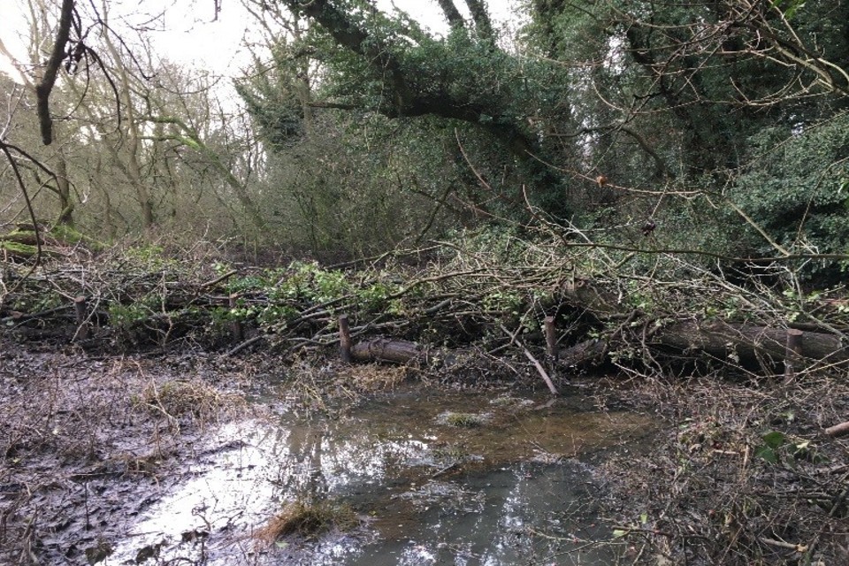
a constructed wood bund for NFM
The Environment Agency tracks the NFM programme to understand the flood risk and environmental benefits. We will publish the second interim lessons learnt report and update the working with natural processes evidence directory in 2021.
5.10 Improving the environment
RMAs look for opportunities to create and improve habitat as part of their FCERM work. They often form partnerships with groups such as wildlife and rivers trusts. The Environment Agency has a legal obligation to compensate where it damages habitats. For example, we will create a habitat in a new location if building a flood or coastal risk management scheme damages an existing habitat.
The environmental improvements completed by RMAs from 1 April 2019 to 31 March 2020 include:
- enhancing 164km of waterbodies
- enhancing 485 hectares of habitat
- creating 300 hectares of habitat
Examples of these improvements include:
- removing or modifying weirs to make it easier for fish to migrate upstream
- creating and restoring woodland habitat to help manage water runoff and reduce flood risk downstream
5.11 Local flood risk management (FRM) strategies
Under the FWMA 2010 all 152 LLFAs must have a local FRM strategy. They must develop, maintain and track progress against their local strategies.
Local flood risk includes flooding from surface water, groundwater and ordinary watercourses.
LLFAs must exercise their FCERM activities, including plans and strategies, consistently with the National FCERM Strategy. By March 2019 all LLFAs in England had published their local FRM strategies. The Environment Agency and Defra are working with LLFAs to update local FRM guidance and strategies where appropriate.
Over the previous year, LLFAs have reported using their strategy and action plan in a variety of ways. These include:
- securing funding for schemes
- identifying priority work, including schemes
- informing spatial planning advice and/or decisions
- communicating and engaging with local communities
- raising the profile of flood risk and influence within the council and with partner organisations
5.12 Reservoir safety
The Environment Agency regulates large raised reservoirs in England. This is a requirement of the Reservoirs Act 1975. We regulate 1,873 third-party-owned large raised reservoirs. We also operate 217 large raised reservoirs, mainly for flood risk management purposes. This data is correct as of 31 March 2020. The act aims to ensure that dams and reservoirs are safe. Responsibility for the safety of reservoirs lies with their undertakers which are the owners or operators of the reservoir. Our role, as the enforcement authority for the act, is to ensure the undertakers follow the legal safety requirements. Further details can be found in our Reservoir safety biennial report: 1 January 2017 to 31 December 2018 published in April 2019. The next report is due to be published in spring 2021.
In January 2020, the Environment Agency published its Reservoir safety post-incident annual report for 2018. The post-incident report for 2019 was published on 5 March 2021. Between 1 April 2019 and 31 March 2020, there were 11 incidents where emergency measures were taken. These measures were to prevent an uncontrolled release of water. This is the total number of incidents reported to the Environment Agency. The average number of incidents reported per year is 7.
Two of the incidents were classed as ‘level 2’ and 9 were ‘level 3’. Level 2 is a serious incident that requires emergency drawdown or emergency works. Level 3 is an incident that requires a precautionary drawdown or unplanned works. In one case, the Environment Agency used emergency powers to intervene and drawdown the reservoir.
The most significant incident occurred at Toddbrook Reservoir in August 2019. The Environment Agency immediately contacted the undertakers of all registered reservoirs to identify reservoirs similar to Toddbrook.
Following the incident, the government commissioned an independent review to learn and share lessons from Toddbrook reservoir. The findings were published on 16 March 2020. The report contained 22 recommendations for the reservoir network and community, which have been accepted by government. The Canal and River Trust (CRT) own and manage Toddbrook Reservoir. CRT commissioned a separate technical assessment of the incident. It was published on 16 March 2020. The Environment Agency produced a Technical Bulletin about the incident to inform all reservoir undertakers and engineers of the lessons learnt.
On 9 June 2020, Defra announced a second stage of the independent review of reservoir safety guidance and legislation. This will focus on whether the regulation of reservoirs remains effective in securing the ongoing safety of this critical infrastructure.
5.13 Asset registers
Under the FWMA 2010, each LLFA must:
- establish and maintain a register of flood risk assets
- make it available to the public
By 31 March 2020:
- 109 LLFAs had compiled up-to-date asset registers
- 43 LLFAs had work in progress to develop their registers, or to update the contents
Over the previous year, LLFAs reported using the outputs of their asset register in a variety of ways. These include:
- guiding decisions on asset inspection, operation maintenance and replacement
- influencing discussions with asset owners
- prioritising internal funding
5.14 Public sector cooperation agreements
The FWMA 2010 says that RMAs must cooperate with each other when carrying out FCERM activities.
RMAs can work together to provide flood risk maintenance and other activities. One example of partnership working is the public sector cooperation agreements (PSCAs). The benefits of partnership working are now well established. The efficiencies generated show this.
The Environment Agency uses PSCAs for a wide variety of work including:
-
routine maintenance
-
small improvement works
-
incident response
We will continue to increase the number of PSCAs and their use where appropriate.
Table 15: summary of national PSCAs at 31 March 2020
| PSCAs status | Internal drainage board | Lead local flood authority | Navigation authority | Total |
|---|---|---|---|---|
| PSCAs in place | 46 | 13 | 2 | 61 |
| PSCAs in principle | 9 | 8 | 0 | 17 |
| Renewals in progress | 9 | 0 | 1 | 10 |
5.15 Skills and capacity in LLFAs and other RMAs
Protecting people and properties from flooding and coastal erosion relies on effective collaboration between:
- community groups
- business leaders
- local enterprise partnerships
- the Environment Agency
- local authorities and other RMAs
Sharing expertise and resources in a flexible way continues to be an important approach. RFCCs continue to play a central role in:
- raising skills and capacity issues
- working with members to maintain skills and capabilities
The capacity and capability of LLFAs is variable across the country. Since 2019 LLFAs have been able to use framework contractors procured through the Environment Agency’s procurement arrangements. Feedback suggests that this approach is complimentary to local procurement frameworks managed by local authorities, IDBs and water companies.
During 2019, the Environment Agency worked with other RMAs to embed skills and know-how in the following areas:
- preparing business cases
- identifying and calculating efficiencies to support business cases
- project appraisal
- understanding assurance processes
The Environment Agency facilitated local workshops which continue to help share knowledge and build technical capability across the RMA community.
We’ve set up a community of practice for RMAs to share their experience, ask questions, read case studies and access e-learning material. This flexible and engaging platform is proving to be essential as we adjust our working practices for the COVID-19 pandemic.
In March 2020, we conducted a survey of RMAs and other practitioners from across the sector. The results showed that climate change was the most commonly anticipated future challenge. Other core skills will need to continue to be reinforced across the sector in the years ahead. These include:
- digital literacy
- programme and project management
- hydrology
- engineering
- crisis management
- commercial acumen
5.16 Flood Risk Regulations 2009 and flood risk management plans
Flood risk management plans (FRMPs) were first published in March 2016. They set out how RMAs will work together and with communities to manage and reduce the risk of flooding. They cover all sources of flooding over a 6 year cycle. This means that some of the measures in table 16 may not begin until later in the period or may be superseded or replaced over time.
The Environment Agency, LLFAs and other RMAs are currently reviewing and updating the first cycle of plans. This includes working with stakeholders to develop measures to manage flooding in areas within a river basin district. Our aim is to take a more strategic approach to the next cycle. This will be achieved by:
- aligning objectives and measures with the ambitions in the national FCERM Strategy
- closer integration with river basin management plans (RBMPs)
Table 16: progress made towards implementing the FRMP measures for the period 2015 to 2021 as of 31 March 2020
| Progress | Number of measures |
|---|---|
| Ongoing | 3024 |
| Complete | 1054 |
| Superseded | 660 |
| Not started | 1246 |
Case study 5: Godalming flood alleviation scheme, Surrey
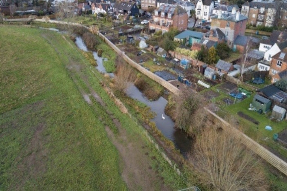
Goadalming flood alleviation scheme
A new £5.8 million flood alleviation scheme for Godalming in Surrey opened on 11 October 2019. The scheme was a true collaboration between several organisations. They all helped to drive innovation and bring together the necessary funding. The project was funded by FCERM grant-in-aid with supporting investment from:
- Surrey County Council
- Waverley Borough Council
- Godalming Town Council
- Thames Water
- Thames RFCC
This innovative scheme will help reduce the risk of flooding to approximately 90 homes. It comprises:
- 525 metres of flood wall
- a small section of removable temporary flood barrier across the Catteshall Road Bridge
- 2 pumping stations
The scheme also incorporates important environmental enhancements. These include an area to attract spawning fish and the creation of a wetland area.
The scheme was put to the test during Storm Dennis in February 2020 when it successfully protected the local community from rising flood water.
6. Research and flood digital
6.1 FCERM research and development programme
The FCERM Research and Development Programme is run by:
- Defra
- the Environment Agency
- Welsh Government
- Natural Resources Wales
The programme is divided into 3 themes. These are:
- Policy, Strategy and Investment
- Asset Management
- Incident Management and Modelling
The programme provides research, information, tools and techniques. It ensures we use high quality science to inform policy and practice. The Environment Agency is currently working on over 80 partnership projects. Combined these have a value of over £10 million per year.
We launched a new dedicated FCERM research website in March 2021.
6.2 Research publication highlights
6.2.1 Understanding the effects of climate change on sea level rise
In August 2019 the Environment Agency published Exploratory sea level projections for the UK to 2300 (SC150009). This work developed new projections of extreme sea levels to the year 2300. It will inform our understanding of:
- future coastal and estuarine flood risk
- the impact on infrastructure, society and our economy
Outputs from the project were used in the development of the FCERM strategies for both England and Wales.
6.2.2 Real-time mapping for flood incidents
In November 2019 we published our final report on Real-time inundation mapping for flood incident management (SC120023).
6.2.3 Valuing blue-green Infrastructure
In November 2019 we published a report to help secure investment in blue-green infrastructure. We worked in partnership with Construction Industry Research and Information Association and others to update the Benefits Estimation Tool – FRS18071 (B£ST).
B£ST provides a structured approach to help identify and quantify the financial, social and environmental benefits of SuDS and NFM measures. This is known as blue-green infrastructure. Following feedback from RMAs the tool is now available online to aid wider accessibility and application.
6.3 Flood digital development
At the Environment Agency, the way we use digital technology continues to grow. We have developed and improved our services in several ways, including:
- the way that we directly warn members of the public about expected flooding through our flood warning service
- our flood risk information services on GOV.UK
- making our flood information available as open data
6.3.1 Flood warning service
The Environment Agency has continued to improve and expand flood warning services based on user feedback. In April 2019, the flood warning service began using GOV.UK Notify to send letters to users. This makes the process much simpler, quicker and cheaper for us.
In October 2019 we introduced a new text to speech engine using Amazon Polly. This service uses advanced machine learning technology to provide natural human-like text-to-speech voices. It offers a far more flexible and powerful service at a fraction of the cost of the previous technology.
The Environment Agency has also made improvements to the flood warning messages sent via text. Text messages remain an important part of the flood warning service. Text messages now contain a direct link to audible flood warning information. The audible information is played through our Floodline service. Trials have started to include links in text messages that take users to the most relevant part of the flood information service on GOV.UK. By bringing existing services closer together, users can access information and advice through whichever channel works best for them.
The Environment Agency continues to work with Google to include flood warnings in the Google Public Alerts platform. As of July 2019, Environment Agency flood warnings now appear on Google Public Alerts Map and are more prominent in Google search results.
In December 2019, Vodafone customers in high risk flood areas were added to the flood warning service. This was done through an automatic registration process known as Extended Direct Warnings. This resulted in an excess of 3 million registrations for the first time. This ensures more people receive critical flood warning information in advance of flooding.
We are working with the Cabinet Office to influence mobile phone operators to implement a UK–wide mass alerting system using cell broadcast technology. The service could send alerts to people based on their location and they would not need to register. This means we could issue warnings to people of immediate flood threats, including people on the move.
6.3.2 Flood risk information services
Between 1 April 2019 and 31 March 2020, the Environment Agency designed and continuously improved 3 of the main flood services on GOV.UK. They are the:
The floods of winter 2019 to 2020 proved to be the biggest test of our flood warning and information services for several years. All systems performed exceptionally well.
In July 2019, the Environment Agency improved the performance of the flood information service on GOV.UK. This was to ensure it could cater for greater numbers of users. This was well worth the investment as during 1 April 2019 to 31 March 2020 the service broke records for the number of visits. The service performed exceptionally well. There were 3.3 million users during the February 2020 floods, with almost 33 million page views.
Further improvements were made to remove delays between warnings being issued and the information appearing on GOV.UK.
Throughout the year, more flood forecast levels were added to the live flood information service. The number of locations with a 36-hour river level forecast continues to increase. During the reporting period we added another 30 locations taking the total number to 60. This has allowed more communities to assess their flood risk.
We have made some changes to the long term flood risk information service and renamed it check the long term flood risk for an area in England. The service now includes:
- the use of simpler English and an improved structure
- improved messages on surface water flood risk
- better signposting to LLFAs for further information
- the ability to introduce data warnings where appropriate
We have been developing a new function as part of the flood map for planning service. During the reporting period this work was at the planning phase. The new service will automatically provide flood risk assessment data. This has the potential to reduce customer service times for this data from 20 working days to an average of 20 minutes. Data requests are currently done manually by the Environment Agency. This is a time consuming and relatively expensive process. We are currently testing the new service and plan to make it available to the public in autumn 2021.
6.3.3 Open flood data
We also provide services that enable others to use our data in their own systems. This results in even more ways for people to be warned and informed of their flood risk. Our open data services include:
- direct downloads, where users take a copy of our data
- a supply of ‘Web Map Services’ which are particularly aimed at users of geographic information or mapping systems
- Application Programming Interfaces (APIs) which are used by system and application developers to incorporate our data into their own services
Of these 3 services, our APIs are by far the most used for flood data. Usage has increased rapidly. Between 1 April 2019 and 31 March 2020 there were more than 450 million automated requests for our open data flood monitoring APIs. We saw the figures increase from 31.7 million requests in April 2019 to 48.4 million by March 2020.
It was a considerable challenge to support such high usage and ensure an uninterrupted service for our customers. During the reporting period, we made some significant internal changes to improve the way our data is provided and enhance how it joins up with other services. We successfully found ways to make these changes without disrupting the service.
7. Looking forward
7.1 Government announcements
In March 2020, the government announced a record £5.2 billion investment to build 2,000 new flood and coastal defence schemes. These will better protect 336,000 homes between 2021 and 2027.
The government also committed £200 million to part fund FCERM innovative resilience actions in 25 areas in England. These actions could include SuDS and nature-based solutions. The programme will also support work on long-term planning for climate change adaptation in the:
- Thames estuary
- Humber estuary
- Severn Valley
- Yorkshire
In these areas they will develop and trial ways to better plan and make wise investment choices. They will take into account the uncertainties of climate change when doing this.
A further £120 million was announced to repair assets damaged in the winter floods of 2019 to 2020.
In July 2020, the government announced an extra £170 million to speed up work on 22 flood schemes. Construction will start in 2020 or 2021. Areas across the country will benefit from this immediate boost to jobs and local economies.
On 17 April 2020, Defra and the Environment Agency published updated partnership funding guidance for projects starting after 1 April 2021. The main changes are:
- updated payment rates to reflect inflation and new evidence on flood damages since 2011 (including people impacts such as mental health)
- a new intermediate risk band for moving properties and other assets between high and medium risk to help manage surface water flood risk
- improved payment rates for environmental benefits
- recognition of the benefits for properties that will become at risk in the lifetime of flood defences due to the impacts of climate change
On 14 July 2020 the government published their new FCERM policy statement. It sets the long-term ambition to create a nation more resilient to flood and coastal erosion risk.
The policy statement will encourage wider and more comprehensive action through:
- upgrading and expanding our national flood defences and infrastructure
- managing the flow of water more effectively
- harnessing the power of nature to reduce flood and coastal erosion risk
- better preparing our communities
- enabling more resilient places through a catchment based approach
These policies are supported by over 40 actions to better protect and prepare the country against flooding and coastal change.
On 26 August 2020, Defra published an independent review of the arrangements for determining responsibility for surface water and drainage assets. The report contained a number of recommendations. The government has accepted 12 of the recommendations and is considering the others.
In December 2019, government commissioned an independent review into the affordability and availability of insurance in Doncaster. The review was led by Amanda Blanc. The report was published on 5 November 2020. The government is considering the recommendations and will respond in due course.
7.2 National FCERM Strategy
The FWMA 2010 states that the Environment Agency must develop, maintain, apply and monitor a strategy for FCERM in England. On 14 July 2020 the National FCERM Strategy for England (the Strategy) was laid in Parliament. Following Parliamentary scrutiny, the Strategy was adopted and published on 25 September 2020. The Strategy is a framework to guide those involved in FCERM to achieve its ambitions on the ground. It compliments and will help achieve the aims of the government’s policy statement.
Alongside the Strategy, the Environment Agency published the supporting:
- statement of environmental particulars
- final habitats regulations assessment
- consultation responses document
The Strategy’s long-term vision is for a nation ready for, and resilient to, flooding and coastal change – today, tomorrow and to the year 2100. It has 3 ambitions:
- climate resilient places
- today’s growth and infrastructure resilient in tomorrow’s climate
- a nation ready to respond and adapt to flooding and coastal change
The ambitions are described in 21 strategic objectives. These identify the outcomes needed over the next 10 to 30 years. There are also 56 shorter term measures that set clear and immediate actions.
The Environment Agency is developing an action plan to identify and track the practical actions needed to make the Strategy’s vision a reality. It will detail the actions that all RMAs and partners are committed to taking to implement the Strategy. It is expected to be published in spring 2021.
Future FCERM annual reports will align to the 2020 National FCERM Strategy for England. They will contain the best available information and data for benchmarking progress. Future reports will also provide:
- further insights into trends, opportunities and risks
- evidence to inform the direction of future FCERM Strategies
7.3 Climate change
The scale of potential future flooding and coastal change is significant. As climate change leads to sea level rise and more extreme rainfall, the number of people at risk from flooding and coastal erosion will grow. These risks are recognised in the government’s UK Climate Change Risk Assessment. There are 2 main ways we can tackle climate change:
- mitigation - reducing or limiting the effects of greenhouse gases that bring about climate change
- adaptation - changing our lifestyles, economy, infrastructure and local places to make us more resilient and adaptable to future consequences
7.3.1 Adaptation
The National FCERM Strategy for England has 3 core ambitions. These will further strengthen our work on climate change. They look at what can be done now to respond to climate change, as well as how to plan and adapt for the decades ahead.
The Strategy plans for a 2˚C global temperature increase by 2100. It also prepares for more extreme scenarios of climate change, including a 4˚C increase in global temperature by 2100. It calls for an assessment of a range of climate impacts to ensure our approach to FCERM can adapt to a range of climate futures. We’re doing this in both our bespoke planning advice for new developments and the design of new FCERM assets. We will ensure this guidance reflects the latest science.
In July 2020 we published updated guidance for RMAs on how to account for climate change in projects, schemes and strategies when applying for FCERM grant-in-aid.
We’ve updated the sea level rise allowances to reflect the UKCP18 climate change projections. The updated guidance is in line with our partnership funding and appraisal guidance. It enables the Strategy ambition to plan for a range of climate futures to happen.
We are working to update the fluvial allowances by summer 2021 and the rainfall allowances by the end of 2021.
We’re continuing to look at what climate change means for our own organisation and how we respond to the risks, and opportunities, it presents. The Strategy commits to developing an adaptive approach. The Environment Agency is also embedding climate adaptation across all its advisory, operational and regulatory work. In 2021 we will publish a report that sets out our climate risks and latest adaptation plans, including for FCERM and water management. Publishing this report is a requirement of the Climate Change Act.
7.3.2 Mitigation
In 2019 the government set a new target requiring the UK to bring all greenhouse gas emissions to net zero by 2050. It is important that all those involved in flooding and coastal change show leadership in achieving this ambitious target. Many local authorities and other public bodies are already leading actions and working with local people to reduce carbon emissions. Practitioners involved in FCERM have a vital contribution to make to achieve net zero and drive change at a local level.
In October 2019 the Environment Agency set the goal of becoming a net zero organisation by 2030. That means that by then we will be taking as much carbon out of the atmosphere as we are putting into it. We will no longer contribute to climate change. We have adopted a tough, internationally recognised definition of net zero. Net zero is not just the carbon we produce ourselves but also the carbon produced by our supply chain.
We will achieve our ambitious 10 year target by reducing our emissions by at least 45% by 2030. We will address the effect of our remaining emissions through tree planting and other offsetting measures. The measures will lock up carbon harmlessly and provide multiple benefits like reduced flood risk.
The Environment Agency’s main carbon footprint comes from constructing flood defences and pumping water to alleviate flood and drought. The emissions from these activities need to significantly reduce to achieve net zero. This will require innovation because some of the technologies we will need do not yet exist. This does not mean we will stop building flood and coastal defences or pumping water out of people’s homes if they flood. But over time, and working with our partners, we will need to find new and different ways to do these things. These new and different ways will need to produce less - and ultimately zero - emissions.
7.4 International relationships
The Environment Agency has strong links with several international organisations and agencies. Our international engagement focuses on 2 main priorities:
- to learn from others and benefit people and communities in England
- to help others improve their flood and coastal risk management
The Environment Agency engages internationally to learn from, share and shape best practice. We have good and highly valued relationships with international organisations and agencies including:
- the Dutch flood agency, Rijkswaterstaat
- the United States Army Corps of Engineers
- the Australian Bureau of Meteorology
These relationships are supported by non-legal Memorandums of Understanding.
There has been active engagement with these organisations for many years. We exchange knowledge and technical expertise in flood and coastal risk management. The topics and issues covered include:
- flood assets
- coastal processes
- incident management and response
We share best practice and learn from others managing storm surge barriers through the I-STORM international network. This network enables managers of storm surge barriers to share knowledge and experiences and provide peer review on common issues. These include the Thames Barrier in England and the Hurricane Storm Damage Risk Reduction System in New Orleans, USA.