Flood and coastal erosion risk management report: 1 April 2018 to 31 March 2019
Updated 30 June 2026
Applies to England

© Crown copyright 2026
This publication is licensed under the terms of the Open Government Licence v3.0 except where otherwise stated. To view this licence, visit nationalarchives.gov.uk/doc/open-government-licence/version/3 or write to the Information Policy Team, The National Archives, Kew, London TW9 4DU, or email: psi@nationalarchives.gov.uk.
Where we have identified any third party copyright information you will need to obtain permission from the copyright holders concerned.
This publication is available at https://www.gov.uk/government/publications/flood-and-coastal-risk-management-national-report/flood-and-coastal-erosion-risk-management-annual-report-1-april-2018-to-31-march-2019
This report summarises activities carried out by risk management authorities (RMAs) in England. This is for the period 1 April 2018 to 31 March 2019. RMAs are:
- the Environment Agency
- lead local flood authorities (LLFAs)
- district councils (where there is no unitary authority)
- internal drainage boards (IDBs)
- water and sewerage companies
- highways authorities
RMAs work together to reduce the risk of flooding and coastal erosion.
The Environment Agency also works closely with the regional flood and coastal committees (RFCCs). The RFCCs:
- bring together RMAs and other local organisations to better understand flood and coastal erosion risks in their region
- ensure there are coherent plans to manage flood and coastal erosion risks across catchments and shorelines
- encourage efficient, targeted and risk-based investment that meets the needs of local communities
- assign funding through a local levy
1. Flood risk
Over 5.2 million homes and businesses in England are at risk from flooding.
1.1 Properties at risk of flooding
Sources of flooding include:
- rivers
- the sea
- surface water
- groundwater
Some properties are at risk from more than one source of flooding.
During a significant flood there may be disruption to local services and utilities. Over two-thirds of properties depend on infrastructure located in areas at risk of flooding. Research from the long-term investment scenarios shows for every person affected during a large flood about 16 more suffer knock-on effects from loss of utility services.
Table 1: properties at risk of flooding from 1 April to 31 March for each year
| Source of flooding | 2014 to 2015 | 2015 to 2016 | 2016 to 2017 | 2017 to 2018 | 2018 to 2019 |
|---|---|---|---|---|---|
| Rivers and the sea | 2.4 million | 2.7 million | 2.7 million | 2.6 million | 2.5 million |
| Surface water | 3 million | 3 million | 3.2 million | 3.2 million | 3.2 million |
| Rivers, the sea and surface water | 600,000 | 660,000 | 660,000 | 660,000 | 660,000 |
| Groundwater | 122,000 – 290,000 | 122,000 – 290,000 | 122,000 – 290,000 | 122,000 – 290,000 | 122,000 – 290,000 |
The figures for groundwater in table 1 may include properties at risk of flooding from surface water.
The Environment Agency uses flood mapping and modelling to understand the risk of flooding at a local and national level.
The number of properties at risk of flooding varies from year to year. This is due to improvements in the data and modelling information used.
Table 2: properties in areas at risk of flooding from rivers and the sea, and from surface water as of 31 March 2019
| Level of risk | Total number of properties in areas at risk of flooding from rivers and the sea | Number of residential properties in areas at risk of flooding from rivers and the sea | Total number of properties in areas at risk of flooding from surface water | Number of residential properties in areas at risk of flooding from surface water |
|---|---|---|---|---|
| High | 200,000 | 121,000 | 324,000 | 239,000 |
| Medium | 672,000 | 458,000 | 504,000 | 395,000 |
| Low | 1,047,000 | 801,000 | 2,353,000 | 1,879,000 |
| Very low | 631,000 | 525,000 | Not assessed | Not assessed |
| Total | 2,549,000 | 1,905,000 | 3,181,000 | 2,513,000 |
1.2 Flooding between 1 April 2018 and 31 March 2019
The majority of flood impacts were from surface water and river flooding. These occurred during 2 notable events in May 2018 and March 2019. There were a few minor, local level impacts from coastal flooding during the year. We recorded no groundwater flooding impacts.
Significant flooding occurred in Birmingham and Northampton on 27 May 2018. In the following days thunderstorms cause localised flooding in Shropshire, Nottinghamshire and Oxfordshire. Over 500 properties were flooded. Sadly there was also a fatality in Birmingham when a car was submerged in flood water. At the peak of the incident, the Environment Agency had 28 flood warnings in place. Many of these were in Birmingham City Centre. Some rain gauges in the Midlands recorded between 40mm and 60mm of rainfall in 3 hours. At Winterbourne, Edgbaston, 58mm of rain fell in 1 hour. It overwhelmed drainage systems and some rivers, causing widespread disruption across the city. Yet other gauges nearby recorded less than 10mm.
The first half of March 2019 was wet in the north of England. A succession of low pressure systems brought strong winds and frequent heavy rain. The volume of water increased in rivers across the north of England and the Midlands in response to:
- persistent heavy rainfall during Storm Gareth on 11 and 12 March 2019
- a period of heavy rain over the weekend of 15 to 17 March 2019
The Environment Agency issued flood warnings and alerts across a widespread area. On 16 March 2019, persistent heavy rain fell on ground that was already wet. This caused high river levels in and around York. In Tadcaster, the River Wharfe overtopped its banks on to the Ings. This caused flooding to the football field and also one property. On 17 March 2019 there were 58 flood warnings and 69 flood alerts in place. This was the highest number during the incident. In Yorkshire, 32 properties were flooded and 24 were flooded in the Greater Manchester, Cheshire and Merseyside area. The majority of these were from river flooding.
Table 3 shows the estimated number of properties (homes and businesses) flooded. The Environment Agency collates this data. We base it on information received from the public, our flood partners and our staff during a flood event. All figures are subject to change as we confirm and update our records.
Table 3: notable floods from 1 April 2018 to 31 March 2019
| Location of flood | Date | Number of properties flooded |
|---|---|---|
| Birmingham, West Midlands | End of May 2018 | 230 |
| Northampton, East Midlands | End of May 2018 | 140 |
| Milton Keynes, Buckinghamshire | End of May 2018 | 150 |
| Yorkshire | Mid-March 2019 | 30 |
| Greater Manchester, Cheshire and Merseyside | Mid-March 2019 | 20 |
1.2.1 Local flood investigations
Under section 19 of the Flood and Water Management Act 2010 LLFAs must:
- investigate the causes of locally significant flood events in their area
- publish the results and notify other relevant RMAs of the findings
Between 1 April 2018 and 31 March 2019 LLFAs used the findings most frequently to:
- influence funding priorities
- increase awareness and resilience of local communities
- inform the local flood risk management strategy or action plan
1.3 Flood warning registrations
Being prepared for flooding helps reduce the impacts and enables faster recovery. The Environment Agency encourages people to register for its free flood warning service. Alerts and warnings enable the public to take action to protect themselves and their possessions.
The Environment Agency’s flood warning service covers:
- flooding from rivers and the sea
- some properties at risk of groundwater flooding
It does not cover flooding from surface water. LLFAs are responsible for flooding from surface water. Properties can be in more than one flood warning area. This occurs if the property is at risk of both coastal or tidal, and river flooding.
As of 31 March 2019, there were over 1.42 million properties registered to receive free flood warnings. Since 2010 we have automatically added phone numbers registered in areas at risk of flooding. We began by adding BT landlines followed by mobile phones.
In the Autumn Budget 2018 government announced £5.4 million to create around 250 new flood warning areas. The new areas will include all communities in England at the highest risk of flooding
1.4 Flood alerts, flood warnings and severe flood warnings issued
From 1 April 2018 to 31 March 2019, the Environment Agency issued:
- 2,210 flood alerts
- 852 flood warnings
- 0 severe flood warnings
See Flood alerts and warnings: what they are and what to do to find out what the different types of warnings mean.
Table 4 and graph: number of flood alerts, flood warnings and severe flood warnings for the period 1 April 2018 to 31 March 2019
| Month / year | Flood Alert | Flood Warning | Severe Flood Warning |
|---|---|---|---|
| Apr 2018 | 400 | 149 | 0 |
| May 2018 | 129 | 65 | 0 |
| Jun 2018 | 32 | 33 | 0 |
| Jul 2018 | 76 | 35 | 0 |
| Aug 2018 | 58 | 39 | 0 |
| Sep 2018 | 137 | 56 | 0 |
| Oct 2018 | 234 | 100 | 0 |
| Nov 2018 | 184 | 70 | 0 |
| Dec 2018 | 298 | 53 | 0 |
| Jan 2019 | 71 | 42 | 0 |
| Feb 2019 | 186 | 53 | 0 |
| Mar 2019 | 405 | 157 | 0 |
Table 5 and graph: comparison of flood alerts, flood warnings and severe flood warnings issued each year between 2012 and 2019
| Years | Flood Alert | Flood Warning | Severe Flood Warning |
|---|---|---|---|
| 1 April 2012 to 31 March 2013 | 4527 | 2093 | 15 |
| 1 April 2013 to 31 March 2014 | 3832 | 1897 | 147 |
| 1 April 2014 to 31 March 2015 | 2154 | 343 | 0 |
| 1 April 2015 to 31 March 2016 | 3432 | 1285 | 103 |
| 1 April 2016 to 31 March 2017 | 2037 | 496 | 25 |
| 1 April 2017 to 31 March 2018 | 2271 | 420 | 0 |
| 1 April 2018 to 31 March 2019 | 2210 | 852 | 0 |
1.5 Multi-agency flood plan review
The government commissioned a review of multi-agency flood plans (MAFPs) that local resilience forums (LRFs) in England produced in 2017.
The MAFPs final report was published in June 2018. It includes recommendations under 12 headings.
The government published its response to the conclusions and recommendations in January 2019. It recognises the significant work already underway since the publication of the review. This includes:
- workshops with LRFs in October 2018
- extra government funding to expand the Environment Agency’s flood warning service
Resilience Direct is an online collaboration tool used by category 1 and 2 responders. They use it to prepare for and respond to multi-agency incidents. The Cabinet Office published 4 revised MAFP guidance documents on Resilience Direct on 24 April 2019. They are a:
- streamlined and updated guidance document
- checklist for plan assurance
- good practice document with examples from existing plans
- new template to reflect the updated plan structure
2. Coastal change
The Futurecoast data and the National Coastal Erosion Risk Map (NCERM) shows that about 1,800km of open coast is eroding to some degree. About a quarter is eroding at more than 10 centimetres per year. In some places it’s eroding more than 2 metres per year. NCERM indicates that about 2,000 properties are at risk of loss to coastal erosion by 2060. This assumes current shoreline management plan policies are implemented.
Coastal erosion causes permanent loss to property and infrastructure. This can have a significant impact on local economies both within and outside the affected area.
2.1 Shoreline management plans
Shoreline Management Plans (SMPs) provide the long-term management framework for both coastal flooding and erosion. Over the last year there have been no changes to management policies set out in the SMPs. Coastal groups and RFCCs continue to monitor and scrutinise progress against the SMP action plans.
The actions range from:
- implementing projects in the 6 year investment programme
- ongoing engagement or monitoring activities
Discussions continue about:
- how to action the policies in these plans
- what contribution local businesses and communities can make
- when to make important decisions about improving flood risk management assets or withdrawing investment
The government is working closely with coastal authorities on a £1 million project running over 3 years to refresh the SMPs developed between 2006 and 2012. The Environment Agency is co-ordinating the project with support from 6 regional coastal groups.
The refresh will ensure SMPs are up-to-date and use the best evidence available to make decisions about managing the coast. It’s also an opportunity to ensure that:
- we are doing all we can to steer coastal management on a sustainable course
- coastal authorities have a properly resourced plan to achieve this
The Environment Agency will also identify options to make SMPs more accessible.
2.2 Coastal habitats
Constructing FCERM schemes can sometimes cause loss of valuable coastal habitat. Most losses will arise from ‘coastal squeeze’. This is where flood risk management assets prevent the natural landward migration of habitats. We make long-term forecasts about how much habitat we will loose to coastal squeeze.
The Environment Agency reports on habitat created to offset habitat lost in internationally protected areas in England. We submitted our second report to Defra (Department for Environment, Food and Rural Affairs) in January 2018. The ‘National Review of Statutory Habitat Compensation Associated with Flood and Coastal Risk Management Activity’ report is available on request by contacting enquiries@environment-agency.gov.uk
2.2.1 Inter-tidal saltmarsh and mudflats
The Habitats Regulations came into UK law in 1994. Inter-tidal saltmarsh and mudflat habitats are at most risk from coastal squeeze. The total amount of inter-tidal saltmarsh and mudflats created since 1994 is more than the area lost. Since 2000, we have worked with partners to create over 900 hectares of inter-tidal saltmarsh and mudflat. A further 300 hectares is being developed. We estimate that, by 2025, we will have created a total of 296 hectares more than the area lost across England. Large schemes in the Humber Estuary, such as Alkborough Flats, have helped to create this beneficial habitat since 2000.
However, we expect to continue to loose coastal habitat as a result of sea level rise. The Habitat Compensation Programme monitors long-term habitat change at a regional level. The programme also identifies potential sites for further habitat creation.
2.2.2 Other coastal habitats
Other protected habitats at the coast also experience pressure from FCERM activity. These include:
- saline lagoons and vegetated shingle
- freshwater habitats such as reedbed and coastal grazing marsh
The Environment Agency has created an extra 600 hectares of these habitats since the early 2000s. These are mainly reedbed and grazing marsh situated on the east and south-east coast. We need to continue to create these habitats as there are likely to be losses as a result of future schemes.
3. Investing to manage risk
Understanding flood and coastal erosion risk allows us to identify and take appropriate actions to manage it.
In February 2019 the Environment Agency published its updated economic assessment of future FCERM. The long-term investment scenarios (LTIS 2019) show that flood damage to properties and infrastructure will significantly increase without increased investment.
3.1 Investment in FCERM
The current 6 year programme of FCERM schemes runs from 1 April 2015 to 31 March 2021. The government made a commitment to invest £2.6 billion over this period to better protect 300,000 homes.
Since 2015, the government has invested about £1.7 billion of capital funding in FCERM. Of this, the Environment Agency has distributed £433 million to other RMAs. This includes LLFAs and IDBs who use the funding for FCERM schemes.
The government spent a total of £792.4 million on FCERM from 1 April 2018 to 31 March 2019.
In July 2018 government announced an extra £40 million of funding to better protect thousands of homes against flooding. More than 7,000 properties, including over 5,000 homes, will be better protected against the threat of flooding. Across the country 13 flood schemes will benefit from the extra funding. It will:
- enable these schemes to progress
- help support economic growth and regeneration in areas that have flooded in recent years
Since 2015, RFCCs have invested £100 million of capital local levy in FCERM. The local levy is a fund raised from LLFAs by the RFCCs for local priority FCERM projects.
Funding for FCERM schemes is allocated through the government’s partnership funding policy. More funding is available for schemes that:
- better protect a greater number of homes
- better protect a greater number of homes in deprived areas
- provide economic benefits
- create or enhance habitats
Some schemes do not justify full funding from government. Partnership funding contributions supplement government funding so that it can go further. This gives more communities the opportunity to invest in (and benefit from) local FCERM measures that could not be funded by central government alone.
The Environment Agency reviews the programme of FCERM schemes each year to make sure it:
- gets the best value for money
- will reach the target of 300,000 homes protected between 2015 and 2021
Investment is prioritised where the risk is highest. This is regardless of where it is in the country. Each scheme is carefully considered to identify where most people and property will benefit. The Environment Agency also ensures that funding is available for FCERM projects up to 2021. This means the amount of funding invested each year can vary.
Table 6: FCERM capital investment from 1 April to 31 March for each year
| Investment type (£ million) | 2015 to 2016 | 2016 to 2017 | 2017 to 2018 | 2018 to 2019 |
|---|---|---|---|---|
| Grant-in-aid (GIA) | 391 | 447 | 403 | 453 |
| Funding from partners | 75 | 104 | 76 | 95 |
| Local levy | 16 | 23 | 28 | 33 |
3.2 Significant schemes completed
Government has set a target to better protect 300,000 homes from the risk of flooding and coastal erosion between April 2015 and March 2021.
Between 1 April 2018 and 31 March 2019, the Environment Agency worked with other RMAs to complete 202 FCERM schemes. The majority of these schemes (84) were built to better protect people and homes from the risk of flooding from rivers. The rest better protected people and homes from:
- flooding from the sea (45)
- flooding from surface water (62)
- coastal erosion (9)
- flooding from groundwater (2)
In total, these schemes helped better protect:
- 49,127 homes from flooding - 6,854 of these are in areas of significant flood risk and economic deprivation
- 1,627 homes from coastal erosion - 81 of these are in areas of significant flood risk and economic deprivation
Table 7: examples of significant schemes better protecting homes between 1 April 2018 to 31 March 2019
| Scheme name | RFCC | Cost of scheme (£) | Number of homes better protected between 1 April 2018 to 31 March 2019 |
|---|---|---|---|
| Morecambe Wave Reflection Wall | North West | £10.8 million | 5,464 |
| Exeter Flood Risk Management Scheme | South West | £45.7 million | 2,970 |
| Land Yeo Lower and Blind Yeo Asset Improvements | Wessex | £2.1 million | 2,825 |
| Humber: Hull frontage | Yorkshire | £27.3 million | 2,270 |
The total cost of a scheme in table 7 is for all funding sources and for all years. This includes all prior and future years funding, as some of these schemes will better protect more homes in future years.
Case study 1 : Ipswich tidal flood barrier

Ipswich flood tidal barrier control centre.
The Ipswich Flood Defence Management Strategy comprises a mix of new and refurbished flood walls and gates along the River Orwell. The Ipswich tidal barrier officially opened in February 2019. It cost almost £70 million and will reduce the risk of tidal flooding to:
- over 1,600 homes
- 400 businesses
- important infrastructure
The scheme received funding from:
- the Environment Agency
- Ipswich Borough Council
- Anglian Eastern RFCC
- UK Power Networks
The Environment Agency worked closely with the local community, council and businesses to design and build a scheme that provides a greater level of protection for the town. The scheme will release land for development helping to create an estimated 4,000 jobs.
As well as better protecting people and homes, FCERM schemes can have additional benefits. They can help to better protect businesses, infrastructure and agricultural land.
Table 8 and graph: other benefits of FCERM schemes from 2011 to 2019
| Year from 1 April to 31 March | Agricultural land (ha) | Commercial properties | Roads (km) | Rail (km) |
|---|---|---|---|---|
| 2011 to 2012 | 74,011 | 5,572 | 1,800 | 107 |
| 2012 to 2013 | 75,645 | 5,874 | 1,774 | 75 |
| 2013 to 2014 | 84,106 | 5,487 | 2,247 | 54 |
| 2014 to 2015 | 100,580 | 11,282 | 2,340 | 122 |
| 2015 to 2016 | 74,644 | 11,500 | 1,854 | 150 |
| 2016 to 2017 | 30,442 | 7,041 | 1,090 | 51 |
| 2017 to 2018 | 32,838 | 7,595 | 1,176 | 55 |
| 2018 to 2019 | 36,307 | 8,677 | 1,343 | 63 |
3.3 Maintaining flood risk management assets
Between 2015 and 2020 government will be spending over £1 billion on maintaining flood risk management (FRM) assets.
Between 1 April 2018 and 31 March 2019, the Environment Agency invested over £200 million on maintaining FRM assets.
The investment includes developing technology and maintenance activities, such as:
- inspecting, maintaining and operating assets
- channel maintenance
The Environment Agency maintains around 78,000 assets that have a FRM purpose in England. These include:
- 5,200km of defences on main rivers
- 1,200km of tidal defences
- 600km of coastal defences
- 20,000 structures
- 200km of culverts
The Environment Agency regularly inspects over 175,000 FRM assets. These are maintained by:
- the Environment Agency
- other RMAs
- third parties
At 31 March 2019, 97.9% of Environment Agency maintained flood risk assets in high consequence FRM systems were in the required condition. Assets that are below the required condition need additional maintenance work. It does not mean they have structurally failed or that performance in a flood is compromised. If an asset’s performance is reduced, we will take action to effectively manage flood risk until it is fully repaired or replaced.
Details of planned maintenance activities are published in the river and coastal maintenance programme.
3.3.1 Reviewing river maintenance and management
Involving local communities and organisations in decision making and managing watercourses is important. The Environment Agency worked with some IDBs and LLFAs to transfer FRM activities on some stretches of watercourses. This means that IDBs and LLFAs can take on more responsibility for their local flood risk where appropriate. Their designation will change from main river to ordinary watercourse. This is known as de-maining.
We completed the de-maining pilots at:
- South Forty Foot in South Lincolnshire in November 2018
- Isle of Axeholme and Stour Marshes in summer 2019
As a result we successfully transferred the management of flood risk to 3 IDBs along with:
- 63.8 km of watercourses
- 28 flood risk management assets
- 178 acres of land
3.4 Efficiency savings
The Environment Agency is required to report to government about FCERM efficiency. This is to achieve the best possible value for the investment of public funds. This is a requirement of HM Treasury. Opportunities to improve efficiencies come from:
- national initiatives that allow operational improvements
- local project specific activities
Savings are achieved through:
- innovation
- value engineering
- longer-term planning and packaging of work
The total efficiencies achieved since April 2015 is £178 million. Efficiencies vary from year to year. They depend on:
- the FCERM funding allocation for that year
- individual project completion dates
Table 9 and graph: FCERM efficiencies achieved between 2015 and 2019
| Period | 2015/16 | 2016/17 | 2017/18 | 2018/19 |
|---|---|---|---|---|
| Efficiency savings (£ million) | 50 | 40 | 45 | 43 |
4. Reducing risk and minimising consequences
Flooding and coastal erosion cannot be totally eliminated but we can reduce the risk. This takes a variety of approaches and close working with other RMAs and organisations.
4.1 Development in areas at risk of flooding
The National Planning Policy Framework makes it clear that inappropriate development in areas at risk of flooding should be avoided.
Development should be steered to areas with the lowest risk of flooding. Where this is not possible the development should show it will:
- be safe throughout its lifetime, including any future risk from climate change
- be appropriately flood resistant and resilient
- not increase risk elsewhere
The Environment Agency comments on development proposals:
- in areas that are currently at medium or high risk of flooding from rivers and the sea
- in areas with critical drainage problems
- within 20 metres of a main river
Between 1 April 2018 and 31 March 2019:
- fewer than 9% of new homes were built in high flood risk areas
- over 95% of all planning decisions were in line with Environment Agency advice on flood risk
- over 99% of new homes proposed in planning applications complied with Environment Agency advice on flood risk
These results are comparable to previous years. The Environment Agency records a sample of the decision notices that are available via local planning authority web pages. We also publish a comprehensive list of all applications where we’ve lodged objections on flood risk grounds. Many of the issues will have been resolved before a final decision was made.
Table 10: planning applications reviewed by the Environment Agency and determined in line with its advice
| Environment Agency | 1 April 2018 to 31 March 2019 |
|---|---|
| Planning applications responded to | 12,140 |
| Number of planning decisions made that related to flood risk objections | 1,709 |
| Number of planning decisions made in line with the Environment Agency’s advice | 1,626 |
| % of planning applications determined in line with the Environment Agency’s advice | 95.14% |
| % of residential properties in planning applications in line with our advice | 99.44% |
4.2 National Planning Policy Framework
The government took action to strengthen and clarify planning requirements in the revised National Planning Policy Framework (NPPF). It was published in July 2018 following a public consultation and joint working by:
- the Environment Agency
- Defra
- Ministry of Housing, Communities and Local Government.
Changes include:
- local planning authorities should consider the extent of future flooding in their strategic development plans
- proposed developments in a low flood risk area that will be at greater flood risk in the future should have a flood risk assessment
- developments that benefit from FRM schemes should also have flood risk mitigation and resilience measures
- a stronger policy on sustainable drainage systems (SuDS), particularly SuDS that also benefit biodiversity, water quality and amenity
- a clearer requirement that maintenance arrangements need to be in place for the lifetime of developments to ensure operational standards for SuDS
SuDS replicate natural drainage processes. They transport surface water and slow down runoff before it enters watercourses and drainage systems. Many types of SuDS also provide wider water quality, biodiversity and wellbeing benefits.
4.3 Sewers for adoption
The Environment Agency and Defra have worked with Water UK to:
- assess if there are barriers to effective SuDS adoption by water companies
- identify how these barriers can be overcome
New sewerage sector guidance has been developed by Water UK and approved by Ofwat. The update includes design and construction guidance for SuDS. It will allow water and sewerage companies to adopt SuDS that meet the relevant requirements. This is effective from 1 April 2020.
4.4 Water and sewerage companies
The Environment Agency publishes an annual report on the environmental performance of the 9 water and sewerage companies operating mainly in England. Between 1 April 2018 and 31 March 2019, water companies invested:
- £187 million to reduce the risk of sewer flooding to homes
- £288 million to maintain the public sewer system to prevent blockages and flooding
- £4.7 million in property-level measures to reduce the risk of sewer flooding in homes
Water companies worked with others to:
- support flood risk assessments and produce integrated drainage models to better understand the risk of flooding
- provide co-funded partnership solutions to reduce flood risk to communities and enhance the environment
- enhance the resilience of their networks and services to flooding
- enable growth that manages flooding, pollution and improves water quality
- raise customer awareness of their impact of sewer misuse
- exercise incident management and winter preparedness plans
- start work on their drainage and wastewater management plans (DWMPs)
- develop their price review 2019 plans and future investment needs
Companies continue to work with the wider water sector to develop tools and approaches to:
- improve their resilience to flooding
- strengthen their environmental performance
A number of companies are working with partners to make cities and catchments resilient to a changing climate. Good practice includes:
- Thames Water’s adaptive planning for London 2100
- Northumbrian Water’s work with the Northumbrian Integrated Drainage Partnership (NIDP)
In September 2018 Water UK’s 21st Century Drainage Programme published a framework for the long term planning of drainage and wastewater services. Water and sewerage companies will use the framework to produce DWMPs by the end of 2022. The DWMPs will support their business plans for the 2024 price review.
Case study 2 : Living with Water
The Living with Water (LWW) partnership comprises:
- the Environment Agency
- Hull City Council
- East Riding of Yorkshire Council
- Yorkshire Water
These partners work together to make the Hull and East Riding area more resilient to flooding.
In February 2019 the LWW partnership launched a water-related design competition. The Royal Institute of British Architects (RIBA) administered the competition. It invited participants to design flood-resilient concepts for 2 major regeneration sites in the city’s former docklands. The Humber Quays West and Hull Arena is one of the city’s most prestigious redevelopment opportunities. With a waterfront location resilient development is a main priority.
The winning design features a strategy for ‘absorb, retain, release’. Sunken basements beneath the residential buildings provide large basins to hold flood water. These spaces are also car parks and cycle storage areas. The sunken basins hold flood water over extended periods of time. The water can then be slowly released back into the local drainage or the Humber. Sunken ball courts, amphitheatres and play spaces are also designed to fill and hold rainwater.
4.5 Surface water management action plan
In July 2018 Defra published a surface water management action plan. It sets out the actions government and others are taking to improve our understanding of the risks and the way we manage them.
These include:
- improving risk assessment and communication
- making sure infrastructure is resilient
- clarifying responsibilities for surface water management
- joining up planning for surface water management
- building local authority capacity
The government’s Autumn Budget 2018 included funding to boost action on surface water flood risk. This included measures to improve our flood risk assessment for surface water by:
- better combining local and national information
- commissioning improved surface water flood risk information in “hotspot” areas
- developing plausible extreme scenarios for surface water flooding
- improving and updating local detail of surface water flood maps
- enhancing the speed of communication of storm forecasts to local responders
This work will support the implementation of the surface water management action plan. It is also aligned with the National Infrastructure Commission’s recommendations on surface water in their National Infrastructure Assessment.
4.6 Flood risk activities – environmental permitting
The Environment Agency regulates work on or near main rivers through environmental permits. On 1 April 2018 we published a new charging scheme for regulatory permits and services.
Flood risk activity permitting moved from a single fixed fee for all permit applications to a categorised approach. The higher risk activities incur a higher charge. This approach ensures we operate on a cost recovery basis for our regulatory service. Businesses and organisations now pay the full cost of the services they receive. The new charging model is simpler, fairer and more effective. It will lead to long-term environmental and FRM improvements. Customers will see a more efficient, transparent and consistent service.
The environmental permitting table of charges lists activities that need a permit or registered exemption from the Environment Agency.
The Environmental Permitting (England and Wales) Regulations 2016 allow us to make standard rules. These rules reduce the administration for applicants while maintaining environmental and flood standards.
The Environment Agency reviewed the standard rules for flood risk activities this year. This is the first time since we introduced them in 2016. A consultation ran from 6 November 2018 to 11 January 2019. Following this we amended the existing standard rules and created 3 new ones. We published the new and updated standard rules in August 2019.
4.7 Natural flood management
Natural flood management (NFM) protects, restores or copies the natural function of:
- rivers and their floodplains
- estuaries
- the coast
NFM can reduce flood and coastal erosion risk, and offer other benefits such as:
- creating or restoring important wildlife habitat
- improving the local environment
- creating recreation opportunities
- capturing and storing carbon
There are 40 projects in the current FCERM capital investment programme that include NFM measures as part of their solution. Examples include:
- creating upstream storage areas
- building woody dams in rivers to slow the flow of water
4.7.1 NFM programme
In 2016 government announced £15 million of funding which was then allocated to 58 projects in the NFM programme.
The NFM programme started in 2017 and will continue until 2021.
The projects will:
- reduce flood and/or coastal erosion risk
- improve habitats and increase biodiversity
- contribute to research and development and reduce the evidence gap for NFM
- promote partnership working
Two community led projects were completed between 1 April 2018 and 31 March 2019.
Case study 3 : Orford and Havergate (Suffolk)
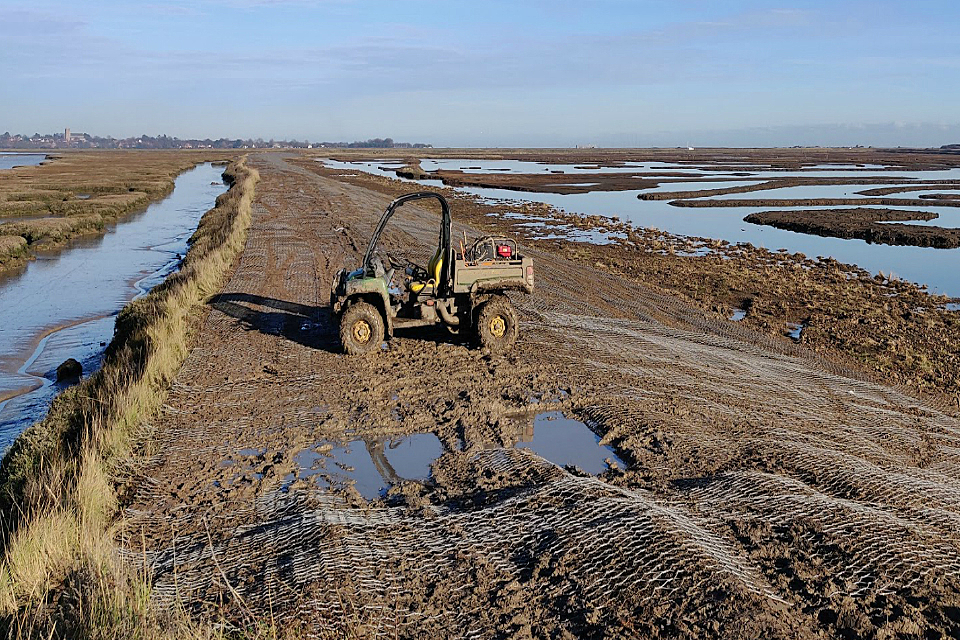
Orford and Havergate NFM scheme under construction.
The project lowered a 650 metre section of seawall that surrounds Havergate Island. Reducing the height by nearly half a metre allows more sea water to flow in and out of the coastal nature reserve. This helps to protect its designated habitats and wildlife against the impacts of climate change. It has also created much needed extra flood storage capacity
Case study 4 : Papermill Dyke (South Yorkshire)
This was a 3 year project led by Yorkshire Wildlife Trust. The aim was to slow the river flow through the catchment. Extra benefits include:
- reducing the pollution input into Maltby Low Common Site of Special Scientific Interest (SSSI)
- restoring wet woodland and wet grassland habitats
The Environment Agency will track the NFM programme to understand the flood risk and environmental benefits. In January 2019 we published a NFM programme interim lessons learnt report. It is based on feedback from NFM project managers and practitioners who are taking part in the NFM trials. The report groups the findings into 4 themes:
- developing a programme
- valuing benefits and project assessment
- partnership working
- responsibilities and maintenance
4.8 Improving the environment
RMAs look for opportunities to create and improve habitat as part of their FRM work. They often form partnerships with groups such as wildlife and rivers trusts.
The Environment Agency has a legal obligation to compensate where it damages habitats - see the coastal habitats section. For example, we will create a habitat in a new location if building a flood or coastal risk management scheme damages an existing habitat.
The environmental improvements completed by RMAs from 1 April 2018 to 31 March 2019 include:
- enhancing 164km of waterbodies
- enhancing 485 hectares of habitat
- creating 300 hectares of habitat
Examples of these improvements include:
- removing or modifying weirs to make it easier for fish to migrate upstream
- creating and restoring woodland habitat to help manage runoff and reduce flood risk downstream
4.8.1 Biodiversity net gain
One of the ambitions of the government’s 25 Year Environment Plan is to embed an ‘environmental net gain’ principle for development.
To help achieve this Defra consulted on plans for new development to achieve biodiversity net gain. This approach aims to leave the natural environment in a better state than before the development started. It may also provide opportunities for flood and coastal erosion risk management. The consultation ran from 2 December 2018 to 10 February 2019.
New biodiversity net gain measures were recently announced in the Environment Bill 2020. This means that new development, including new housing, will help wildlife to thrive by improving habitats and creating new green spaces.
4.9 Local flood risk management (FRM) strategies
Under the Flood and Water Management Act 2010 all 152 LLFAs must have a local FRM strategy. They must develop, maintain and track progress against their local strategies.
Local flood risk includes flooding from surface water, groundwater and ordinary watercourses.
By March 2019 all LLFAs in England had published their local FRM strategies.
Over the previous year, LLFAs have reported using their strategy and action plan in a variety of ways. These include:
- securing funding for schemes
- identifying priority work for delivery, including schemes
- informing spatial planning advice and/or decisions
- communicating and engaging with local communities
- raising the profile of flood risk and influence within the council and with partner organisations
4.10 Reservoir safety
The Environment Agency regulates large raised reservoirs in England. This is a requirement of the Reservoirs Act 1975. We regulate:
- 1,849 third-party-owned large raised reservoirs
- 213 large raised reservoirs that we operate mainly for flood risk management purposes
The act aims to ensure that dams and reservoirs are safe. Responsibility for ensuring the safety of reservoirs lies with their operators. Our role, as the enforcement authority for the act, is to ensure the operators comply with the legal safety requirements. Further detail can be found in our Reservoir safety biennial report: 1 January 2017 to 31 December 2018 published in April 2019.
The Environment Agency published its Reservoir safety post-incident annual report for 2018 in January 2020. Between 1 April 2018 and 31 March 2019, there were 11 incidents where emergency measures were taken to prevent an uncontrolled release of water. This is the total number of incidents reported to the Environment Agency. The average number of incidents reported per year is 7.
Two of the incidents were classed as ‘level 2’ and 9 were ‘level 3’. Level 2 is a serious incident that requires emergency drawdown or emergency works. Level 3 is an incident that requires a precautionary drawdown or unplanned works. In one case, the Environment Agency used emergency powers to intervene and draw down the reservoir.
4.11 Asset registers
Under the Flood and Water Management Act 2010, each LLFA must:
- establish and maintain a register of flood risk assets
- make it available to the public
By 31 March 2019:
- 109 LLFAs had compiled up-to-date asset registers
- 43 LLFAs had work in progress to develop their registers, or to update the contents
Over the previous year, LLFAs reported using the outputs of their asset register in a variety of ways. These include:
- guiding decisions on asset inspection, operation maintenance and replacement
- influencing discussions with asset owners
- prioritising internal funding
4.12 Public sector cooperation agreements
The Flood and Water Management Act 2010 states that relevant authorities must cooperate with each other when carrying out FCERM functions. RMAs can work together to provide flood risk maintenance and other activities. One example of partnership working is the public sector cooperation agreements (PSCAs). The benefits of partnership working are now well established and the efficiencies generated show this.
The Environment Agency uses PSCAs for a wide variety of work including:
- routine maintenance
- small improvement works
- incident response
We will continue to increase the number of PSCAs and their use where appropriate.
Table 11: summary of national PSCAs at 31 March 2019
| Internal drainage board | Lead local flood authority | Navigation authority | Total | |
|---|---|---|---|---|
| PSCAs in place | 61 | 14 | 2 | 77 |
| PSCAs in principle | 7 | 11 | 0 | 18 |
4.13 Skills and capacity in LLFAs
RFCCs play an important role in encouraging members to understand and address skills and capacity issues in their area. Local levy and co-funded posts play an important part in maintaining capacity in LLFAs. They supplement small teams and support inter-agency working. Sharing expertise and resources flexibly in this way works well for many authorities. There are good examples of a joint team looking after a wider geographical area.
From 1 April 2018 to 31 March 2019 the Environment Agency focussed on increasing skills and capability across the sector. We wanted to improve the collective ability of RMAs to secure partnership funding for FCERM schemes.
We held local workshops and training events around the country, involving about 650 delegates. The workshops and training covered topics such as:
- partnership funding
- effective business engagement for investment
- Geographical Information Systems (GIS) for coastal groups
- project appraisal, including benefits and economic appraisal
An important area for development for RMAs was how to:
- prepare business cases
- identify and calculate efficiencies
- understand assurance processes
We formed a network of subject matter experts to help streamline assurance processes. We also produced an ‘Investment Journey Toolkit’ with training material and best practice advice.
The Environment Agency introduced Programme Delivery Units (PDUs) in July 2017. They consist of Environment Agency staff and our suppliers. PDUs have helped to increase capacity, provide additional technical skills and improved service. They continue to provide help with project management capability for:
- carrying out scheme appraisals
- scheme development
- support in letting contracts
The PDUs are also helping us move to our new ways of working under the New Generation Supplier Arrangements (NGSA). The Water and Environment Management (WEM) Framework came to an end in April 2019.
Capacity continues to be a challenge for RMAs where a single person holds several different roles. If RMAs do not have the in-house technical skills or enough capacity, they use framework contractors and consultants as needed.
4.14 Progress on implementing the Flood Risk Regulations 2009 and flood risk management plans
Flood risk management plans (FRMPs) were first published in March 2016. They set out how RMAs will work together and with communities to manage and reduce the risk of flooding. They cover all sources of flooding over a 5 year cycle and take a strategic look over the next 100 years. This means that some of the measures in table 12 may not begin until later in the period or may be superseded or replaced over time.
The process of reviewing and updating the first cycle of FRMPs is underway. The aim is to take a more strategic approach to the next cycle including closer integration with river basin management plans (RBMPs).
Table 12 and graph: progress made towards implementing the FRMP measures for the period 2015 to 2021 as of 31 March 2019
| Progress | Number of measures |
|---|---|
| Ongoing | 3099 |
| Complete | 897 |
| Superseded | 528 |
| Not started | 1410 |
Case study 5 : Skipton flood alleviation scheme, Yorkshire

Skipton flood alleviation scheme flood storage area.
A new flood alleviation scheme for Skipton opened in October 2018. It cost £17.8 million and will reduce the risk of flooding from the Eller Beck and Waller Hill Beck. The Environment Agency was the lead partner in the scheme. Funding also came from:
- the Defra Growth Fund
- North Yorkshire County Council
- Yorkshire RFCC
- Yorkshire Water
The scheme will reduce flood risk for 378 homes and at least 165 businesses. The scheme involved the creation of 2 upstream water storage areas. These slow the flow of water from the surrounding hills, reducing the risk of flooding in the town centre.
4.15 UK Climate Projections 2018
The government published the latest set of climate change projections in November 2018 (UKCP18).
The UKCP18 projections are an important source of information for UK organisations to ensure they are resilient to future climate and weather extremes. UKCP18:
- provides the underlying evidence base for the next Climate Change Risk Assessment in 2022
- informs the National Adaptation Programme (NAP)
The Environment Agency is working with Defra to account for UKCP18 in our planning and decision-making. This includes our long-term investment in FCERM over the next 50 years.
We’re already building-in climate change to create resilient places and make sure they are fit for the future. We’re doing this in both our bespoke planning advice for new developments and the design of new flood risk management assets.
On 17 December 2019 we published updated guidance for developers and planners on how to account for climate change in their flood risk assessments. This includes updated sea level rise allowances to reflect the UKCP18 climate change projections. We are working to update the rainfall allowances later in 2020.
5. Research and flood digital
5.1 FCERM research and development programme
Defra, the Environment Agency, Welsh Government and Natural Resources Wales manage the Joint Flood and Coastal Erosion Risk Management Research and Development Programme. The programme is divided into 3 themes. These are:
- Policy, Strategy and Investment
- Asset Management
- Incident Management and Modelling
The programme provides research, information, tools and techniques. It ensures we use high quality science to inform policy and practice. The Environment Agency is currently working on over 80 partnership projects. These projects have a value of over £10 million per year.
A full list of completed research published between 1 April 2018 and 31 March 2019 is available on the Joint Flood and Coastal Erosion Risk Management Research and Development Programme website.
5.2 Research publication highlights
5.2.1 Better understanding of flood risk
In April 2018 we published a user guide relating to our research on Realistic Planning Scenarios for FCRM (SC140002).
The project developed methods and guidance to address the need for realistic planning scenarios. These scenarios account for:
- the risk of widespread flooding across England and Wales
- flooding from multiple sources (river, surface water and the sea)
- the potential impacts of these types of flooding
The Cabinet Office’s National Risk Register now includes a surface water flooding risk. This is based on the evidence and modelling produced by this project. The results also informed the National Flood Resilience Review.
5.2.2 Understanding asset performance
In February 2019 we published our final report on Asset Performance Tools (SC140005). This research developed methods, tools and guidance to improve asset management decision-making. It identifies where, when and how to reduce flood risk for least cost and greatest benefit. The results of this will:
- inform future research
- address aspects of the Environment Agency’s Asset Management Strategy 2017 to 2022
It also supports our accreditation to ISO 55000. This is the international standard for asset management.
5.2.3 Improving drainage rate calculations
The improving drainage rate calculations project (SC120020) developed new guidance to estimate local drainage rates when mapping and modelling surface water flood risk. The guidance helps LLFAs check if the national maps correctly represent surface water flood risk in their area. It can also be used to:
- see how the flood maps may change with more or less drainage
- test scenarios like future climate change
5.2.4 Developing and trialling improved capabilities for forecasting surface water flooding
The Environment Agency worked with the Natural Hazards Partnership to develop a new surface water flood forecasting model (SC120006). It will help the joint Met Office and Environment Agency Flood Forecasting Centre to improve:
- surface water flooding forecasts
- information passed on to emergency responders (Flood Guidance Statements)
5.3 Flood digital development
Between 1 April 2018 and 31 March 2019 the Environment Agency designed and continuously improved 3 of the main flood services on GOV.UK. They are the:
5.3.1 River and sea levels
In spring 2018 the Environment Agency made further improvements to our river and sea levels service. We increased the number of locations with a 36-hour river level forecast to 30. Since then, we have received very positive comments from communities using the forecasts. We continue to learn and iterate the service based on their feedback. The number of locations with a 36-hour river level forecast continues to increase. We added another 30 locations in summer 2019 taking the total number to 60.
5.3.2 Flood warning service
In October 2018 the Environment Agency registered around 340,000 Three UK mobile phone customers to our free flood warning service. We worked with Three UK to automatically register customers who live in flood risk areas in England and Wales. They now receive a message to their mobile if a flood warning is issued for their area.
In December 2018 we successfully switched our text notification service to GOV.UK Notify. This provides us with a cheaper, smarter and better service. Since then we have been exploring how we can use GOV.UK Notify to further improve our service.
5.3.3 Flood risk information services
The Environment Agency continues to grow and improve its flood services on GOV.UK. This includes work to:
- improve surface water and reservoir data on the long term flood risk information service
- provide a self-service option for flood risk assessment information through the flood map for planning service
6. Looking forward
6.1 Government announcements
In July 2019 the government asked for views and evidence on some important issues which will inform future flood policy. Later in 2020 the government will set out its policies to tackle flooding and coastal erosion in the long-term.
In December 2019 the government announced an independent review into flood insurance. The review will:
- recommend ways to help homes and businesses get sufficient insurance for flooding
- inform any future policy decisions in this area
In the March 2020 Budget, the government announced that it will double its investment in FCERM to £5.2 billion over the next 6 years. This will ensure a further 336,000 homes and non-residential properties such as businesses, schools and hospitals are better protected from flooding and coastal erosion.
In addition, the government will provide £200 million between 2021 and 2027 for a place-based resilience programme. This will support 25 local areas to take forward wider innovative actions that improve their resilience to flooding and coastal erosion.
The government has worked with the Environment Agency to update how the level of government funding is allocated to FCERM projects. The changes will take account of wider environmental and social benefits that come with reducing the risk of flooding. Building on these changes, Defra will launch a public consultation in 2020 to gather views on a flood funding policy.
Following the announcement in the March 2020 Budget, the government published Planning for the future. It sets out plans for housing and planning and a commitment to review the policy for building in areas at flood risk.
6.2 National FCERM Strategy
In 2020 the Environment Agency will publish a new National FCERM Strategy for England.
We consulted on a draft strategy in summer 2019 and received a significant amount of constructive feedback and support.
The draft strategy had 3 high level ambitions:
- climate resilient places
- today’s growth and infrastructure is resilient in tomorrow’s climate
- a nation of climate champions
The final strategy will set a direction to ensure the nation is resilient to flooding and coastal change. This is up to 2100 and accounting for climate change.
6.3 Property resilience pathfinders
In the Autumn Budget 2018 the government announced funding to boost action to make homes and buildings more resilient to floods. On 22 July 2019 government allocated funding up to £700,000 to each of 3 pathfinder projects. The funding is to boost research into property-level measures and their uptake. The 3 projects are:
- Yorkshire Future Flood Resilience Pathfinder project (led by City of York Council)
- Oxford-Cambridge Pathfinder (led by Northamptonshire County Council)
- South West Partnership project (led by Cornwall County Council)
The funding will go towards:
- new research initiatives
- demonstration and advice centres and online advice to help people learn about the benefits of installing measures in their homes
The Environment Agency will support and track the projects to highlight successes and identify lessons. We will use this information to encourage greater use of measures elsewhere across the country.
6.4 Flood digital
One of the main aims of the Environment Agency’s flood information service is to improve how we alert people to flooding, even when they are on the move. We have worked closely with Google for 2 years to design and put in place Google Public Alerts in England.
This exciting development:
- ensures vital warning information is more visible
- means flood warnings will be more targeted to those who need them
We’ve achieved this using location information on Google search. The Environment Agency is one of the first partners to go live with Google Public Alerts in Europe. The service was launched in July 2019. Our flood warnings now appear on the Google Public Alerts map and are more prominent in Google search results.
We are also working with the Cabinet Office to influence mobile phone operators to put in place a UK–wide mass alerting system. The service could send alerts to people based on their location and they would not need to register. The Environment Agency would be ideally placed to benefit from this. For example it would enable us to issue warnings to people of immediate flood threats, including those on the move.