Corporate Brochure
Published 18 February 2020

© Crown copyright 2020
This publication is licensed under the terms of the Open Government Licence v3.0 except where otherwise stated. To view this licence, visit nationalarchives.gov.uk/doc/open-government-licence/version/3 or write to the Information Policy Team, The National Archives, Kew, London TW9 4DU, or email: psi@nationalarchives.gov.uk.
Where we have identified any third party copyright information you will need to obtain permission from the copyright holders concerned.
This publication is available at https://www.gov.uk/government/publications/corporate-brochure/corporate-brochure
The UK Hydrographic Office is a world-leading centre for hydrography. We provide marine geospatial data to inform maritime decisions.
UK Hydrographic Office - a new adventure
We specialise in providing accurate and reliable marine geospatial information and expertise, helping others to unlock a deeper understanding of the world’s oceans. We support defence, safe maritime navigation and marine development around the UK and worldwide.
We share this geospatial information with governments, businesses and researchers across the globe. We also make it available through our portfolio of ADMIRALTY Maritime Data Solutions. This includes a world-leading range of charts, publications and custom data sets, and can be found on over 90% of ships trading internationally. Working with a wide variety of data suppliers and partners, we source, process and provide access to marine geospatial data, ranging from below the seabed to above the sea surface, and from coast to coast. This data and expertise helps others make best use of our oceans in safer, more secure and more sustainable ways.
We’re continuing to innovate so that we can meet the evolving needs of our existing users and reach new users in wider markets. As our marine data and technology capabilities grow, we will help people working in the blue economy to make better decisions and truly make the most of the world’s oceans.
1. The blue economy opportunity
Look around you. Almost everything you see, whether products or raw materials, is likely to have arrived by ship.
As an island nation, this is how 95% of imports reach the UK. In fact, 90% of global trade is maritime.
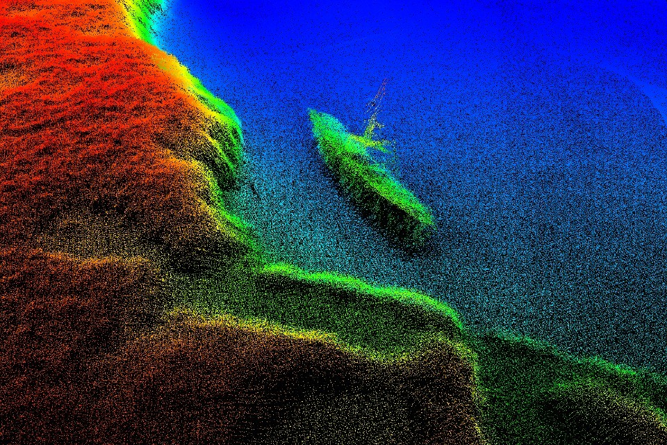
Bathymetric data of a wreck
The sustainable use of our oceans for economic growth has come to be known as the ‘blue economy’. Globally, this is expected to double in value by 2030. This not only means an increase in maritime trade, but also significant growth in industries such as offshore wind power.
As our reliance on the oceans as a source for economic growth increases, so too does the need for comprehensive and up-to-date marine geospatial data, so that we can make use of the marine environment in a responsible way. As the UK Hydrographic Office, we specialise in this information.
By working with our partners, we help users make critical decisions in the rapidly developing maritime sphere. Together, we’re unlocking a deeper understanding of the world’s oceans, supporting a sustainable and thriving blue economy for the future.
£47 billionestimated Gross Value Added of the blue economy in the UK
99%of global telecoms traffic is transmitted via subsea cable
1 billionnumber of people that depend directly on seas for their primary source of food
95%of the UK’s trade is carried by sea
$3 trillionpredicted value of the global blue economy by 2030
40 millionpeople will work in ocean-based industries by 2030
2. We are the UK government’s hydrographic and marine geospatial experts
As part of our public task, we provide the hydrographic products and services needed to support safe passage in UK waters under the Safety of Life at Sea (SOLAS) Convention.
Our data is also used to improve the effectiveness of UK national defence. We supply the Royal Navy and other defence customers with products and data in support of the UK National Security Strategy (NSS), enabling safe navigation and informing tactical operations.

UKHO data science looking at code
In addition to hydrography, we provide specialist advice to government across a range of disciplines. These include oceanography, marine cartography, computational astronomy and Law of the Sea, and we help represent the UK as experts in these fields.
As technology advances, we will continue to share our expertise to help shape the success of the UK maritime industry and wider sectors – from autonomous vessels and smart shipping, to geospatial innovation.
2.1 Maximising the value of the UK’s geospatial data
We are one of six leading geospatial bodies in the UK’s Geospatial Commission
Recognised for holding some of the UK’s most valuable location data, we are working in partnership with the British Geological Survey, Coal Authority, HM Land Registry, Ordnance Survey and Valuation Office Agency.
By driving the move to use public and private sector data more productively, it is estimated this could contribute up to £11 billion of extra value for the economy every year.
3. Trusted by mariners for safe, efficient and compliant navigation
Supporting safe navigation across the globe is at the heart of what we do.
For over 220 years, we’ve been producing world-leading charts and publications to support the safety of ships, crew and cargo. In fact, our portfolio of ADMIRALTY Maritime Data Solutions is found on over 90% of ships trading internationally.
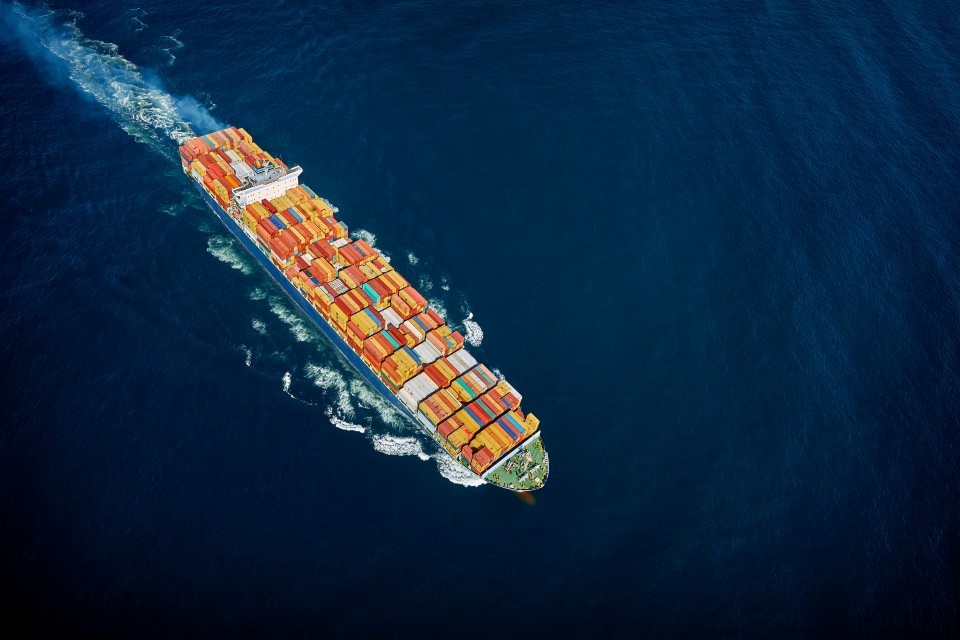
Container ship at sea
Today, maritime navigation is primarily digital, and we provide a range of electronic charts, publications and services so that we can continue to meet the evolving needs of the mariner.
Using cutting-edge technologies, we maintain this portfolio in smart data-driven ways. From analysing billions of data points, we can monitor the movement of global shipping traffic to keep our products up to date. By processing over 20 years’ worth of tidal observations, we can make future predictions with confidence.
Now we’re helping to lead the way in digital navigation, providing a wider range of solutions for the maritime industry as it embraces new technologies, so that we can support safety at sea for the next 220 years and beyond.
3.1 Working to set and raise global standards
Our portfolio of ADMIRALTY Maritime Data Solutions offers the most comprehensive range of charts, publications and digital services available.
We also offer world-leading expertise in the development of hydrographic and charting standards, working across the international hydrographic community to set and raise global standards of hydrography, cartography and navigation.
90%of ships trading internationally rely on ADMIRALTY Maritime Data Solution
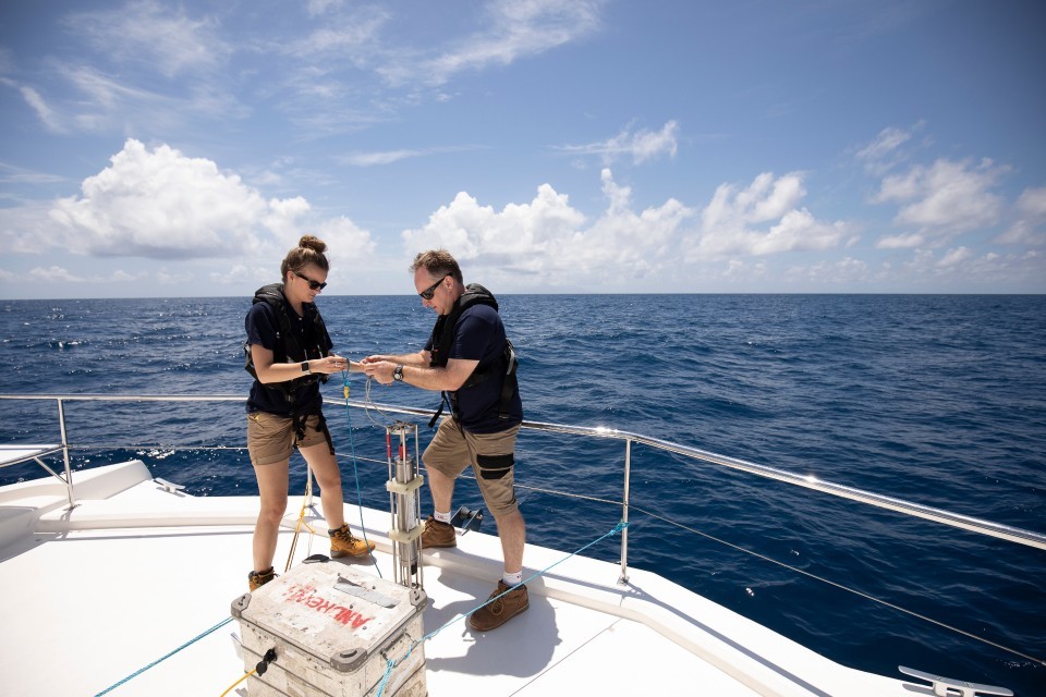
4. Enabling better use of the marine environment
We hold a wealth of marine geospatial data from the seabed, to the coast, offshore and beyond.
The data we hold is gathered from a range of expert providers by working closely with government organisations, hydrographic offices and other partners across the world.
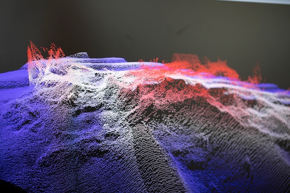
Bathymetric data of the seabed
This includes vast amounts of hydrographic data, ranging from complex multibeam surveys to simple sightings crowdsourced from mariners at sea.
We also hold millions of water salinity and temperature profiles, thousands of observations on marine mammals and bioluminescence, and a range of other data sets collected by satellites, overland drones, underwater autonomous vehicles, and more.
All this information is collated, processed and published by our specialist teams, so that we can add value and provide expert solutions.
4.1 Global marine geospatial information
We hold wide-ranging data sets from seabed to surface, including:
› Bathymetry and seabed profiles
› Seabed geology and seabed samples
› Tidal information
› Pipelines, cables and subsea infrastructure
› Navigational information
› Water column data (salinity and temperature)
› Marine biology information and observations
› Astronomical and celestial information
› Maritime limits and boundaries.
We hold over 23,000 marine mammal observations
5. Supporting defence operations by providing specialist expertise
All UK Defence vessels, from ships to submarines, rely on our navigational and operational products and services.
We work closely with the Royal Navy and other Defence customers to develop and deliver specialist products to support national defence and security.
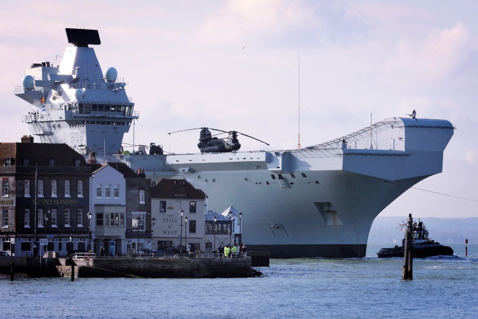
HMS Queen Elizabeth in Portsmouth
These include specialist navigational charts for submarines with complex, contour-rich detail to aid subsea navigation. We also supply products for situational awareness including Additional Military Layers (AML).
Environmental and oceanographic data can also be tactically significant for our Defence customers. We provide information and expertise to further their understanding of the maritime environment, such as marine mammal activity, territorial boundaries, seasonal weather conditions, and more.
Not only does this information support UK defence, but it can help minimise the environmental impact of military activity – whether under, on or above the sea.
5.1 Enhancing situational awareness in the marine environment
The specialist geospatial information we provide enables Defence users to use the marine environment safely and effectively.
We support 90+ Defence vessels including Royal Fleet Auxiliary ships
6. Working collaboratively to develop the global blue economy
Our work supports sustainable development and economic growth in the UK and across the globe.
As the blue economy continues to develop, accurate marine geospatial information will be needed to support industries such as maritime trade, tourism, aquaculture, infrastructure development, as well as new emerging sectors. For many coastal and island nations that rely upon their ocean resources, this is critical for their safety, food security and livelihoods.
UKHO staff on board a survey vessel
We support blue economy growth by undertaking seabed mapping, analysing marine data and producing up-to-date nautical charts. Not only does this support safe navigation worldwide, but it can also inform environmental protection, resilience against the effects of climate change, and disaster relief efforts.
And as the Primary Charting Authority for 71 coastal states, we help other countries and regions that do not yet have their own hydrographic capabilities to fulfil their international maritime obligations.
6.1 Supporting sustainability in coastal nations
We work on key international hydrographic programmes on behalf of the Foreign and Commonwealth Office, undertaking surveying and capacity building.
As part of the Overseas Territories Seabed Mapping Programme, we’re enabling sustainable blue economy growth in 14 UK Overseas Territories.
We support a further 17 Commonwealth states across the Pacific and Caribbean by partnering on the Commonwealth Marine Economies Programme.
We are the Primary Charting Authority for 71 states across the globe
7. Investing in technology and talent
Underpinning our organisation is our technology and our people – and we are investing in both.
From hydrography and oceanography to software engineering and data science, we employ experts across a range of disciplines, in a variety of challenging and interesting roles.
We believe people are the key to our success, which is why we support all staff in reaching their full potential.
Apprenticeships, internships and trainee programmes are just some of the training and development opportunities we offer to encourage learning for new and existing staff alike. We’re also adopting cutting-edge technologies and tools, so our staff are equipped to work in new and innovative ways.
In the local community, we deliver a programme of STEM activities to encourage young people into science, technology, engineering and mathematics careers. Through the programme, we partner with schools, participate in code clubs and work with thousands of people across the South West.
7.1 Award-winning apprenticeships
Since 2016, we have offered the opportunity to study for an industry-recognised qualification while gaining practical on-the-job experience through our apprenticeship scheme.
Over the years, our programme has expanded and today we offer a variety of roles across the business at advanced and higher levels.
This has led us to winning ‘Large Employer of the Year’ at the regional National Apprenticeship Awards in 2018, and ‘Highly Commended’ at the national awards
50+ number of apprentices we employ across the business
8. The way we work
Based in the heart of Taunton, Somerset, our new office has transformed the way we work.
Purpose-built to meet our needs as a modern hydrographic office, the building provides an open and dynamic workplace for our people.

Interior of UKHO headquarters
Within it, we foster a culture of creativity and collaboration. We embrace flexible working so that our teams are empowered to deliver – whether working remotely or in one of our collaborative workspaces.
By championing smarter ways of working, we’re enabling our teams to work together and innovate, so that we can remain world-leading in our field for years to come.
9. Specialist services
We have additional expertise across specialist departments.

UKHO staff presenting in front of satellite imagery
Law of the Sea
Our Law of the Sea team specialises in technical aspects of maritime baselines, limits, zones and boundaries.
We provide expert technical advice to governments and commercial organisations on all matters relating to the definition and delimitation of maritime space, including freedom of navigation issues, definition and illustration of maritime areas, and training on technical aspects of law of the sea.
Cartographic training
We deliver a certified range of training programmes to develop the core skills of marine cartography, which meet international standards and accreditation.
These courses are delivered by our training team, who have extensive experience in marine cartography, Electronic Navigational Charts (ENCs) and related disciplines.
His Majesty’s Nautical Almanac Office
His Majesty’s Nautical Almanac Office (HMNAO) provides solutions to astronomical and celestial navigation problems for a wide range of customers.
We provide data, both printed and electronic, in the form of astronomical and nautical almanacs, commercial data, expert witness testimonies, celestial navigation software, apps and a range of web services.
UKHO Archive
Our Archive contains hundreds of thousands of records and represents one of the most complete hydrographic collections of its type in the world.
Some of our treasured items include a chart of Portsmouth from the 1620s, surveys by Captain James Cook and records relating to HMS Beagle and Charles Darwin. The archive is open to researchers by appointment only.
10. Looking to the future
To achieve our vision, we’re investing in our data handling capabilities and harnessing big data technologies such as machine learning and algorithms.
Using data science, we can gain valuable insight from big data sets – from understanding the layout of the seabed from terabytes of data, to analysing how our products are being used on board thousands of ships.
Machine learning also helps us to handle complex geospatial data in new and innovative ways. Using ‘deep learning’, we can identify and classify wind turbines, oil platforms and other offshore objects. With the help of image segmentation technology, we’re able to automatically define the coastline.
These techniques allow us to add ever-greater richness to the data solutions we provide, helping our partners to make the most of the marine environment.
11. Our history of transformation
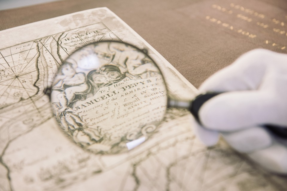
Magnifying glass over a historical chart
1795
- UKHO founded by an order in Council authorised by King George III
- Alexander Dalrymple appointed as first Hydrographer to the Admiralty Board
1800
- First nautical charts created and sold to the public
- First Sailing Directions, Tide Tables and Notices to Mariners published
1930s
- Printing moves to Taunton during WWII
- UKHO takes on additional roles in oceanography and meteorology
1990s
- UKHO registers as a trading fund, owned by the Ministry of Defence
- First digital navigational charts are produced
2000s
- ADMIRALTY portfolio expands to offer a range of digital products
- The use of ECDIS becomes mandatory for navigation
2019
- UKHO moves to its state-of-the-art new headquarters, built on its existing site in Taunton
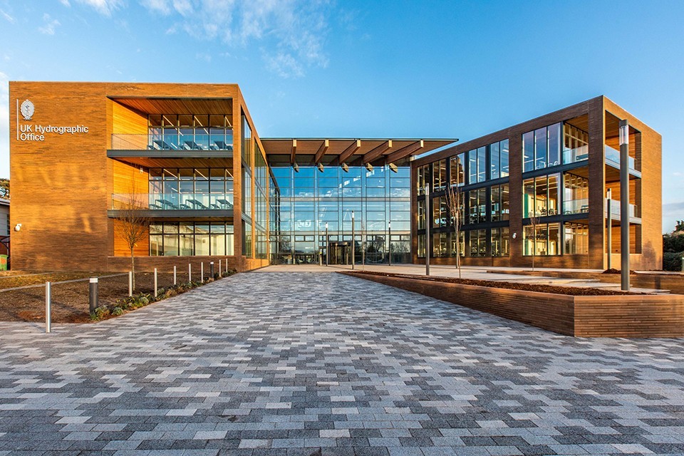
Exterior of UKHO headquarters
Unlocking a deeper understanding of the world’s oceans: for safer navigation, for the marine economy and for the future of our planet