
Identifying and protecting woodland archaeology
Published 26 October 2026
Applies to England

© Crown copyright 2026
This publication is licensed under the terms of the Open Government Licence v3.0 except where otherwise stated. To view this licence, visit nationalarchives.gov.uk/doc/open-government-licence/version/3 or write to the Information Policy Team, The National Archives, Kew, London TW9 4DU, or email: psi@nationalarchives.gov.uk.
Where we have identified any third party copyright information you will need to obtain permission from the copyright holders concerned.
This publication is available at https://www.gov.uk/government/publications/identifying-and-protecting-archaeological-features-in-woodland/identifying-and-protecting-woodland-archaeology
Introduction
Woodlands preserve a rich legacy of the past. Nearly all woodlands, ancient or modern, contain archaeological features in some form, reflecting how people have used the landscape over time. These features can include significant trees, such as giant pollards, or various earthworks – sometimes described as ‘lumps and bumps’ on the ground.
Archaeological features found in woodlands are fragile and irreplaceable. This guide helps woodland owners and people working in the forestry sector to identify archaeological features on the ground, so their protection and management can be built into any plans or proposals.
If you require a PDF version of this guidance, you can read identifying and protecting woodland archaeology.
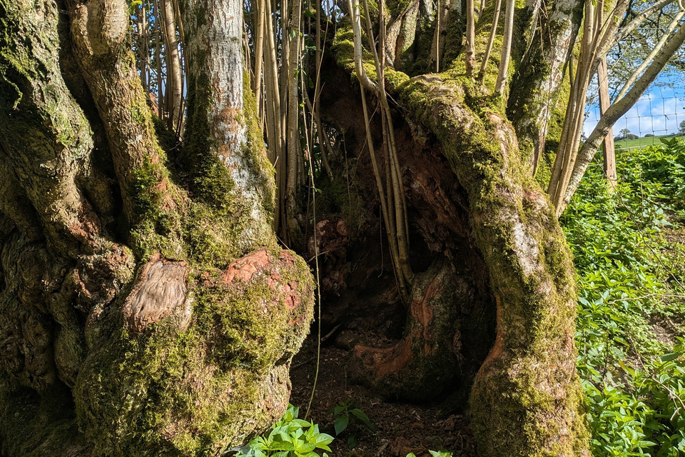
A historically worked tree growing along an old routeway. Bowerchalke, Wiltshire. Credit: Wessex Archaeology
The archaeology of woodlands
Some archaeological features found in woodlands are directly related to the past history and management of the woodland itself. These are examples of the archaeology of woodland. They include:
- banks which formed the boundary of a managed or enclosed woodland
- charcoal platforms used to convert wood into charcoal for fuel and other purposes
- saw pits used to cut large logs into planks, beams or boards
- trees which have been historically managed, such as coppiced stools or pollards
A woodland may also contain archaeological features for other reasons. Industries such as ironworking or pottery production were often located near to woodlands because of the availability of fuel and raw materials, such as iron ore. Similarly, many woodlands preserve significant evidence of past military use, particularly from the Second World War. Military sites such as airfields, camps, barracks, munitions stores, practice trenches and even bombing ranges were often located within or close to woodland. Trees helped to conceal many military structures, particularly munitions stores, from aerial attack.
The archaeology in woodlands
Many archaeological features found in a woodland have a non-woodland history. They were once situated in a more open landscape, but are now surrounded by trees. In some cases, woodland has naturally developed over an archaeological feature. In other cases, a feature previously located on open moorland or heathland has been over-planted with trees.
These features form part of the archaeology in woodland. They include:
- prehistoric barrows and burial mounds
- abandoned settlements of varying date, for example Roman farmsteads and medieval villages
- ridge and furrow earthworks from medieval or post-medieval fields
- rabbit warrens used to produce meat and fur, mainly in the post-medieval period
Identifying archaeological features in woodlands
How can we tell an Iron Age hillfort from a medieval moated site, or distinguish a 19th-century quarry from a Second World War bomb crater? Archaeological features that are identified on the ground are less likely to be damaged during forestry works, and you can factor their protection into management plans or proposals.
A brief guide to identifying some of the most commonly encountered types of earthworks, buildings and ruins is set out below. Use this as an introductory guide only.
Some archaeological features are difficult to recognise and interpret correctly. The reason why a woodland contains a ditch, hollow or ruined structure may only become clear through detailed archaeological investigation, or from a close examination of historical sources such as maps, written documents and old photographs.
If you are unsure on how to identify an archaeological feature, seek advice from a historic environment specialist so that it can be properly understood and protected.
Mounds - identification and types
Mounds and barrows are commonly found in woodlands.
A guide for identifying mounds in woodlands
Circular mound
Size: 5-20m wide and > 1m high
Possible features:
- prehistoric round barrow
- medieval/post-medieval windmill mound
- post-medieval tree planting mound
Broadly rectangular mound
Size: 5-50m long, 5-10m wide and 0.5-2m tall
Possible features:
- neolithic long barrow
- medieval/post-medieval rabbit warren
Irregular mound
Possible features: medieval/post-medieval spoil heap
Round barrows
Round barrows are commonly found in woodlands. These features were constructed to cover a burial or burials, mainly during the Bronze Age (around 2100-800 BC). Barrows may be confused with other types of circular or oval-shaped mound:
- medieval and post-medieval windmill mounds, which supported the superstructure of the windmill – generally 10 to 30m wide and over 1m tall
- post-medieval tree planting mounds located in historic parks and gardens – these can vary considerably in size
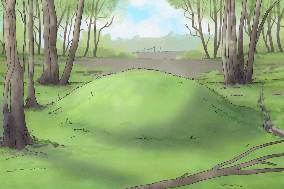
An illustrated round barrow: a grassy mound within woodland. Credit: Wessex Archaeology
Long barrows
Long barrows are a type of burial mound used in the Neolithic period (around 4000-3500 BC) by early farming communities.
They have an elongated appearance and can be rectangular, oval, trapezoidal and lozenge-shaped. They may be confused with pillow mounds, which were used to farm rabbits in the medieval and post-medieval periods.
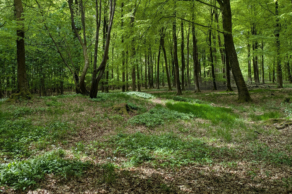
Long barrows: lozenge-shaped mounds in a woodland. Credit: Wessex Archaeology
Spoil heaps
Some mounds encountered in a woodland will reflect the legacy of past industry. Spoil banks were created by dumping waste from mining, for example, coal, can create clusters of irregularly shaped mounds arranged in parallel rows or ‘fingers’.
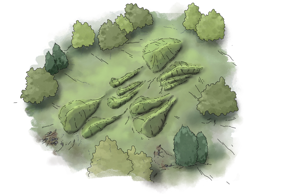
Illustrated spoil mounds: irregular shaped grassy mounds, known as spoil heaps or extractive mounds (‘finger mounds’) formed from dumping mining waste. Credit: Wessex Archaeology
Other mounds
Other types of mounds encountered in a woodland may include:
- prehistoric burnt mounds, which were used with hot-stones for boiling, cooking, bathing or other purposes – these are often circular, oval or crescent-shaped, and consist of accumulations of charcoal and fire-cracked stones, are generally 5 to 10m wide and around 0.5m tall, and are usually located near a watercourse
- prehistoric burial cairns and clearance cairns, which appear as mounds of stone, often partially covered by grassy vegetation – clearance cairns were created by removing stones from fields and can be over 10m wide
- medieval mottes associated with Norman castles – these earthen mounds are generally steep-sided with a flat top, and can be very large (over 10m tall and 50m wide), although some are smaller; the motte is often associated with other earthworks such as banks and ditches
Banks and ditches – identification and types
Banks and ditches are among the most common archaeological features found in woodlands. They can vary greatly in size and form. Some are very substantial, such as the steep banks marking the site of an Iron Age hillfort or the broad ditches that once enclosed a medieval moated site. Others may only be visible as a slight rise in the ground, as with a 19th-century field boundary.
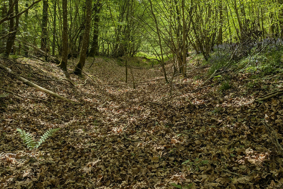
Prehistoric linear earthwork at Vernditch Chase, Wiltshire: a ditch flanked with banks along the forest floor. Credit: Wessex Archaeology
A guide for identifying banks and ditches in woodlands
Bank or ditch runs for hundreds of metres
Smaller (<2m wide and <1m high) and large (2-20m wide and > 1m high) bank or ditch which does not form an enclosure, possible features include:
- prehistoric linear earthwork
- medieval/post-medieval woodbank
- medieval/post-medieval park pale
- medieval/post-medieval parish boundary
- field boundaries (various dates)
If the bank or ditch forms an enclosure, possible features include:
- prehistoric enclosed settlement/Iron Age hillfort
- Medieval moated enclosure
- other enclosure
- field boundaries (various dates)
Zig-zag shaped ditch
Possible features: First/Second World War practice trenches
Woodbanks
The boundaries of many woodlands were marked in the medieval and post-medieval periods by the construction of banks and ditches, or sometimes by stone walls. These are known as ‘woodbanks’, and they helped to protect the woodland from damage, particularly from livestock. The interior of a woodland may have been further divided by low banks to create coppice compartments, each of which was managed separately.
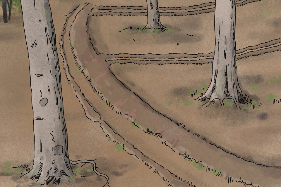
An illustrated internal woodland boundary showing low banks running across a woodland. These may reflect abandoned coppice compartments. Credit: Wessex Archaeology
A woodbank may be confused with other types of boundary feature, such as a prehistoric linear earthwork or a bank enclosing a medieval deer park. Many administrative boundaries, such as parish edges, are also marked by banks.
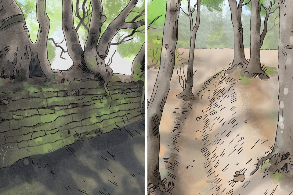
Illustrated woodbanks showing banks often marked the edge of a woodland or park. Credit: Wessex Archaeology
Iron Age hillfort
Iron Age hillforts are defended enclosures, often defined by substantial ditches and banks. The interior may contain the remains of roundhouses and other settlement features, such as refuse pits.
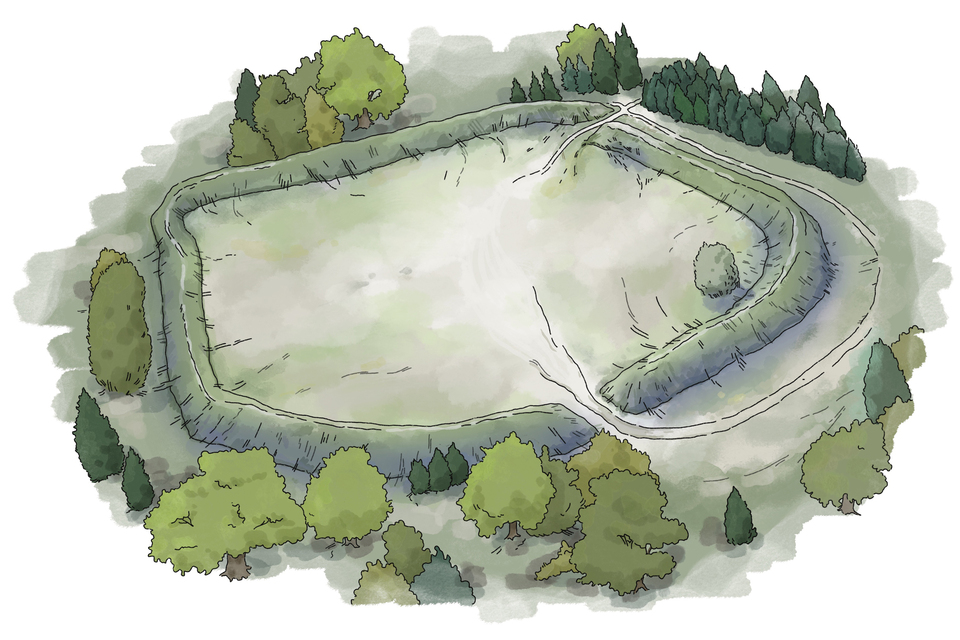
An Iron Age hillfort illustration showing an open space surrounded by substantial banks and ditches within woodland. Credit: Wessex Archaeology
Medieval moated site
Medieval moated sites were high-status residences, mainly used in the 13th and 14th centuries. They were often located near woodland and, following their abandonment, were subsequently colonised by trees. Some were later incorporated into designed landscapes such as parks and gardens where trees were deliberately planted.
The moat may still be visible as a deep, wide ditch, often retaining some water. The interior of the enclosure may contain the remains of buildings and gardens
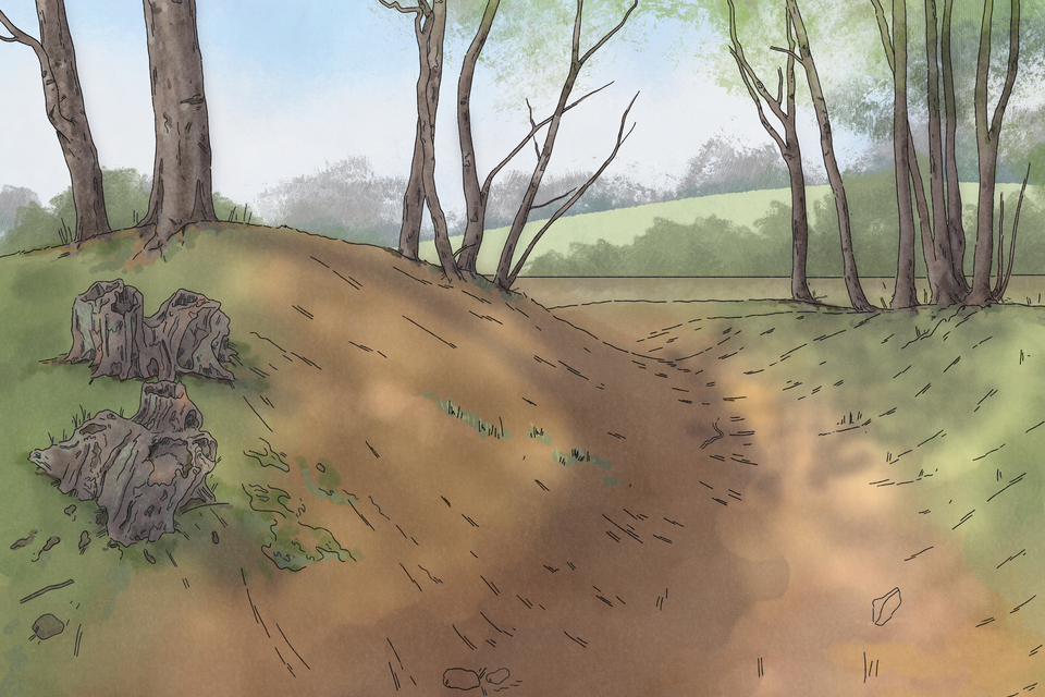
An illustrated medieval moated enclosure within a woodland. The winding ditch (moat) has dried up. Credit: Wessex Archaeology
Practice (training) trenches
Large numbers of practice trenches were dug for military training exercises during the First and Second World Wars. Their locations were rarely recorded on maps or in other sources.
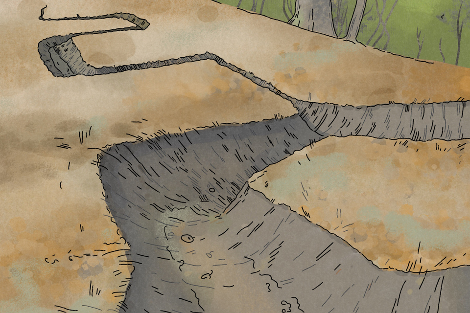
A practice (training) trench illustration showing a geometric network of trenches dug out of woodland. Credit: Wessex Archaeology
Pits, hollows and levelled areas - identification and types
A guide to identifying pits, hollows and levelled areas in woodlands
Hollows in the ground
Circular hollows
Size: 5-10m wide and < 0.5m deep
Possible features:
- tree throw hole
- medieval/post-medieval charcoal hearth
- Second World War bomb crater
Rectangular or oval hollows
Size: 5m long, 1-2m wide and 0.5-2m deep
Possible features:
- post-medieval saw pit
- First/Second World War slit trench
Irregular or steep-sided hollows
Possible features:
- medieval/post-medieval quarry pit
- post-medieval bell pit
- Second World War bomb crater
Circular levelled areas
Possible features:
- medieval/post-medieval (5-10m wide)
- charcoal hearth (5-10m wide)
- Building platform of various dates (larger than 10m wide)
Charcoal hearths
Charcoal production was a major rural industry throughout the medieval and post-medieval periods, providing an important source of fuel for industries such as ironworking. Evidence for charcoal production may take the form of a shallow pit, hollow or levelled area. The soil around the site is often stained black.
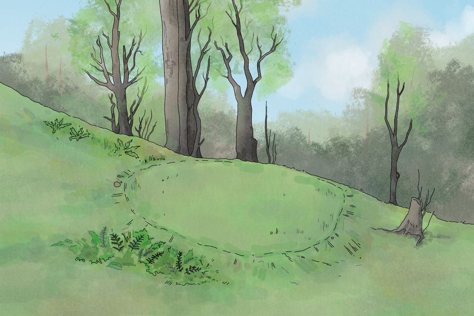
A charcoal hearth illustration showing a circular levelled area covered in grass within a woodland setting. Credit: Wessex Archaeology
Saw pits
Saw pits were widely used throughout the post-medieval period to convert trees into timber, for example planks, beams and boards. A large log was placed over a narrow, slit-like pit and sawn by two people – one standing in the pit below and one working from above. Saw pits can be recognised as shallow, broadly rectangular trenches.
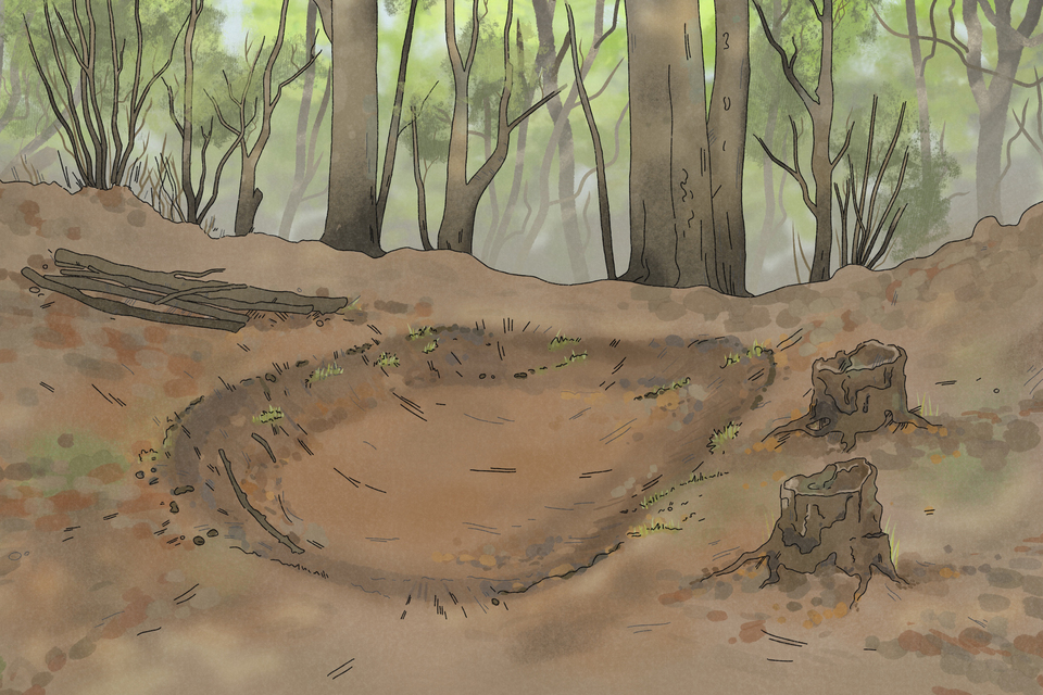
A saw pit illustration showing a shallow rounded rectangle trench on a woodland floor. Credit: Wessex Archaeology
Quarry and dell pits
Quarry and dell pits were used to extract materials such as chalk, clay, flint, gravel, sand or building stone, although their date is often difficult to determine. They can generally be recognised by a deep, wide depression in a woodland, although in some cases they may be difficult to distinguish from a natural, geological feature.
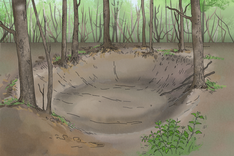
A post-medieval quarry or dell pit illustration showing a deep wide depression in a woodland. Credit: Wessex Archaeology
Bell pits
Bell pits are an early type of mine, characterised by a vertical shaft and a wide cavity at their base. This creates the characteristic ‘bell’ shape when viewed in cross-section. They were mainly used for coal mining in the post-medieval period, although they are also associated with the extraction of other materials. A bell pit typically takes the form of a shallow, circular depression, usually with a spoil collar.
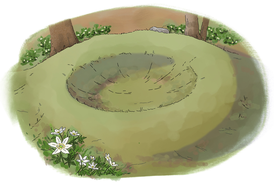
A post-medieval bell pit/shaft illustration showing a shallow, circular depression in the ground. Credit: Wessex Archaeology
Bomb craters
Bomb craters can appear as roughly circular depressions in woodlands, often in clusters. They generally measure around 3 to 15 metres across and up to 0.5 metres deep. Some may hold water seasonally or support vegetation that differs from the surrounding area. The craters are often the result of military training exercises during the Second World War. They can be well preserved in woodlands because they have not been filled in or significantly disturbed by later activity.
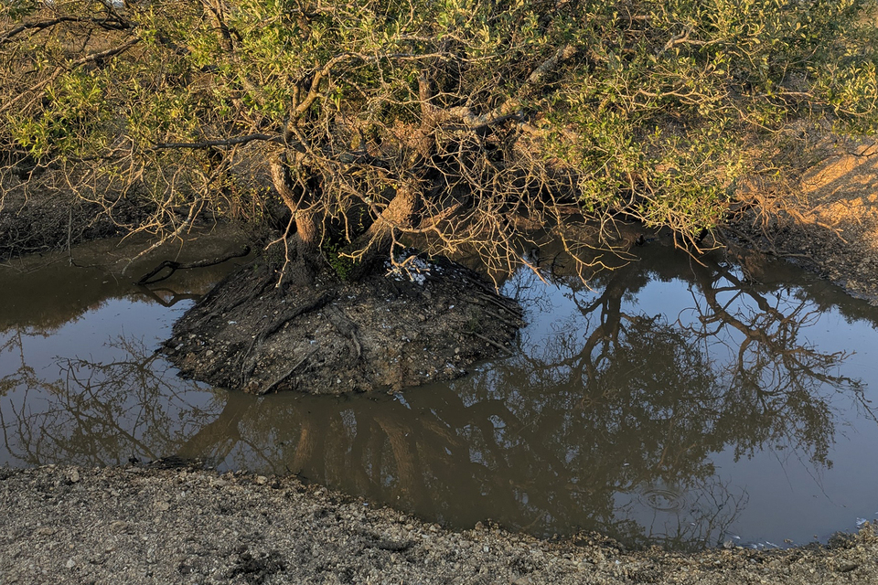
A large bomb crater located in the Ashley Walking Bombing Range, New Forest, Hampshire. Trees are growing out of the flooded crater. Credit: Wessex Archaeology
Buildings, ruins and water features – identification and types
Many of the buildings, ruins and water features found in present-day woodlands were originally located in open areas. Trees, brambles and ivy have often colonised estates, farms, industrial areas and military sites which were abandoned in the 19th and 20th centuries.
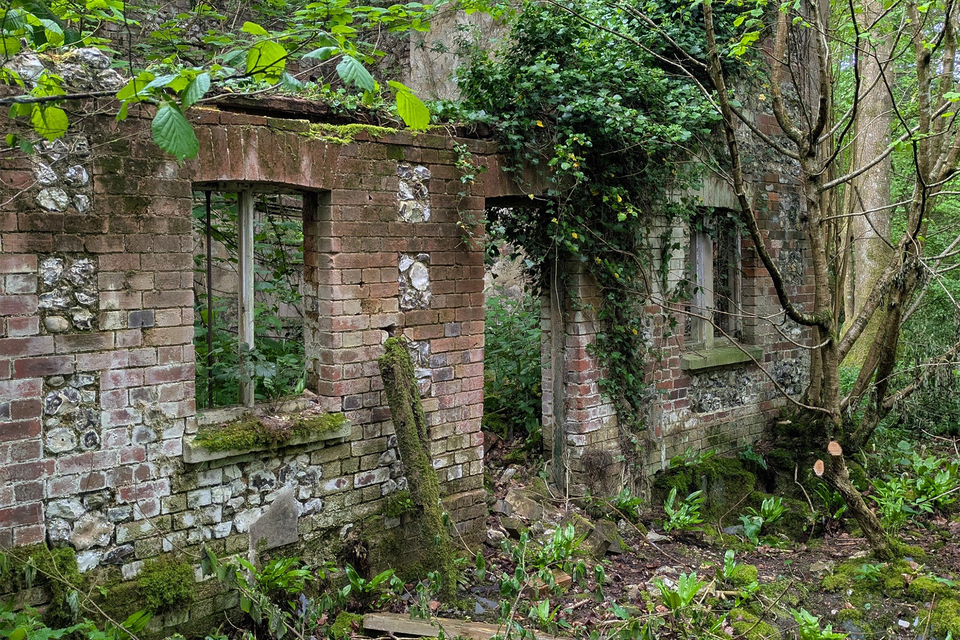
An abandoned, 19th century brick-built estate cottage at Grovely Woods, Wiltshire. Trees and vines are growing through the hollow building. Credit: Wessex Archaeology
Common structures found in woodland
| Structure | Main characteristics | Common date range |
|---|---|---|
| Mills | Building or buildings located next to a stream, leat (mill race) or pond, with substantial thick walls. Evidence for a wheel pit. Made of stone or brick. | Medieval to post-medieval |
| Industrial features (lime kilns, ironworks) | Chimney stacks, spoil heaps and remains of kilns or furnaces. Ponds may be located nearby. Made of stone or brick. | Post-medieval |
| Woodland industries and crafts (charcoal burners’ huts, bark peelers’ huts) | Simple, small structures, often roughly built of stone or turf. | Post-medieval |
| Agricultural and estate buildings (cottages, gate lodges, barns, farmhouses) | Rectangular structures of brick or stone, with windows and remains of chimneys or fireplaces. | Mainly post-medieval |
| Military sites (air raid shelters, ammunitions stores, Nissen huts, other structures) | Structures made of concrete, brick and corrugated metal. | 20th century |
Post-medieval lime kilns
Kilns were frequently built near to sources of limestone or chalk to produce lime, a material widely used for building, improving agricultural fields and other purposes. Most lime kilns date to the post-medieval period, although they were also used in earlier periods.
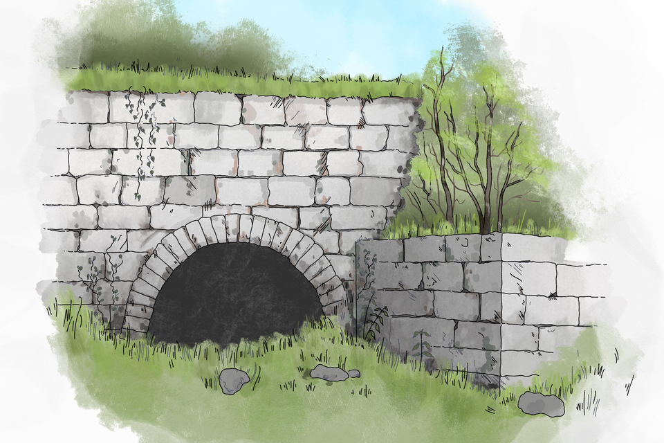
An illustrated post-medieval lime kiln showing the arched aperture of the drawhole. Credit: Wessex Archaeology
Bark peeler’s hut
Oak bark was an essential raw material for tanning leather. It was highly sought after, particularly during the post-medieval period when demand for leather grew significantly. The bark was harvested seasonally, and the remains of shelters or huts used by the workers who stripped the bark may be preserved in woodlands.
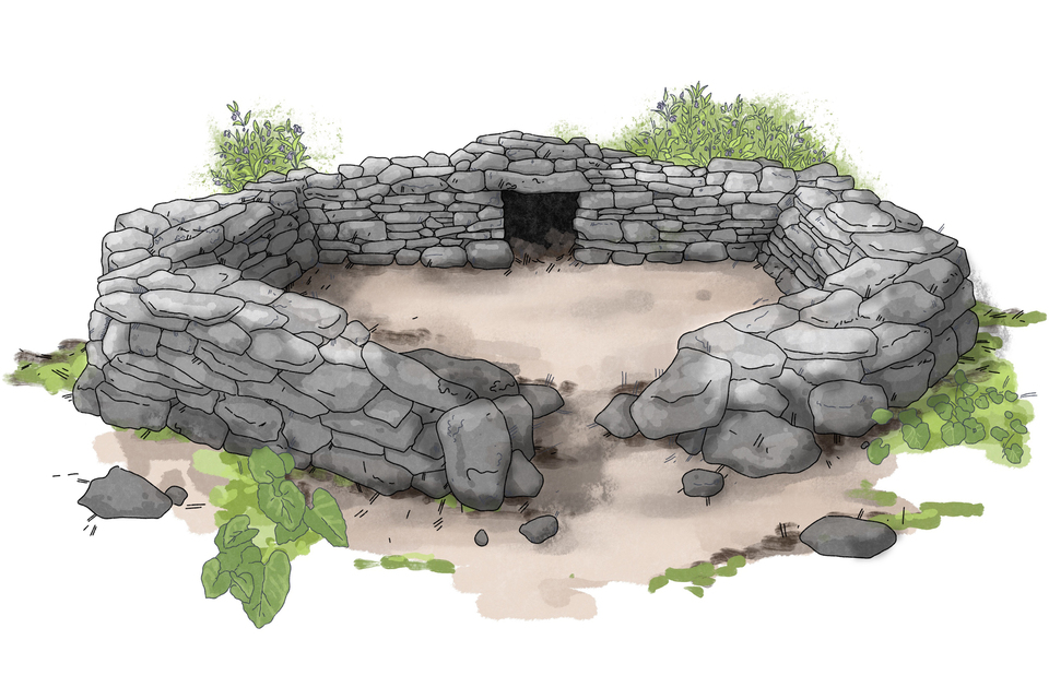
Illustrated remains of a post-medieval bark peeler’s hut enclosed by a circular stone-built wall with an opening. Credit: Wessex Archaeology
Leats
A leat is an artificial watercourse used to supply water to a watermill, millpond or another structure. Leats are often called ‘millstreams’ and date to the medieval and post-medieval periods. A leat will have a very even gradient, following the contour of a slope.
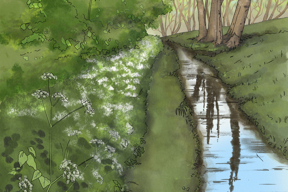
Illustrated medieval or post-medieval leat: a narrow stream of water runs along the bottom of slope in a woodland. Credit: Wessex Archaeology
Routeway identification
Many routeways survive in woodlands as sunken tracks, subtle earthworks or linear clearings, sometimes flanked by low banks, ditches and walls.
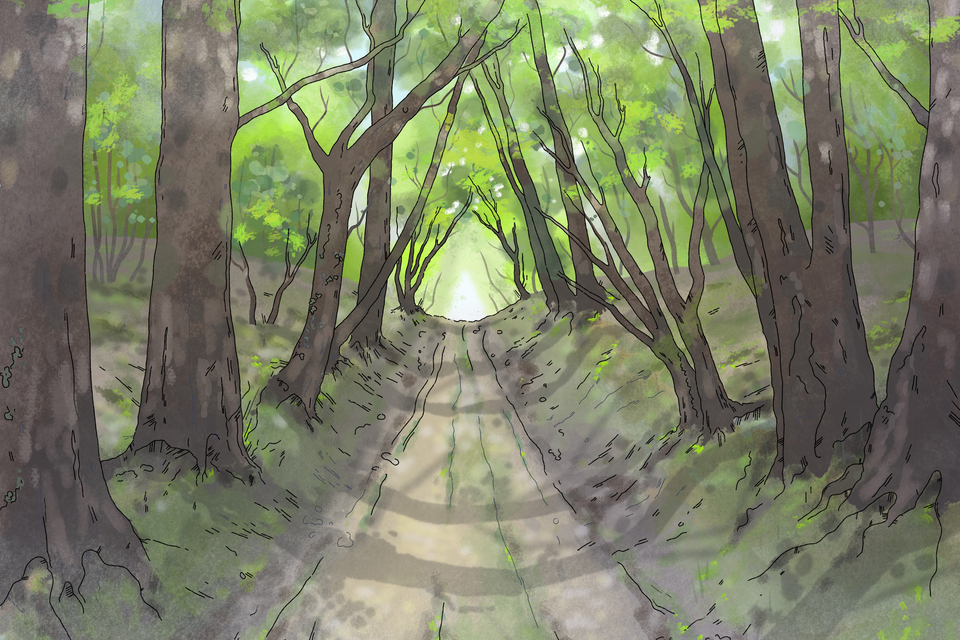
An illustrated holloway flanked by mature trees. Credit: Wessex Archaeology
Common types of routeway found in woodlands
| Feature | Width | Main characteristics | Main time period |
|---|---|---|---|
| Roman road | 5-12 metres | Largely straight alignment, with the road raised slightly on an embankment. Often re-used in later periods. | Roman and later |
| Holloway | 2-10metres | Deep, sunken lane with banks, often flanked by mature trees. | Medieval to post-medieval, sometimes earlier |
| Drove road | 10-50+ metres | Wide corridor, often narrowing into a funnel, with walls or banks along the edges. | Medieval to post-medieval, sometimes earlier |
| Railways/ tramways | 2-5 metres | Even-gradient route associated with embankments, often near industrial sites such as quarries or mines. | 18th to 20th century |
| Woodland rides | 5-40 metres | Wide strip between areas of woodland. | 19th to 20th century, sometimes earlier |
| Forestry tracks | 3-8 metres | Engineered road surface, flanked by drainage ditches. | Mostly modern |
| Other routeways | Variable | Often narrow (1 to 5 metres), and may follow historic routes, such as Roman roads. Can include footpaths, bridleways and pack horse tracks. | Any period |
Other earthworks – identification and types
Ridge and furrow
Ridge and furrow features were created by repeatedly ploughing fields in the medieval and post-medieval periods. They are characterised by parallel rows of low banks (ridges) and ditches (furrows). The ridges can vary considerably in size and form, measuring 5 to 20 metres across. Medieval examples often have a characteristic reversed ‘S’ shape.
Read more about identifying ridge and furrow.
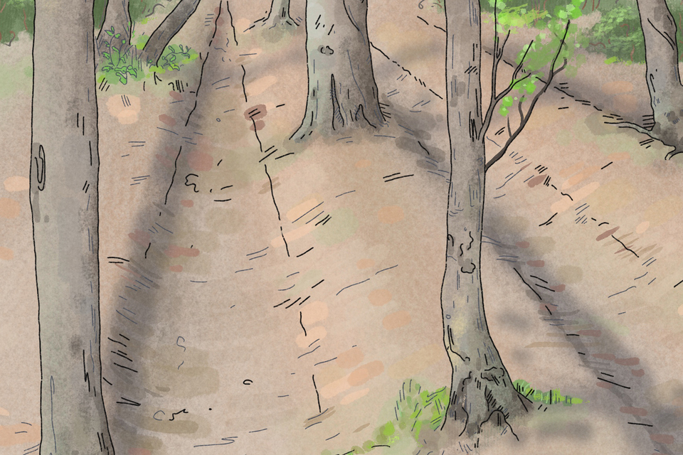
A ridge and furrow illustration showing parallel rows of low banks (ridges) and ditches (furrows) within a woodland. Credit: Wessex Archaeology
Lynchets
Lynchets are terrace-like features that form through the erosion of plough soil, although they can also accumulate naturally. A positive lynchet forms at the base of the slope, whilst a negative lynchet, a depression, forms where the surface is eroded away. They can vary in date from prehistoric to post-medieval. They run across a slope and can range in length from a few metres to hundreds of metres. Lynchets can be very similar to landslips, and it may not always be possible to tell the two apart.
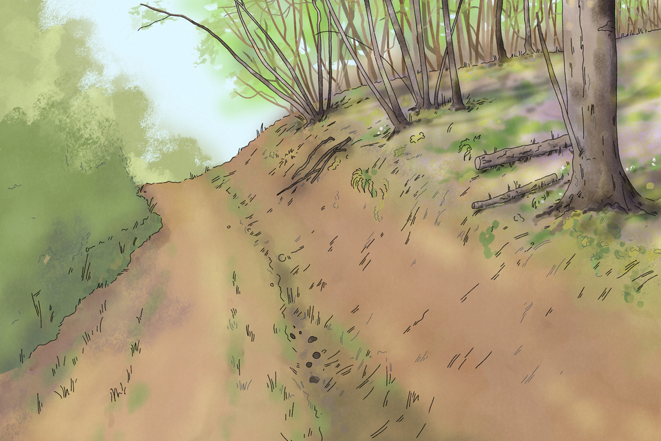
An illustrated lynchet formed through soil erosion. The lynchet runs along the base of a slope. Credit: Wessex Archaeology
Significant trees – identification and types
Coppiced trees
Many woodlands were historically managed by coppicing to produce timber, fuel and wood for a range of uses, such as hazel poles for hurdles or fish traps. Coppiced trees are cut close to ground level on a rotational cycle. Historical sources suggest that this cycle ranged from around 6 to 15 years. One of the most common systems of management was coppice-with-standards, in which some trees were cut on a regular cycle, for example hazel, while others were left to grow on as mature timber trees, such as oak.
Pollarded trees
Historically, pollarding was widely used to manage trees in wood-pasture and farmland. Trees were cut back around 2 to 3 metres above ground level to encourage the growth of new branches, which could then be harvested for timber, fuel or animal fodder. This allowed livestock to graze beneath the trees. The trunk of the tree, known as a boll or bolling, often develops a distinctive hourglass shape and a gnarled appearance.
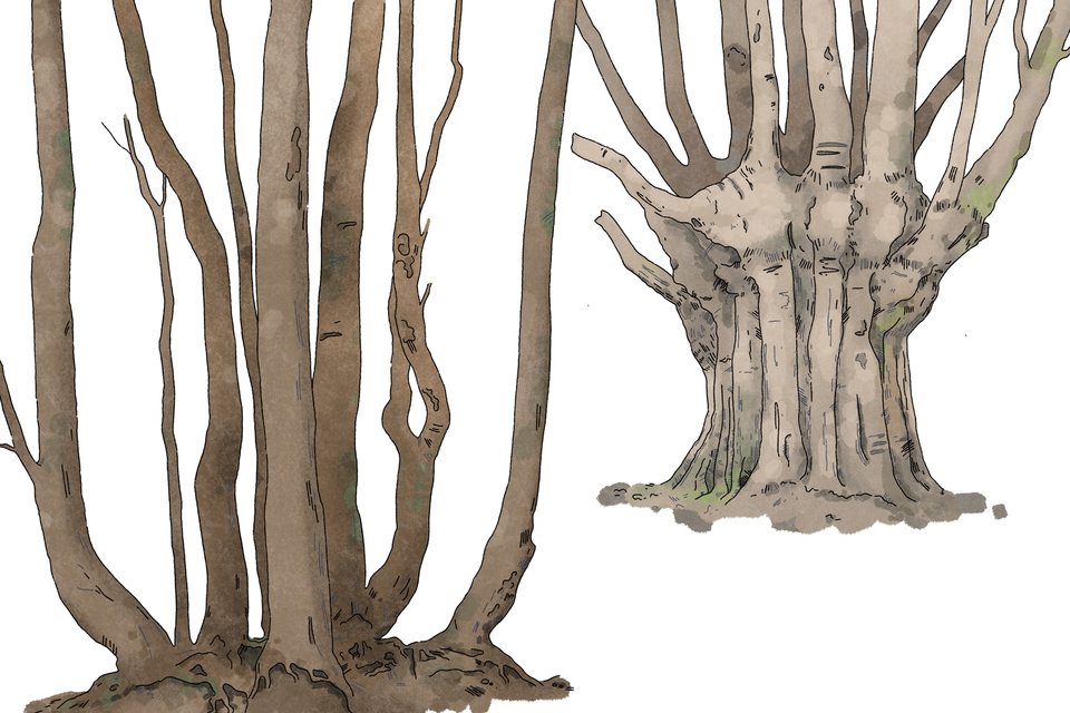
An illustrated outgrown coppiced stool (left) and an outgrown pollard (right). The coppiced stool is split at the base. The pollard trunk is gnarled and hourglass shaped. Credit: Wessex Archaeology
Outgrown hedgerows
Groups of trees growing along the boundary banks of woodlands or the edges of field systems, may reflect an abandoned and outgrown hedge line. The trees will often have a distinctive growth form, with the stem or branches lying at roughly a 90-degree angle.
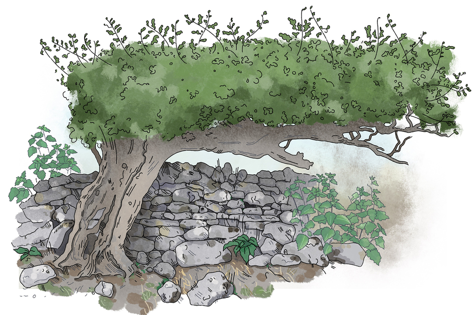
An outgrown hedgerow illustration reflecting the location of an abandoned field boundary. The hedgerow grows through the remains of a stone wall. Credit: Wessex Archaeology
Caring for archaeological features during management works
Archaeological features are fragile and irreplaceable. It is important to protect them now and for future generations. They can be damaged by operations that break the ground surface or cause compaction.
Before starting any works, you should:
- collate information on archaeological features at the earliest stage
- check the protection status of the archaeological features (see Scheduled Monument section below)
- clearly define the extent of the archaeological features
- inform those working on the site of its significance, any legal obligations, the proposed method and the need to avoid damage – consider marking the features with paint or tape
When felling:
- limit works to periods of dry ground conditions
- use existing tracks where suitable – do not drive on or around archaeological features
- if the use of vehicles is unavoidable, use brash matting beneath machines and on existing trackways close to the features
- cut trees as close to ground level as possible – stumps and roots should be left to rot in situ (in their original position) and not be grubbed out
- treat stumps to prevent regrowth where appropriate
- do not leave vehicles and machinery parked on archaeological features
- fell larger trees in sections to avoid damage from falling timber
- use brash matting to cushion the impact of falling timber onto archaeological features where unavoidable
When extracting timber:
- avoid dragging timber across the archaeological features – consider using a grapple, winch or horse for extraction
- do not stack timber on archaeological features
- do not burn material on site
When restocking:
- no restocking can take place on a Scheduled Monument without consent
- consider leaving open space around archaeological features, with a plan for the ongoing management of scrub and regeneration
If you are working near a Scheduled Monument, you must also:
- check Historic England’s ‘Search the List’ to establish whether your archaeological feature has designated status
- contact Historic England for advice where significant works are proposed near designated assets
- be aware that it may be a criminal offence to damage, or permit damage to, the ground surface of a Scheduled Monument, either deliberately or accidentally
- be aware that planned works that will disturb the surface of the ground will require Scheduled Monument Consent (SMC)
- note that SMC is generally not required for tree felling – however, a felling licence may require restocking, so SMC would be needed for this on scheduled areas, or you will need an exemption from the felling licence conditions or to undertake compensatory planting elsewhere
Other consents
The activities described in this guide may require additional consents depending on the specifics of the site.
Felling licence
A felling licence may be required to undertake felling operations. Seek advice from the relevant Forestry Commission Woodland Officer.
Site of Special Scientific Interest consent
Natural England must give consent for any activity on land designated as a Site of Special Scientific Interest.
An outline of woodland development
How we study woodland history
Several strands of evidence need to be brought together to study the history of a woodland. Place names and documentary sources are often the first starting point, particularly historical maps, which can provide evidence for woodland continuity.
Surveys of archaeological features tell us how the landscape was used in the past. Archaeological evidence can show whether a woodland has developed on land that was previously open, or whether the site shows evidence of far longer woodland continuity.
Palynology, the analysis of pollen, can extend our understanding of woodlands further back in time. Pollen grains are surprisingly robust, and they can be preserved in waterlogged sediments such as peat or in the organic-rich deposits found in river valleys, ponds and lakes. Many different types of trees, shrubs and woodland plants produce distinctive pollen grains, and their relative proportions can be recorded to examine changes in past vegetation.
Alongside pollen, waterlogged sediments may also preserve other types of evidence relevant to past woodland environments, such as wood, seeds and invertebrates.
The development of woodlands
Late upper Palaeolithic (around 25,000 to 11,000 BC)
Thick ice sheets covered most of northern Britain around 25,000 BC, although these were beginning to shrink as the climate gradually warmed. By 11,000 BC, much of Britain had become free of permanent ice cover, although the climate remained cold. Landscapes were largely open, with windswept plains of tundra and steppe. Trees only grew in scattered locations where conditions were favourable.
Mesolithic (around 10,000 to 4000 BC)
Woodlands developed following a rise in temperatures around 10,000 BC. Many trees, shrubs and woodland plants, as well as animals and people, colonised Britain through a vast land bridge known as Doggerland. This land bridge connected large parts of eastern Britain to mainland Europe until it was submerged by rising sea levels around 8000 to 6000 BC.
By 6000 BC, mixtures of closed-canopy woodland and open woodland covered around 70 to 80% of the landscape. Some areas had even higher levels of woodland cover, while others were more open. The level of woodland cover was influenced by hunter-gatherer populations and natural factors, such as climate, soils and the effects of wild grazing animals.
Neolithic (around 4000 to 2200 BC)
Agriculture was introduced around 4000 BC, and there was a major period of population growth. This coincided with significant woodland disturbance, with short-lived clearance phases.
Bronze Age (around 2200 to 700 BC)
A major period of landscape transformation occurred throughout the Bronze Age, with a shift from a predominantly wooded landscape to one which was largely open. Rising population levels and an expansion in agriculture were the main causes of woodland loss.
Iron Age (around 700 BC to AD 43) to Roman (around AD 43 to 410)
Woodland cover continued to decrease throughout these periods, falling to around 20 to 30%. Some areas retained a greater degree of woodland cover, while others became increasingly open.
Early medieval (around AD 410 to 1100)
There was little overall change in the level of woodland cover between the Roman and early medieval periods. However, between the 8th and 11th centuries, woodland cover had fallen further. It is estimated that around 15% of the English landscape was either woodland or wood pasture by the end of the 11th century.
Medieval (around AD 1100 to 1500)
Significant population growth in the 13th century and an agricultural expansion contributed to further woodland loss. Woodland only covered around 10% of the English landscape by the 14th century. More formal systems of woodland management developed in this period, notably coppices.
Post-medieval (around AD 1500 to 1900)
Population levels rose further, and woodland loss continued. By the end of the 19th century, woodlands (including plantations) covered around 5% of the English landscape. Changing social and economic circumstances had a significant impact on how woodlands were managed and used.
Early to mid-20th century (around AD 1900 to 1950)
Woodland cover reached a historic low point and traditional methods of woodland management had gone into sharp decline. There were severe timber shortages and in response there was a major expansion in timber plantations. Large numbers of ancient woodlands were partially cleared or modified, often by replanting with dense conifer plantations.
Mid-20th century to present day (around AD 1950 onwards)
Woodland cover gradually increased over time, reaching 19% in Scotland, 15% in Wales and 10% in England. Environmental and social values became central to woodland management in order to enhance biodiversity, carbon capture and public health.
Further information
Historic environment guidance for forestry in England.
Selected references
This content has drawn upon information in published studies. Key sources used are:
Bannister, N.R., 2007. The cultural heritage of woodlands in the South East. Natural England/Forestry Commission.
Barnes, G. & Williamson, T., 2015. Rethinking Ancient Woodland: the archaeology and history of woods in Norfolk. Hertfordshire: University of Hertfordshire Press.
Fyfe, R., 2018. ‘Natural’ vegetation in Britain: the pollen-eye view. British Wildlife, 29, 339-349.
Peterken, G.F., 2023. Trees and woodlands. London: Bloomsbury Publishing (British Wildlife Collection 12).
Rackham, O., 2006. Woodlands. London: Collins.
Prepared with Wessex Archaeology.