Check for live flood warnings: guidance for professional users of the get flood warnings service
Updated 25 June 2026
Applies to England

© Crown copyright 2026
This publication is licensed under the terms of the Open Government Licence v3.0 except where otherwise stated. To view this licence, visit nationalarchives.gov.uk/doc/open-government-licence/version/3 or write to the Information Policy Team, The National Archives, Kew, London TW9 4DU, or email: psi@nationalarchives.gov.uk.
Where we have identified any third party copyright information you will need to obtain permission from the copyright holders concerned.
This publication is available at https://www.gov.uk/government/publications/get-flood-warnings/check-for-live-flood-warnings-guidance-for-professional-users-of-the-get-flood-warnings-service
1. Overview
You should read this guide if you have a professional (organisation) login for the Get flood warnings service. You are likely to be an administrator for your organisation’s Get flood warnings account.
Administrators for an organisation can add locations of interest and then link contacts to these. This allows organisations to tailor which flood alerts and flood warnings each of their contacts receive.
This guide explains how administrators for an organisation can log in and view flood alerts and flood warnings currently in force for areas of interest to their organisation.
2. Live flood warning maps
When users log into their professional (organisation) account for the Get flood warnings service, they will initially be presented with the live flood warnings page. This page provides a summary list and map view. These show how many of your organisation’s locations are covered by a live flood alert or flood warning.
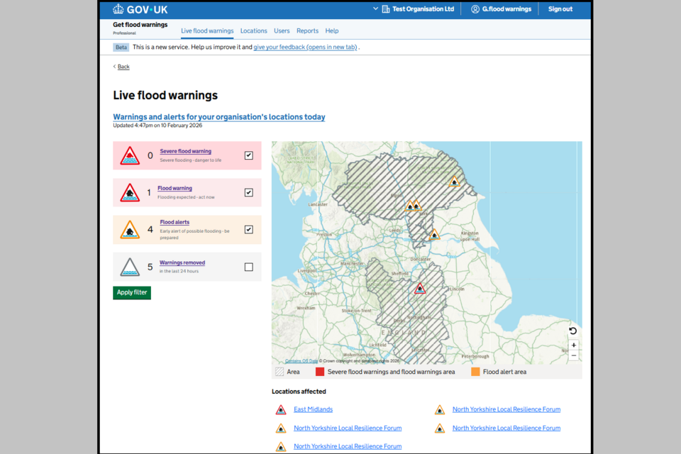
Image 1: Live flood warnings page showing warnings in force. Image courtesy of the Environment Agency
The list on the left counts how many of your organisation’s locations are currently covered by live warnings. These include:
- flood alerts
- flood warnings
- severe flood warnings
Use the check boxes alongside these to toggle flood alerts, flood warnings, severe flood warnings and warnings removed on and off in the map view. Select Apply filter when your selection has been made.
Note: These flood alerts and flood warnings will be counted multiple times if your organisation has:
- locations which overlap
- multiple locations within a flood alert or flood warning area
The map displays the flood alerts and flood warnings currently in force. It will also display any flood alerts and flood warnings that have been removed in the last 24 hours. Zooming in on the map will show the areas covered by flood alerts and flood warnings.
Grey hatched areas on the map refer to:
- boundary type locations for your organisation that have been added from the available predefined list
- boundary locations which have been uploaded by your organisation as a shapefile
Selecting the link Warnings and alerts for your organisation’s locations today will open the Live flood warnings report page. You can find out more about the reports available in your professional (organisation) account in the separate reports guide.
If there are no flood alerts or warnings in force, or no locations associated with the account, the map display will be empty. Locations can be added from the Locations tab. You can read more about adding locations in the separate locations guide.
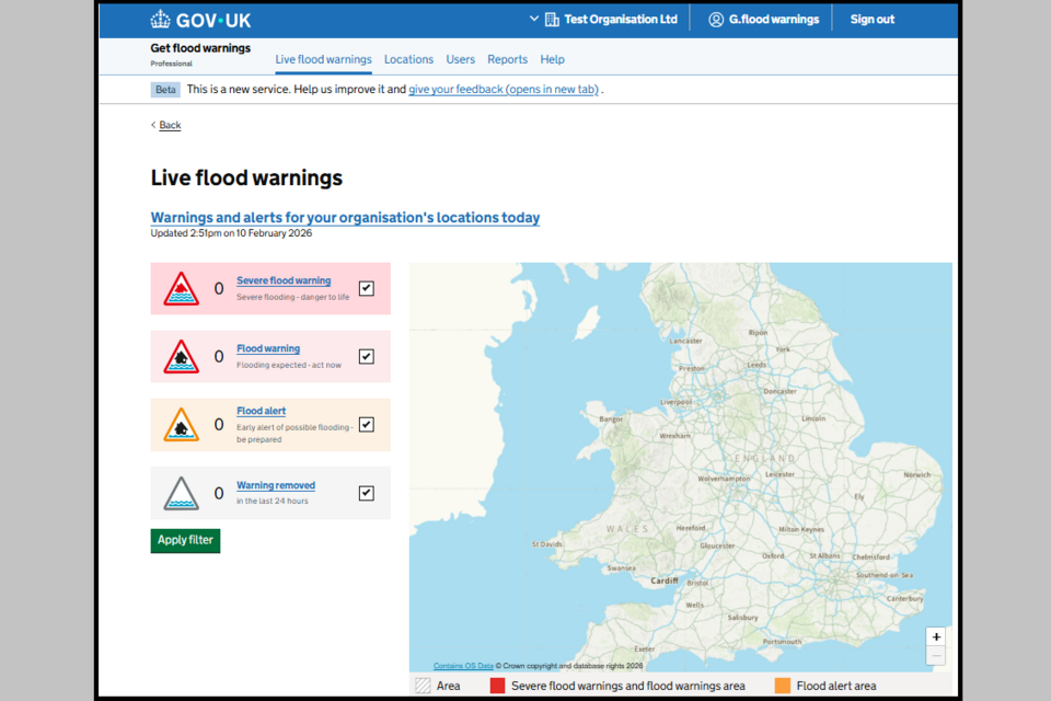
Image 2: Live flood warnings page showing no warnings. Image courtesy of the Environment Agency.
3. Find out more
You can also watch this YouTube tutorial to find out how to:
- check active flood alerts and warnings
- filter data
- produce a report