New phase of King Charles III England Coast Path opens
The latest stretch of the King Charles III England Coast Path, extending from Aust to Clevedon, has opened.
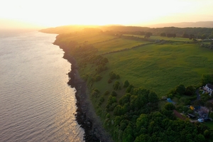
Image shows the path between Portishead and Clevedon
The new path stretches from Old Passage near Aust just south of the Old Severn Bridge in South Gloucestershire through to Wain’s Hill, Clevedon in North Somerset. It is the second phase of the path between Aust and Brean Down.
The first stage between Sand Bay near Weston-super-Mare and Brean Down Fort in Somerset opened in June 2022. The remaining phases aim to be completed by the end of 2024 enabling a continuous walking route to the Somerset coastline and beyond.
This is the first section of path to open in South Gloucestershire and Bristol and the second section in North Somerset.
-
23 miles of these lengths of King Charles III England Coast Path adds to the 12 miles already open in this stretch
-
Route highlights include excellent views of the Severn Estuary and the crossings to Wales contrasting with the industrial landscape near the Port of Bristol and the tranquil and rocky coastline between Portishead and Clevedon
The path also forms part of the next section of the ‘North Somerset Tidal Trail’ which will eventually follow the length of North Somerset’s coastline.
This is the latest section of the 2,700 mile King Charles III England Coast Path to be opened by Natural England. The new 23 mile long path stretches from just north of Severn Beach through to Clevedon, one of the original British seaside resorts with its famous Victorian Pier. The trail is mostly along existing rights of way with new additional access rights along the seawall at Portbury in North Somerset.
Natural England has worked in collaboration with South Gloucestershire Council, Bristol City Council, North Somerset Council, the Environment Agency, local landowners and many other local partners to make the route available and accessible to the public.
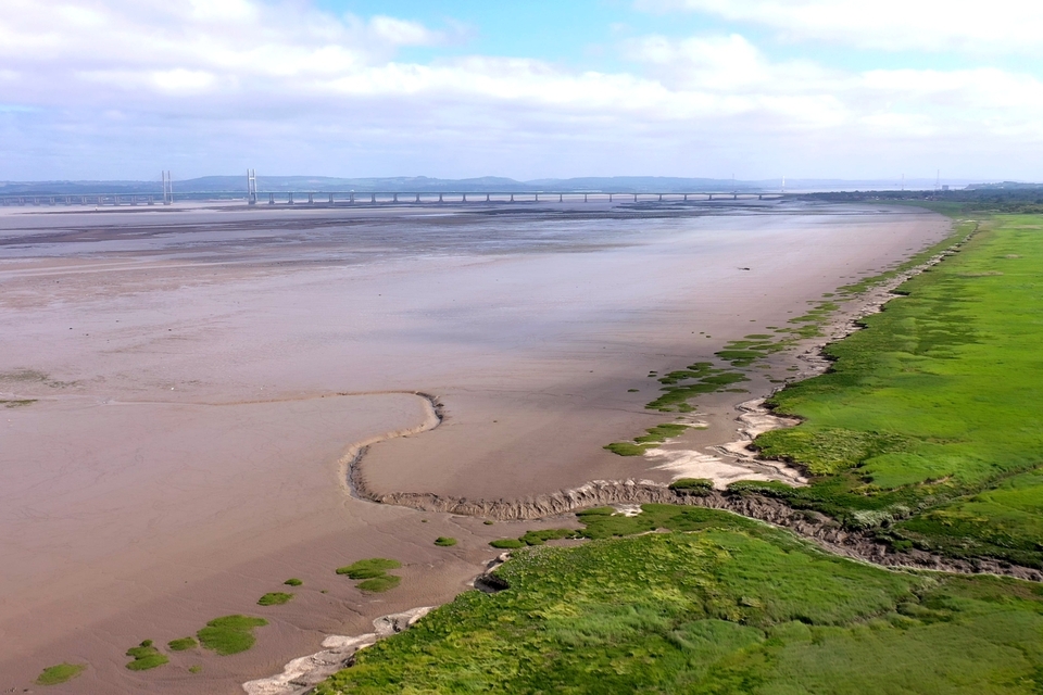
The image shows the coastal margin looking north towards the Prince of Wales Bridge
Visitor highlights
Local and visitor highlights of the stretch include:
-
Portbury Wharf Nature Reserve on the edge of the Severn Estuary between Portishead and Royal Portbury Dock, which consists of wetlands and saltmarsh. Skylarks andwaders are often visible from the bird hides, while otters can be seen in the rhynes.
-
Clevedon Pier, one of the earliest surviving examples of a Victorian pier.
-
The Prince of Wales Bridge.
-
The Old Aust Ferry Slipway.
-
Wildfowl and waders on the estuary during the autumn and winter, including redshank, dunlin and black-tailed godwit.
-
Wheelchair accessible paths at Severn Beach, Portishead and Clevedon Promenades.
Rachel Williams, Area Manager for Wessex at Natural England said:
We’re pleased to open this new section of the King Charles III England Coast Path today, over 23 miles of spectacular views boasting some of our region’s most iconic wildlife.
We know that just two hours of contact with nature a week can significantly boost our health and wellbeing. This path is a welcome addition for South Gloucestershire the Avonmouth area of Bristol as well North Somerset and will provide both the local community and visitors and tourists from further afield more opportunities to access the coast and connect with nature.
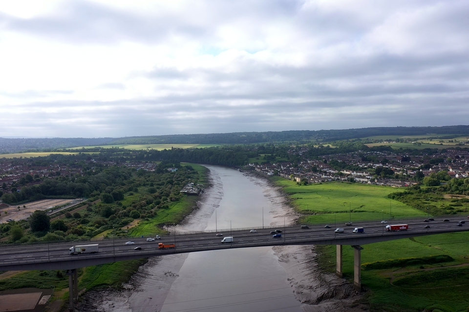
Images shows the Coast Path crossing the Avonmouth Motorway Bridge between Bristol and North Somerset
‘important step forward’
Councillor Mike Solomon, North Somerset Council’s executive member for culture and leisure, said:
Today marks an important step forward in the opening up of our beautiful coastline for the enjoyment of residents and visitors alike. I’m delighted to see the official opening of this section from Aust to Wain’s Hill in Clevedon, an Iron Age hill fort dating back to the Late Bronze and Early Iron Age.
I’d like to take the opportunity to thank council officers, local authority partners and Natural England for continuing to work together to create the King Charles III England Coast Path, such an important project which continues to create exciting opportunities for tourism and our economy.
Councillor Chris Willmore, cabinet member for planning, regeneration and infrastructure at South Gloucestershire Council, added:
I’m delighted to see the next section of the King Charles III England Coast Path officially opened, which improves access to the coastal path in our area, including wheelchair accessible paths.
The route includes a section from Aust to Avonmouth in South Gloucestershire, connecting the national coast paths of England and Wales and offering stunning views of the River Severn coastline, including the Old Aust Ferry Slipway and the Severn Bridges.
When complete, the King Charles III England Coast Path will be the longest continuous coastal path in the world. This National Trail will encompass the entire English coast, passing through some of the most stunning, dynamic and internationally recognised scenery.
The King Charles III England Coast Path will provide more people with the opportunity to experience the natural environment, as is part of the government’s ambition to connect people with nature outlined in the 25 Year Environment Plan. Coastal communities and businesses are also set to benefit from increased visitors to these areas.
In order to deliver vital flood defences, works to construct flood ramps and associated structures will mean parts of the footpath in Severn Beach and Aust will remain closed for the time being with diversions in place.
For more detail on the closures and diversions please visit the Avonmouth and Severnside Enterprise Area Ecology Mitigation and Flood Defence Project website at Road and Footpath Temporary Closures – Avonmouth and Severnside Enterprise Area (asea-flood-ecology.co.uk)
Updates to this page
-
28 July 2023: Information added on footpath diversions.; 20 July 2023: First published.