News story
Leicestershire coronavirus lockdown: areas and changes
Areas of Leicestershire that are included in the localised coronavirus (COVID-19) lockdown and what this means.
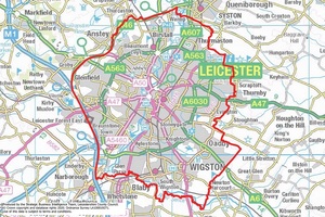
Leicestershire lockdown boundary map
On 29 June, the Secretary of State for Health and Social Care Matt Hancock set out the local action being taken in Leicester following a surge in coronavirus cases in the area.
This morning, the local councils set out the following areas of Leicestershire that are included in the localised lockdown:
- in Blaby District:
- Braunstone Town (including Fosse Park)
- Glenfield
- Glen Parva
- Leicester Forest East (east of the M1)
- Thorpe Astley
- in Charnwood:
- Birstall
- Thurmaston
- all areas of Oadby and Wigston
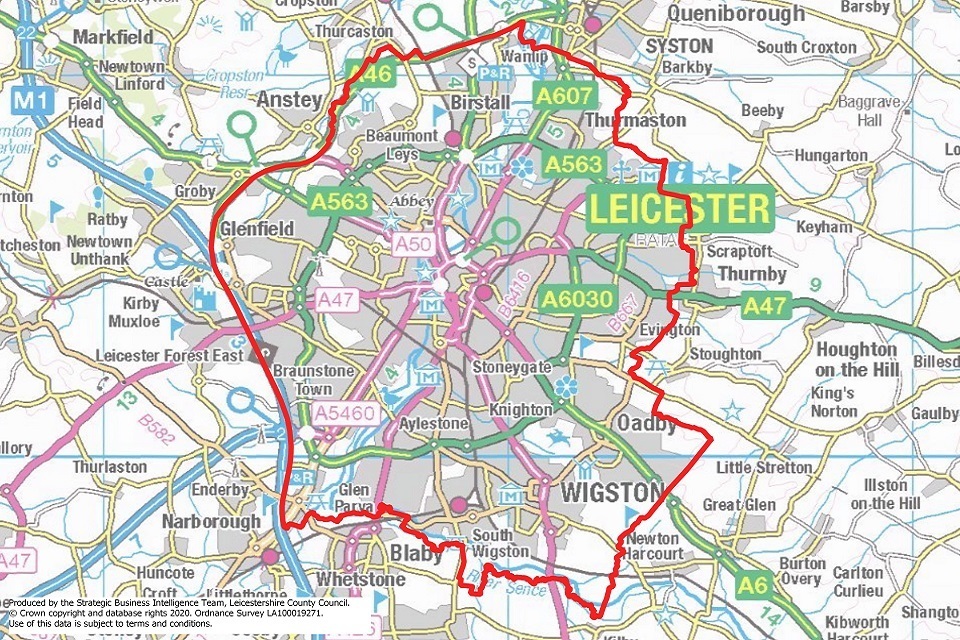
Leicestershire lockdown boundary map
See latest information and advice on coronavirus for Leicester.
Changes in the Leicester area
Within this boundary, restrictions will be put in place pending a review from 18 July.
This means:
- non-essential shops that reopened on 15 June have been asked to close from today (30 June)
- bars, restaurants and hairdressers will not reopen on 4 July
- schools will close from Thursday 2 July except to vulnerable children and children of key workers. They will not reopen until next term
- the relaxation of shielding measures due on 6 July cannot now take place in Leicester
- single-adult households (those who live alone or with dependent children only) can still form a support bubble with one other household
- people are still able to meet in a group of up to 6 and only outdoors, provided strict social distancing is followed
- people in Leicester are recommended to stay at home as much as they can
- we advise against all but essential travel to, from and within Leicester. See travel advice for areas under local lockdown
Updates to this page
Published 30 June 2020