42 mile stretch of King Charles III England Coast Path opens
A continuous path from the Scottish border to Gibraltar point in Lincolnshire has officially been completed with the trail between Easington to Bridlington
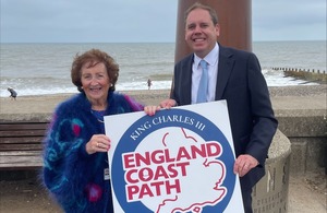
Charlie Dewhurst MP and Cllr Barbara Jefferson at the opening of the KCIII English Coastal Path between Easington to Bridlington. Natural England.
The final stretch of King Charles III England Coast Path in Yorkshire and the North East has officially opened today (18 August)
The new stretch joins Easington to Bridlington, forming a continuous path from the Scottish border down to Gibraltar point, in Lincolnshire, some 397 miles. It is the latest part of the 2,700 mile (4345km) national path to be completed.
Commencing at the village of Easington, the King Charles III England Coast Path traces a remarkable route northward along the Holderness coastline. The path reveals a striking juxtaposition between industrial landscapes, such as the Easington Gas Terminal, and the natural beauty of the ever-changing clay cliffs and expansive beaches below.
Progressing north, the trail passes through the resort town of Withernsea and crosses the first landfall of the Prime Meridian near Sand Le Mere. It continues past the historic site of the former RAF Cowden before arriving at Hornsea, a coastal town noted for its recently regenerated Victorian Promenade and charming seaside character.
The journey then skirts the vibrant holiday parks that dot the Holderness coast, eventually reaching the rolling dunes south of Bridlington. From there, the path enters the town’s lively harbour and esplanade before culminating in North Bridlington.
1,800 Miles Done, 900 To Go
The King Charles III England Coast Path will be a 2,700-mile long National Trail around the whole of the English coast, passing through some of our finest countryside and some of England’s most stunning, dynamic and internationally famous coastal scenery.
Natural England has worked in partnership with local authorities to open 1814 miles of the route so far – connecting communities from Northumberland to Cumbria via Cornwall.
Commenting on the approval, Paul Duncan Natural England Deputy Director for Yorkshire and Northern Lincolnshire, said:
Todays new route opens up easy access to our spectacular local coastline for people across the country. It invites visitors to discover the stunning North East shoreline, renowned for its unique blend of heritage and seaside charm, featuring historic gems like Withernsea Pier Towers and Bridlington Harbour.
With this latest, and final stretch, for Yorkshire and North East marking 1814 miles of the King Charles III England Coast Path now open, the benefits of walking for health and wellbeing through getting closer to nature are becoming more available for all. The trail will also support the local economy and growth - bringing walkers and visitors to the towns and villages for daytrips, refreshments and places to stay.
Connecting Coastal Communities
Councillor Barbara Jefferson, cabinet member for heritage and coastal at East Riding of Yorkshire Council said:
We are delighted to announce that the final section of the new National Trail is now open, seamlessly connecting the previously established stretches of the King Charles III England Coast Path.
Thanks to funding from Natural England, a range of enhancements have been carried out to bring the path up to National Trail standards, with particular attention given to accessibility and environmental sustainability. Walking is a year-round activity, and its ability to extend the tourism season makes it a valuable contributor to the local economy.
This newly completed route is expected to attract both domestic and international visitors, inviting them to experience our natural landscapes, heritage, culture and recreational opportunities. It will also enrich the walking experience for local residents who already enjoy the path.
The King Charles III England Coast Path represents a positive development for coastal communities, creating stronger links between them and encouraging exploration through a continuous, scenic walking route.
Start your adventure and discover your perfect trail with National Trails. So that everyone can make the most of the King Charles III England Coast Path, please follow the Countryside Code. This includes not bringing BBQs or dropping litter, and not lighting fires or camping stoves.
Further Information
-
To plan their visit walkers can access route maps of all opened sections of the King Charles III England Coast Path and any local diversions on the National Trails website. See www.nationaltrail.co.uk. And can check for any restrictions to access at Natural England - Open Access maps.
-
You can promote your business, service, event or place of interest for free on the National Trails website, inspire people to spend more time in your area and benefit from the economic impact of visitors. See: https://www.nationaltrail.co.uk/add-your-business
-
A map showing progress to complete the King Charles III England Coast Path is here www.gov.uk/government/collections/england-coast-path-improving-public-access-to-the-coast.