Information for boaters - River Ancholme
Information about the River Ancholme, including navigation notices, bridge heights, locks, slipways, speed exemptions and event organisation.
River conditions
You can find current river conditions on Anglian Waterways: river conditions, closures and restrictions - GOV.UK.
You can also:
- find out more about river advice for boaters
- register for the service
About the river
The River Ancholme runs straight for 17 miles, from rural Lincolnshire to the Humber Estuary at Ferriby Bridge. It is mainly used for leisure and other activities like canoeing, rowing and angling. South Ferriby provides excellent access to the tidal Humber.
You can read the to find out more.
Visit the Inland Waterways Association website to see the Fens Waterways map and about the Waterways Link project.
Navigation notices
You can see the latest navigation notices on the River Ancholme Mapping tool.
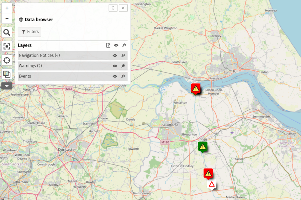
River Ancholme bridge heights
When approaching a bridge, ensure there is enough space between your boat and the roof of the bridge to allow your boat to pass safely. Headroom will be indicated by a gauge board on the bridge.
This table shows the distance between standard water level and the highest point for each bridge on the River Ancholme. These distances are approximate because river levels fluctuate.
| Location | Headway (metres) | Headway (feet) |
|---|---|---|
| Ferriby Belt | 13.0 | 42’65 |
| Electric Cable | 17.36 | 56’95 |
| Horkstow Bridge | 4.76 | 15’62 |
| Saxby Bridge | 3.98 | 13’06 |
| Railway Bridge | 4.32 | 14’17 |
| Water Pipe | 4.44 | 14’57 |
| Broughton Bridge | 4.73 | 15’52 |
| Multi-Fuel Pipe | 6.23 | 20’44 |
| Castlethorpe Bridge | 4.68 | 15’35 |
| M189 Motorway Bridge | 4.19 | 13’75 |
| Gas Pipe | 6.55 | 21’49 |
| Glanford Bridge - on the Old River | 3.43 | 11’25 |
| Town Bridge - On the Old River | 2.49 | 8’17 |
| A18 Cake Mills Bridge | 3.42 | 11’22 |
| Electric Cable | 12.53 | 41’11 |
| Cadney Road Railway Bridge - On the Old River | 5.74 | 18’83 |
| Electric Cable | 12.53 | 41’11 |
| Railway Bridge | 4.59 | 15’06 |
| Cadney Bridge | 4.32 | 14’17 |
| Hibaldstow Bridge | 4.04 | 13’25 |
| Brandy Wharf | 2.38 | 7’81 |
| Snitterby Bridge | 3.53 | 11’58 |
River Ancholme locks
There are 2 locks on the River Ancholme:
- South Ferriby Lock at the confluence with the River Humber
- Harlam Hill Lock upstream of Brandy Wharf (currently closed)
South Ferriby Lock
South Ferriby Lock is the only lock on this river staffed by the Environment Agency. It’s over 150 years old and is protected as a Scheduled Monument.
It can hold boats up to 5.5 metres (18ft) in beam and 20.5 metres (68ft) in length.
South Ferriby lock is currently closed. You can find out more in our navigation notice .
Lock keeper hours of duty at South Ferriby Lock
South Ferriby Lock requires at least 48 hours’ notice to arrange staffing from the Environment Agency. Bookings are dependent on tidal conditions and can only be accommodated during suitable daylight locking windows.
To request a booking, call 07483 173 523 in the first instance or 07825 503 848 as a back-up.
If you are unable to contact the lock directly, call the Environment Agency Customer Contact Centre on 03708 506 506 during normal office hours. They will forward your enquiry to the Lincolnshire and Northamptonshire Anglian Waterways Operations Team.
Harlam Hill Lock
Harlam Hill Lock isn’t a staffed lock. The Environment Agency controls access through Harlam Hill Lock. You will need a navigation key to use this lock.
Registered boat users can buy navigation keys from the local river inspector or the Environment Agency. To buy a navigation key from the Environment Agency email boatreg@environment-agency.gov.uk or phone 0370 850 6506.
A windlass to fit 2.6 centimetres square is needed to operate the paddles at Harlam Hill Lock. Turning is restricted upstream to boats up to 14 metres/46 feet only.
Contact numbers
- South Ferriby lock keeper telephone number - 07483 173 523
Warning: The Humber Estuary is characterised by strong currents and shifting mud banks and shoals. Boats navigating the estuary should ensure they are well equipped and have a competent master in charge. We also recommend you contact Humber Estuary Services.
Public slipways
The only public slipway on the River Ancholme is at Brandy Wharf Leisure Park. It’s suitable for small boats that can be trailer mounted and towed. The slipway is managed by Brandy Wharf Leisure Park.
Speed limit
A general speed limit of 11 kilometres per hour (7 miles per hour) applies throughout the Ancholme navigation. However, between Coal Dyke, Brigg and Bishopbridge a limit of 6 kilometres per hour (4 miles per hour) applies.
Take care at all times to respect other river users and to protect the water environment and wildlife.
Request a speed exemption
To request a speed exemption, read the . You can apply for a speed exemption using the Anglian Wateways speed exemption form.
Organising an event
If you want to organise an event on the River Ancholme, read the . You can apply for an event using the Anglian Waterways event form.