Gloucestershire's National Nature Reserves
Updated 4 June 2026
Applies to England

© Crown copyright 2026
This publication is licensed under the terms of the Open Government Licence v3.0 except where otherwise stated. To view this licence, visit nationalarchives.gov.uk/doc/open-government-licence/version/3 or write to the Information Policy Team, The National Archives, Kew, London TW9 4DU, or email: psi@nationalarchives.gov.uk.
Where we have identified any third party copyright information you will need to obtain permission from the copyright holders concerned.
This publication is available at https://www.gov.uk/government/publications/gloucestershires-national-nature-reserves/gloucestershires-national-nature-reserves
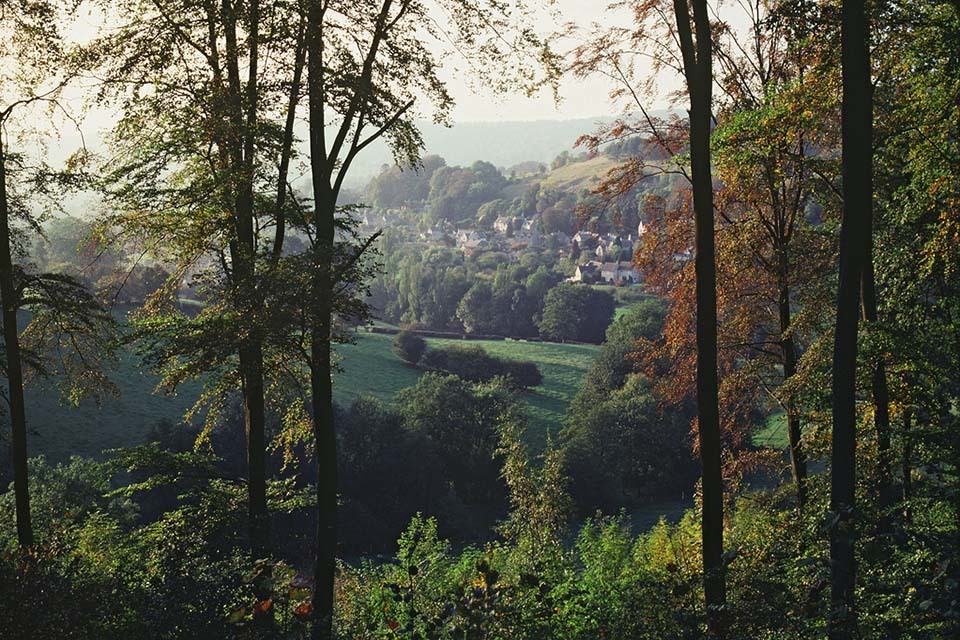
Cheltenham Escarpment
Cheltenham Escarpment NNR forms part of Leckhampton Hill and Charlton Kings Common Site of Special Scientific Interest and is notable for its Jurassic geology, grasslands and associated species. The NNR is geologically renowned for containing one of the thickest onshore successions of Jurassic rocks in Britain, revealed by natural erosion and extensive quarrying during the 19th and early 20th Centuries.
Main habitats: geological exposures, limestone grassland
Area: 60 hectares
Management: Cheltenham Escarpment is owned and managed by Cheltenham Borough Council. It has a management plan which looks to conserve and enhance its unique mosaic of grassland, scrub and geological features, and to provide opportunities for access and enjoyment of the reserve.
Features of interest
The natural outcrops and historic quarries along the west‑facing escarpment provide the thickest single section through the Middle Jurassic Inferior Oolite Group strata in the Cotswolds. This geology tells the story of a time when the Cheltenham area was submerged beneath a warm, subtropical shallow sea around 174 to 165 million years ago, leading to the deposition of a sequence of yellow-coloured limestones under conditions comparable to those of the modern‑day Bahamas.
The steep escarpment, where these rocks are exposed at the surface, is a relatively young landscape feature shaped over the last 1.6 million years by erosion. Rising to 293m at Leckhampton Hill, it offers panoramic views across the Severn Vale, Cheltenham, Gloucester and even the distant Welsh hills.
The reserve features a mosaic of habitats, including unimproved limestone grassland, scrub, and woodland. There is an intimate link between the underlying geology and the flora, with dry, shallow, calcareous soils supporting lime-loving wildflowers such as common rock-rose, wild thyme and autumn gentian.
It also supports a rich variety of insects, with a total of 33 butterfly species recorded. These include marbled white, dark green fritillary, chalk hill blue and the rare Duke of Burgundy.
Further information about the NNR, its geology and wildlife and how to visit, can be found on Cheltenham Borough Council’s website.
Directions
Cheltenham Escarpment NNR lies to the south and south east of Cheltenham. Parking is available at Daisybank Road, off Leckhampton Road, and at Hartley Lane near the hilltop.
The nearest train station is Cheltenham Spa.
Local bus services are available.
Visitor information
The site is open all hours and is free to visit.
There are public footpaths and the land is registered as Access Land.
Cheltenham Borough Council’s website provides details of cattle grazing and any closures or works.
Contact
For more information, email: enquiries@cheltenham.gov.uk.
Cotswold Commons and Beechwoods
Workmans Wood - Cotswold Commons and Beechwoods NNR © Natural England/Peter Wakely
Cotswold Commons and Beechwoods NNR is the largest nature reserve in the Cotswolds. It is largely made up of a chain of beechwoods and limestone grasslands around the upper slopes of the Painswick Valley, in Gloucestershire.
The beechwoods are protected as a European Special Area of Conservation because they are rich in rare wildlife.
Main habitats: woodland, limestone grassland
Management: The NNR is made up of:
- 1 site managed by Butterfly Conservation at Rough Bank
- 6 sites managed by Natural England:
- Rough Park
- Buckholt Wood
- Cranham Common
- Sheepscombe Common
- Bulls Cross Common
- Edge Common (now named Rudge Hill)
- 5 sites jointly managed with the National Trust:
- Workmans Wood
- Saltridge Wood
- Lord’s and Lady’s Wood
- Blackstable Wood
- Pope’s Wood.
Features of interest
The grasslands of the commons feature a rich limestone flora including yellow rattle, knapweed, harebell and wild thyme. In early summer you can see an impressive display of orchids, among them early purple, pyramidal, greater butterfly, common spotted and fragrant.
All these plants support a variety of insects, particularly butterflies. These include chalkhill blue, Adonis blue, small blue, dingy skipper, green hairstreak and the rare Duke of Burgundy fritillary (at Rudge Hill Common).
You can see other butterflies in the open areas within the beechwoods, including silver-washed fritillary and white-letter hairstreak.
Among the trees you can see plants like stinking hellebore, common wintergreen, bird’s-nest orchid, wood barley and broad-leaved helleborine.
Buckholt Wood is especially noted for being home to over 780 species of fungi.
The woodland animals include rare spiders and snails - many restricted to ancient woodland sites. Breeding birds include tawny owls, skylarks, tree pipits and lesser-spotted woodpecker, and kestrels and buzzards are often seen overhead.
To help us look after this wildlife:
- stay on the marked permissive trails if you cycle in the woods
- don’t light fires
- don’t fly drones
There are 2 information leaflets for this reserve:
-
Cotswold Commons and Beechwoods visitor leaflet
-
Buckholt Wood visitor leaflet
Visitor safety
At this reserve:
- beech trees drop branches in strong winds, after hot weather or squirrel activity
- terrain is steep, uneven and slippery when wet
- there are rabbit holes
- there are disused quarries with vertical drops
- busy main roads run through or along the reserve boundary
- mobile phone reception is poor on lower slopes
- ticks may be present in long grass
- livestock often graze on grassland, you must not disturb or feed them
- horse riding is common
- forestry management is often taking place with large machinery
To stay safe you should:
- wear appropriate footwear and clothing for rough terrain and weather conditions
- keep dogs under close control at all times and release them from the lead if there’s a confrontation with livestock
- wear insect repellent from April to September and check for ticks after your visit
- follow signs where forestry operations are taking place and attract the operator’s attention when passing
- give horse riders plenty of room to pass
Directions
The majority of the reserve lies between the A46 and the B4070 near the villages of Sheepscombe and Cranham, and the reserve is accessed from these via various minor roads. Car parking is available at several car parks and lay-bys. Voluntary car parking charges can be paid in advance or on the day using the RingGo app.
The nearest rail stations are Stroud (8 kilometres to the south west) and Gloucester (8 kilometres to the north west).
There are regular bus services from Stroud to Cranham Corner and less frequent services to Sheepscombe and Cranham village. For details go to the Traveline south west website.
The Cotswold Way passes through Edge Common, Pope’s Wood and Buckholt Wood. The Wysis Way passes near the reserve.
Contact
Cotswold Commons and Beechwoods NNR
Natural England Office
The Old Ebworth Centre
The Camp
Stroud
GL6 7ES
Telephone: 01452 813630
Highbury Wood
Highbury Wood NNR is a link in an almost unbroken chain of ancient woods stretching from Chepstow to Ross-on-Wye.
Main habitats: woodland
Features of interest
Highbury Wood lies on the eastern bank of the River Wye and is a prime example of the very rich and diverse woodland for which the Wye Valley is internationally important. The site is noted for its variety of woodland types, reflecting the wide range of soils, aspect and drainage on the site.
Large-leaved lime, which is restricted to the Wye Valley, wild service tree and whitebeam are among the scarcer trees of Highbury Wood. Some yew trees found on the site are more than 300 years old.
Newly-coppiced areas provide open ground conditions which favour light-demanding flowers such as primrose and early purple orchid. Wood spurge also emerges with increased warmth and light.
These conditions favour insects which feed on the abundant nectar and benefit from the shelter of the surrounding trees, such as butterflies and dragonflies.
See the site information leaflet for more details.
Highbury Wood lies within the Wye Valley Woodlands Special Area of Conservation. For detailed ecological information see Highbury Wood Site of Special Scientific Interest citation.
Directions
The reserve lies on the eastern bank of the River Wye near the village of Redbrook. Access is via minor roads from the A466, A4136 and B4228.
The nearest station is Chepstow.
There are bus services along the A466 from Chepstow to Monmouth via Redbrook. See the Traveline south west website for details.
Offa’s Dyke National Trail crosses the reserve. The Wye Valley Walk runs nearby.
Contact
Natural England Office
Lodge Hill Farm
Dowles Brook
Bewdley
DY12 2LY
Telephone: 01299 400 686
Lady Park Wood
Lady Park Wood is part of a large woodland complex in the Wye Valley Woodlands Special Area of Conservation.
Main habitats: woodland
Please note that access is limited to public rights of way. Other access is by permit only.
Features of interest
Lady Park Wood is a prime example of unmanaged, near natural woodland. The reserve was established by the Forestry Commission in 1945 as a long-term ecological project. Research aims to explore the natural processes that take place without human intervention such as tree felling, thinning or coppicing.
Beside the common tree species of beech, oak, ash, wych elm and birch, the site is also home to both native species of lime (small-leaved and the rare large-leaved lime) as well as a rare species of whitebeam (Sorbus eminens). The shrub layer is dominated by hazel but also contains dogwood, spindle, hawthorn, privet and holly. Ground cover mainly consists of dog’s mercury and bramble but plants of interest include wood barley, fingered sedge, wild madder, bird’s-nest orchid, toothwort, lily-of-the-valley and herb paris.
Lady Park Wood has a rich breeding bird community which includes all three woodpecker species, redstart, wood warbler, tawny owl, pied flycatcher and treecreeper. A variety of rare bats have been recorded in the NNR, in particular greater and lesser horseshoe bats which are found here in significant numbers.
See the site information leaflet for more details.
Lady Park Wood lies within the Upper Wye Gorge Site of Special Scientific Interest and forms part of the Wye Valley Woodlands Special Area of Conservation. For detailed ecological information see the Upper Wye Gorge SSSI citation.
Directions
Lady Park Wood straddles the border between England and Wales 3 km north east of Monmouth. Access to the reserve is from the A40 and A4136. There is no car park at the reserve; the nearest parking is across the river at the Biblins Bridge campsite.
Monmouth is at the end of Route 30 of Sustrans National Cycle Network.
The nearest stations are Lydney and Chepstow.
Bus services run from Chepstow to Monmouth and from Lydney to villages near the reserve. See the Traveline south west website for details.
Two major trails pass near the reserve: the Wye Valley Walk and the Wysis Way.
Contact
Natural England Office
Lodge Hill Farm
Dowles Brook
Bewdley
DY12 2LY
Telephone: 01299 400 686
The Hudnalls
The Hudnalls NNR is a woodland with limited management intervention, occupying a prominent position on the eastern side of the Wye Valley gorge.
Main habitats: woodland
Features of interest
The Hudnalls is a good example of semi-natural, unmanaged woodland, dominated by beech, oak, ash and lime. This type of woodland on strongly acid soils is virtually unknown outside the Lower Wye Valley.
Spring is a particularly good time to visit for the display of wild garlic and other wildflowers. Amongst the rare plants found at the reserve are thick berried bramble and wood fescue. Birds recorded here include song thrush, hawfinch, wood warbler, starling and lesser spotted woodpecker. The woodland also features some interesting members of the fly family, such as the rare cranefly Tipula nubeculosa and the scarce cranefly Scleroprocta pentagonalis.
See the site information leaflet for more details.
For detailed ecological information see The Hudnalls Site of Special Scientific Interest citation
Directions
The Hudnalls NNR lies in the Wye Valley on the border between England and Wales, approximately 2 miles south west of St Briavels. The nearest parking is at Brockweir.
The nearest stations are Lydney and Chepstow.
Regular bus services link the local area to St Briavels Common. For travel details see the Traveline south west website.
The reserve is accessible from public rights of way including the Offa’s Dyke National Trail which runs close to both the top (east) and bottom (west) of the site.
Contact
Natural England Office
Lodge Hill Farm
Dowles Brook
Bewdley
DY12 2LY
Telephone: 01299 400 686