Local authority green belt statistics: guidance notes
Updated 23 July 2021
Applies to England

© Crown copyright 2021
This publication is licensed under the terms of the Open Government Licence v3.0 except where otherwise stated. To view this licence, visit nationalarchives.gov.uk/doc/open-government-licence/version/3 or write to the Information Policy Team, The National Archives, Kew, London TW9 4DU, or email: psi@nationalarchives.gov.uk.
Where we have identified any third party copyright information you will need to obtain permission from the copyright holders concerned.
This publication is available at https://www.gov.uk/government/publications/completing-local-authority-green-belt-statistics-guidance-notes/local-authority-green-belt-statistics-guidance-notes
Useful Information
About the return
The purpose of this return is to report the size of designated green belt land in your authority.
Contacts for help
If you have any problems providing the data required in the return please contact planning.data.collection@communities.gov.uk, and a member of the team will get back to you.
If you experience any technical issues with the DELTA system, please contact the MHCLG Service Desk using one of the following options: log an issue via the Service Desk portal – MHCLG Service Desk; email mhclg.digital-services@communities.gov.uk (Please start your subject with the word DELTA); or call 0203 829 0743.
Please visit https://delta.communities.gov.uk/login to login to DELTA using the username and password provided to you previously. If you have not received log in details, please contact the MHCLG Service Desk or call 0203 829 0743.
Revisions
Despite local authorities’ best efforts, it is unlikely that all data submitted are completely accurate, whether through the receipt of subsequent information not available at the submission deadline, errors in calculation, or another reason. As such, our Revisions Policy allows for local authorities to correct errors found, to maximise the quality of our published data. Most revisions see only minor changes made to data, with little to no impact on published national statistics. These changes will be published at the next scheduled release, with no specific announcement, and the previously released data is not revised.
When completing the returns for each annual statistical release, local authorities are asked to confirm the previously published figure for the area of designated green belt land in their area. If they do not agree with this figure, or they have changed the digital boundaries to more accurately represent the actual green belt boundaries, they are asked to provide a revised figure and submit a revised GIS data file (i.e. a shape file) to the department.
In contrast, some revisions are considered major revisions. These might date further back than the previous year’s figure and have a notable impact at the national level. They might arise from substantial errors in the statistical process, or other major methodological issues, whether by local authorities or central government. Major revisions may require a non-scheduled revision of the statistical release to be published, along with a correction notice explaining the error. We aim for transparency in such cases, to maximise the perception of quality in all official statistical releases.
If you think that you need to make a major revision, please get in touch with our team at planning.data.collection@communities.gov.uk. We will then arrange access to the relevant form so you can make the required corrections. You will receive an email, with a link to the data you have previously submitted and requested to revise. Following this link will allow you to amend the data for that year and re-submit.
The policy on revisions has been developed in accordance with the UK Statistics Authority Code of Practice for Statistics and the Ministry of Housing, Communities and Local Government Revisions Policy.
Completing the returns
Completed forms should be submitted on DELTA by Friday 23 July 2021.
If you will be unable to meet this deadline, please contact the Planning team (planning.data.collection@communities.gov.uk) in advance of the deadline. Extensions are only possible when extenuating circumstances apply.
Please complete all boxes on the AGB form as set out in the notes below.
When signing off the return, boxes should not be left blank.
Please ensure that you complete the box at the end to say that the return is final.
As the user completes the return, validation rules (where appropriate) will be displayed.
Please visit https://delta.communities.gov.uk/login to login to DELTA using the username and password provided to you previously. If you have not received log in details, please contact the MHCLG Service Desk or call 0203 829 0743.
Please note: this process currently functions better when using Google Chrome as your web browser.
Email reminders will be sent periodically to alert data providers that the collection instance to submit data is live.
Once you have signed onto DELTA you will arrive at the Welcome Page.
To navigate to the current collection instance for the AGB form manually, please follow the steps set out below:
1. Click on ‘Submissions’ to submit data.

2. Click on ‘Collection Requests’.

3. Navigate to the correct instance of the form you are submitting data for.
You will have received a notification with the exact name of the form awaiting completion and can use this as your reference. You can also sort by the most recently added form or search using the search field. If you are unsure, please contact planning.data.collection@communities.gov.uk.

4a. Once you have navigated to the correct form, under Actions select the drop-down menu ‘More’ for the instance on which you wish to submit data.
4b. Select ‘Provide Data’.

Note: In the example above, the selected form would refer to the 2017-2018 form, with collection between 4 June and 13 July 2018.
Warning
Please note that after logging in and navigating to the correct form to submit your data, the system will automatically log you out after 15 minutes of inactivity.
We recommend that you regularly save your submission to ensure that no data is lost.
Instructions on how to save, print and submit for are included below for each form.
Section A: Confirmation of area of green belt as at 31 March 2020
Question A1

Question A1 asks you if you agree with your green belt estimate from the previous year. The estimate is pre-filled below, as part of question A2.
Please note that this pre-filled figure is calculated based on the boundary files previously submitted by your authority in order to ensure that a consistent methodology is applied across all authorities; the published figure may differ from your own calculations as MHCLG map against ONS Local Authority District (Mean High Water mark) boundaries, and may also use different GIS software to some local authorities.
Using the drop-down menu, you should specify ‘Yes’ if there have been no revisions to last year’s figure since its submission. You will then be instructed to go to Section B, skipping the remaining Section A question.
If you have answered ‘No’ to question A1 please also attach the latest boundary file(s) for your authority’s green belt area. Please ensure all relevant boundary files are zipped up into one file having first removed any password protection from any of these files. To attach the zipped file (containing the boundary file(s)) in the form, then click on the button in DELTA & select the relevant zip file.
NB providing an attachment is mandatory if you have answered ‘No’ to Question A1; you will not be able to submit your return until the file has been attached. Providing the file for the previous year is optional if you answered ‘Yes’ to Question A1. Please note that the department will map all green belt areas against the ONS Mean High Water Mark boundary. Do email us at planning.data.collection@communities.gov.uk if you have any queries regarding the boundary file attachment.
You should select ‘No’ if a change needs making since the previous submission, e.g. due to an error or a revision due to improved methodology or measuring. If you select ‘No’, you will see an additional question, A2, appear below.
Question A2

Question A2 enables you to provide a revised estimate of the area of the green belt as at 31 March 2020. You are shown the published figure (which has been rounded to the nearest 0.1 hectares). You should enter the correct figure in the box, in hectares, to one decimal place with no comma thousand separator.
Question A3

If you have submitted a revised estimate at question A2, please provide a brief explanation of why you did so in the box at question A3.
Section B: Area of green belt as estimated at 31 March 2021
Question B1

Question B1 asks if your local authority changed its green belt boundary between 1 April 2020 and 31 March 2021. If you answer ‘Yes’, you will have two additional questions to answer about this change. Otherwise, you will be instructed to advance to the final section.
Please also attach the latest boundary file(s) for your authority’s green belt area but only if you have answered ‘Yes’ to Question B1. Please ensure all relevant boundary files are zipped up into one file having first removed any password protection from any of these files. To attach the zipped file (containing the boundary file(s)) in the form, then click on the button in DELTA & select the relevant zip file.
Please note that the department will map all green belt areas against the ONS Mean High Water Mark boundary.
Question B2

Question B2 asks for the area of the updated green belt area in your local authority, as at 31 March 2021. Please enter this in hectares to one decimal place with no comma thousand separator.
Question B3

Question B3 asks you to enter the date of this change. Please select the relevant date between 1 April 2020 and 31 March 2021 from the calendar.
Question B4

Question B4 asks for an explanation of the change in green belt land for your authority, for including verbatim in an annex to the forthcoming green belt statistical release. This explanation could include references to your local plan.
Section C: Data sign off
Question C1

Question C1 asks users to specify the level of checks that have been carried out on the data.
Question C2
Question C2 asks for the email address of the GIS contact of your local authority, if there are any technical questions from our teams about the submitted files. This allows us to answer any queries in a more direct manner.
Viewing, saving and submitting
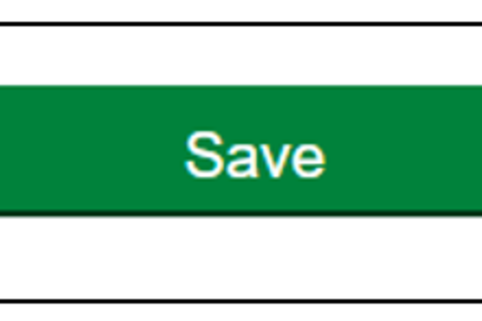
The final part of the form offers three options – ‘PDF’, ‘Save’, ‘Submit’ – with each performing different functions.
Submitting data
Selecting Submit submits the finalised data to DELTA. Users should receive a confirmation email once submission is confirmed and the green message will appear at the bottom of the screen, as below. If the submission contains any entry errors, these will be flagged, and users will need to address each before submission can be confirmed. Please be aware that it may take several seconds for submission to be confirmed.

Once submission has been confirmed, users are taken to their Data Store, where they can view all the data submitted. To submit data for a different site, users will need to navigate back to the Collection Requests by clicking on the navigation bar at the top of the page, as above, and selecting the same form again to enter more data.
Viewing and saving
Selecting PDF takes users to a separate window within their web browser which allows them to view their entry and print or save it to their desktop.
Selecting Save allows users to save their entry in the personal Data Store. This can be reviewed and submitted at a later date. To access the Data Store, users will need to either select ‘Submissions’ and then ‘Data Store’ after logging in, or they can access from the navigation bar at the top of the page.

Reminder
Users must Submit their forms once completed, for data to be sent to MHCLG. Clicking Save will maintain the data for users to complete entry at a later point.