Shallow coal workings data set: User guide
Updated 9 February 2024

© Crown copyright 2024
This publication is licensed under the terms of the Open Government Licence v3.0 except where otherwise stated. To view this licence, visit nationalarchives.gov.uk/doc/open-government-licence/version/3 or write to the Information Policy Team, The National Archives, Kew, London TW9 4DU, or email: psi@nationalarchives.gov.uk.
Where we have identified any third party copyright information you will need to obtain permission from the copyright holders concerned.
This publication is available at https://www.gov.uk/government/publications/coal-mining-data-past-shallow-coal-mine-workings/shallow-coal-workings-dataset-user-guide
1. Introduction
The Coal Authority manages the effects of past coal mining, including subsidence damage claims which are not the responsibility of licensed coal mine operators. It deals with mine water pollution and other mining legacy issues. It also owns, on behalf of the country, the majority of the coal in Britain, and licenses coal mining.
We use our skills to provide services to other government departments and agencies, local governments and commercial partners. We contribute to the delivery of the UK Government’s Industrial Strategy and the environmental, social and economic priorities of the UK, Scottish and Welsh Governments.
By sharing our knowledge and expertise we support them, and our partners, to create cleaner, greener nations for us all.
Our purpose is to:
- keep people safe and provide peace of mind
- protect and enhance the environment
- use our information and expertise to help people make informed decisions
- create value and minimise cost to the taxpayer
The Coal Authority is an executive non-departmental public body, sponsored by the Department for Energy Security and Net Zero.
Further information on all the digital data available from the Coal Authority.
2. Information about the shallow coal workings data set
2.1 Background
The Coal Mines Regulation Act (1872) and Metalliferous Mines Regulation Act (1872) require coal mine operators to deposit abandonment plans of the mine with the Secretary of State following the end of operations. Before this plans were often destroyed or kept in private ownership due to competition between the mine operators.
The Coal Authority’s Mining Heritage Centre houses the collection of around 120,000 coal abandonment plans, covering both opencast and deep mining operations, which depict areas of coal extraction and the points of entry into workings.
These plans are held by the Coal Authority on behalf of the Health and Safety Executive. The mining information contained on these plans has been captured in the Coal Authority’s National Coal Mining Database.
The shallow coal mine workings data set has been derived from the Coal Authority’s records of underground coal mine workings.
2.2 Data set history
The shallow coal workings product has been derived from the underground workings spatial data set, created during the early 1980s in readiness for the automated provision of coal mining reports that was introduced locally in 1985 and established nationally in 1989.
A team of qualified National Coal Board or British Coal Corporation mining surveyors were engaged to rationalise the mining and other source plans, reference them to Ordnance Survey National Grid or County Series and capture the data into the first computerised mining report system.
The spatial data sets were subsequently migrated into the Coal Authority’s current ESRI based geographic information system (GIS) in 2011.
2.3 Who might require this data set?
This data set is currently used by the Coal Authority in the production of planning mining search reports.
This data set is suitable for use by organisations wishing to identify possible ground instability and potential mining hazards.
Users may include but are not limited to local authorities, infrastructure operators, land developers, home-owners, solicitors, loss adjusters, the insurance industry, architects and surveyors.
2.4 What the data set shows
The voids resulting from past underground coal mining activities present a potential hazard.
Former underground mine workings, particularly where shallow, may collapse and cause surface settlement.
The shallow coal workings data set is a footprint which provides information on spatial distribution of potential hazards resulting from past underground shallow coal mining.
2.5 Coverage
The coverage of the shallow coal workings data set is the known extent of coal mining activity in Great Britain. This area does not represent the full extent of geological coal reserves and resources.
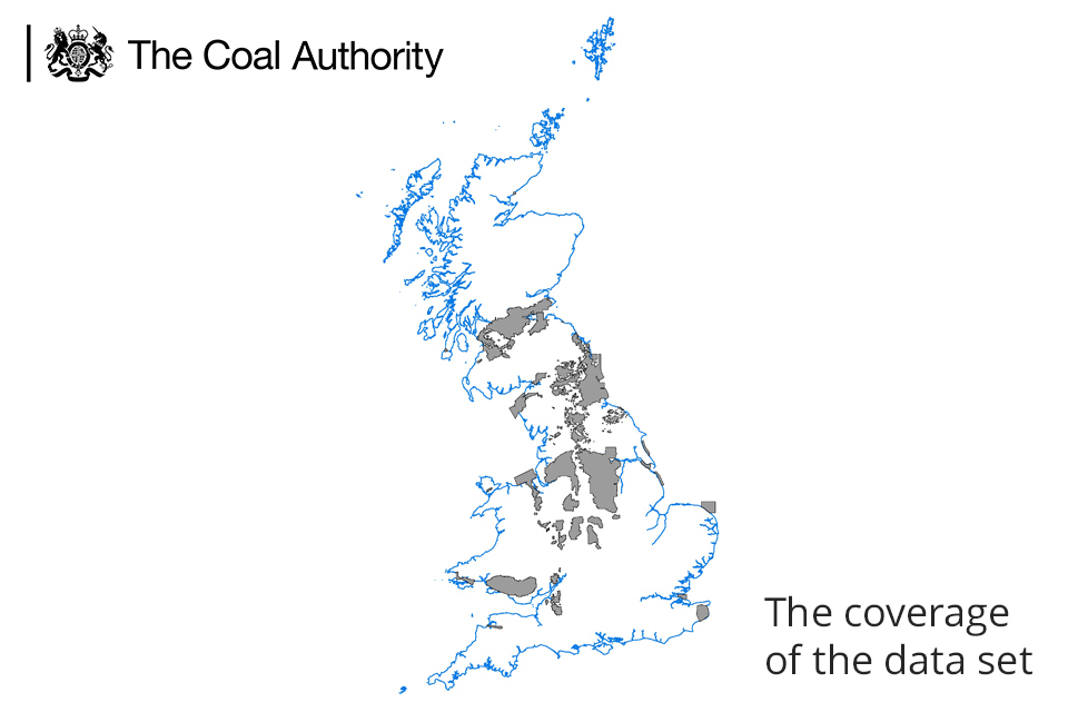
A map showing Great Britain and the coverage of the data set.
3. Technical information
3.1 Definitions - what does ‘shallow’ mean?
The shallow coal workings data set is derived from the Coal Authority’s records of underground coal mine workings.
This data set consists of all those underground coal workings with a recorded or interpolated depth from surface of 30m or less, with the exception of thicker seams where a depth of 50m will be applied.
Underground workings do not readily constitute a threat to surface stability due to the ability of the overlying strata to dissipate any movement from within the workings before they reach the surface.
However, shallow coal workings do not have sufficient overlying strata therefore any movement has the potential to reach the surface and cause damage.
3.2 Accuracy - transfer of information from source plans to the National Coal Mining Database
Due to the primitive emerging GIS technology available at the time of initial capture and the primary purpose of the capture being the automated provision of coal mining reports, the rationalised plans show a simplified version of the information contained on the abandoned mine plans.
The mining information contained on these rationalised plans was subsequently digitised by a team of technicians and captured as polygon, point and line data in the Coal Authority’s National Coal Mining Database.
3.3 Source accuracy limitations
All plans are representations and may contain inherent simplifications due to generalisation. When features are represented on plans, their scale often determines the level of detail shown. In addition to these simplifications, limitations may also be introduced through the drawing process.
3.4 Digitisation process accuracy limitations
The digitisation process is likely to have introduced intrinsic limitations due to simplification requirements. As different mining surveyors produced plans with variable levels of detail, the Coal Authority’s mining surveyors may have reduced the level of detail contained within the plans in order to produce the digital information.
3.5 Scale
The original plans were produced at varying scales, but were in general digitised to a scale of 1:2,500.
3.6 Data format
The shallow coal workings data set has been created as vector polygon data and is supplied as X,Y,Z,M, where the Z value is the level above or below (+ or –) Ordnance Datum (mAOD) and the M value is a measure describing the depth (metres) below the surface.
The data set is supplied in ESRI File Geodatabase (.gdb) format. Other geospatial formats, including geopackages and computer-aided design, can be supplied on request but may incur additional processing costs.
The layer file provided will describe the symbology used by the Coal Authority and has been created using ESRI ArcGIS V10.3.1
Use of any other symbology is not advised for this data set as the symbology used by the Coal Authority is an industry standard and any change of this could significantly affect the perceived understanding.
In order to view the correct symbology the layer file should be loaded in your GIS system.
3.7 Field descriptions
|
Data Field |
Explanation of Data Field |
|---|---|
|
OBJECTID |
OBJECTID File GeoDB ID number |
|
S_OBJECTID |
Source ObjectID Unique Coal Authority ID number |
|
MI_CODE |
Mineral Mineral worked - most are coal but we hold records for other minerals on the system in cases where they were worked with the coal or close to the coal seams. |
|
SE_CODE |
Seam Code A unique alphanumeric identifier used to define a specific seam. |
3.8 Data update frequency
The Coal Authority is constantly reviewing and updating its data. We therefore make no representation that the shallow coal workings data set remains complete, accurate, up-to-date, reliable or exhaustive. Weekly, annual or one-off updates will be provided as per the licence arrangement.
4. Licensing information
The Coal Authority does not sell its digital spatial data to external parties. Instead, it grants external parties a licence to use the data, subject to terms and conditions. In general, a licence fee will be payable based on the type of data, geographic area required, the number of simultaneous users, and the duration (years) of a licence.
All recipients of a licence are required to return a signed licence document to us before authorisation for release of digital data is given.
These are general comments for guidance only. Full details of the terms and conditions of supply are included within licences.
The Coal Authority’s data team will be happy to discuss your proposed use of data.
The data team will usually be able to provide reassurance that the licence will cover individual user requirements or include additional ‘special conditions’ in the licence documentation, addressing specific requirements within the Coal Authority’s permitted usage.
5. Limitations and exclusion of liability
The Coal Authority is committed to ensuring that the digital data it holds and releases to external parties under licence has been through a robust internal approval process to ensure that corporate quality assurance standards are maintained.
This approval process is intended to ensure that all data released:
- is quality assured
- meets agreed data management standards
- is not in breach of any third party intellectual property rights or other contractual issues - such as confidentiality issues
5.1 Limitations
This data set is based on, and limited to, an interpretation of the records in the possession of the Coal Authority at the time the data set was created.
The data set does not categorise the risk of surface collapse and no account is taken of any past remediation that may have been undertaken.
An indication of the presence of a coal mining related feature, such as a mine entry, does not necessarily mean that a location will be affected by ground movement or subsidence. Such an assessment can only be made by inspection of the area by a qualified professional.
If customers are uncertain about the use of particular data they should seek professional advice. However, they may consult the Coal Authority’s data team on technical matters, licensing arrangements, or general aspects including the appropriateness and limitations of the data.
5.2 Exclusions
The databases comprising the subject matter of this report are made up of information supplied to the Coal Authority by third parties under statutory obligation and of which the Coal Authority has no direct knowledge and has not necessarily had the opportunity to verify. Accordingly, it can have no liability for the accuracy of the information comprising the databases or for any loss of whatever nature directly or indirectly caused which may result from any reliance placed upon it.
The licensee takes the information as provided without any such express or implied warranty and must rely upon its own enquiries and where necessary obtain appropriate insurance against any loss arising.