Lincolnshire and Northamptonshire urged to check flood risk
In Lincolnshire and Northamptonshire, more than 263,000 properties are at risk of flooding. Communities are warned not to be complacent despite dry weather.
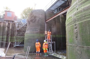
Work being carried out on the Grand Sluice in Boston.
The dry conditions of recent months mean that the ground is hard and compacted, increasing the risk of localised surface water flooding.
Members of the public can:
- check their long-term flood risk
- Get flood warnings by text, phone or email - GOV.UK by phone, text or email
- take steps to protect themselves from future flooding, including preparing a flood kit.
Work led by Environment Agency and its partners in Lincolnshire and Northamptonshire to manage flood risk includes:
-
major refurbishment of Boston’s Grand Sluice
- natural flood management (NFM) solutions, which are often used in rural areas
- roll-out of property flood resilience (PFR) measures.
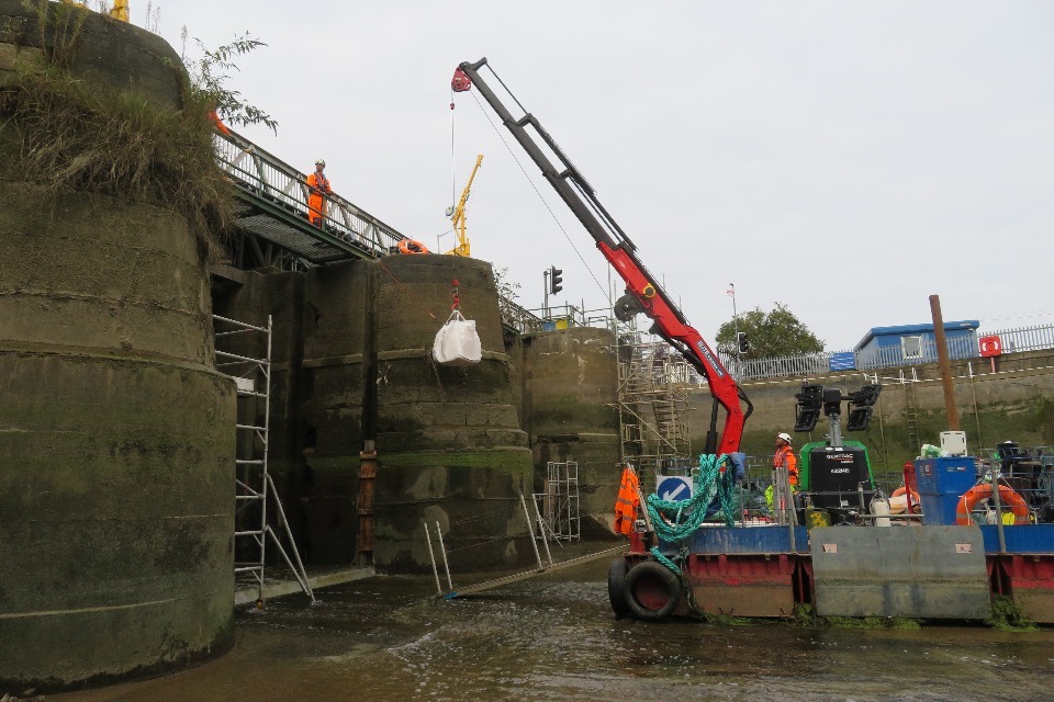
Grand Sluice Boston refurbishment work.
NFM uses natural processes to reduce the risk of flooding. These processes protect, restore, and mimic the natural functions of catchments, floodplains and the coast to slow and store water. Recent examples include flood storage wetland in Brigstock, Northamptonshire, specialist ponds in Swaton, Lincolnshire and floodplain reconnection in Grantham, Lincolnshire.
PFR is a set of modifications added to a building to lower its flood risk. It can reduce flood damage and speed up recovery after a flood. The Environment Agency is supporting roll-out of PFR at Harpers Court in Brigstock which is home to a community of vulnerable residents.
Morgan Wray, Area Flood and Coastal Risk Manager for the Environment Agency in Lincolnshire and Northamptonshire, said:
We know the devastating impact that flooding can have, which is why protecting people and communities is our top priority.
We are working to reduce flood risk through Natural Flood Management and schemes like the Boston Barrier and the refurbishment of Boston’s Grand Sluice.
We urge members of the public to check their flood risk, get flood warnings by text, phone or email - GOV.UK protect themselves from future flooding.
PFR case studies
In Northamptonshire the Environment Agency works closely with the Resilience And Innovation Northants (RAIN) project, which is funded by Defra as part of the £200 million Flood and Coastal Innovation Programme. The project looks to improve flood resilience at property, community and catchment-scales with both the Harpers Brook and Wootton Brook catchments.
Work has included installing flood barriers, self-closing airbricks in the Harpers Court in Brigstock. A further 120 residential properties across Harpers Brook and Wootton Brook are also set to have PFR installed, and it is hoped that the majority of the works will be completed by Christmas.
NFM case studies
In Lincolnshire, the Environment Agency provided advice and support to a landscape recovery pilot project being delivered by Nattergal at their site near Grantham. This summer they have fully re-connected a section of the River West Glen with its floodplain, making more space for water.
This is the first in a number of planned phases of river restoration, all of which should help reduce flood risk for the small village of Lower Bitchfield. Read more here: Landscape Recovery: first projects move into delivery phase – Farming
Swaton, Threekingham and Spanby is home to a Natural Flood Management scheme which consists of 5 specialist attenuation ponds across 3 farms. They have the capability to hold back approximately 22,000 cubic metres of flood water, equivalent to 9 Olympic sized swimming pools. There are also 29 field-edge swales which are 2- to 4-metre-wide strips which intercept water flowing over the land. The swales have the capacity to hold back approximately 26,000 cubic metres of flood water, the equivalent of another 10 Olympic-sized swimming pools.
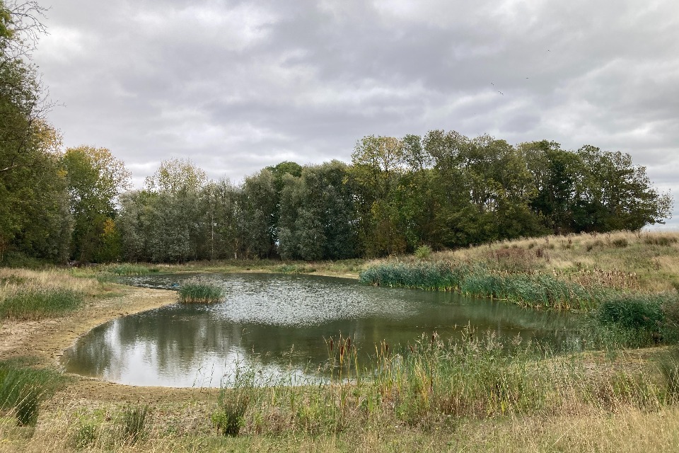
1 of the 5 specialist ponds across farms in Swaton, Threekingham and Spanby.
In Northamptonshire, as part of the Resilience and Innovation Northants project, measures have been introduced which work with nature to hold and store water in the catchments. For example, in the Wootton Brook catchment, agricultural land on a farm upstream of the village of Horton has been transformed into species-rich grasslands to improve soil health and increase water storage capacity. Along with the creation of wetland scrapes to temporarily hold water during storms.
Meanwhile, a series of works have taken place across the Harpers Brook catchment, including a significant flood storage wetland, which is situated immediately upstream of Brigstock.
The Environment Agency also worked with Natural England and Blatherwycke Estate to restore a stretch of the Willow Brook using various techniques. Along one section the deep, straightened channel has been filled in and a new, shallower, meandering channel has been reinstated through the natural floodplain.
In another section the channel has been significantly widened and adjacent floodplain lowered. Both these measures have improved the brook’s connectivity with its floodplain, helping to slow the flow of water and improve flood resilience for the village of Kings Cliffe downstream.
Background
- The Environment Agency knows the devastating impact that flooding can have and is working closely with government to deliver £2.65 billion of investment by March 2026 and a further
- £4.2 billion for 2026 to 2029, to scale up national resilience through building new and improving existing flood defences.
- Lincolnshire and Northamptonshire Area has been in Prolonged Dry Weather status since July of this year. The extremely dry conditions have meant that the ground is hard and compacted across the country, increasing to some extent the risk of localised surface water flooding in all areas.
Surface water flooding generally occurs after heavy rainfall in urban areas, when the volume of water cannot quickly drain away or soak into the ground. It can happen very quickly and can be difficult to predict.