Calstock flood defence improvement scheme
Updated 14 August 2024

© Crown copyright 2024
This publication is licensed under the terms of the Open Government Licence v3.0 except where otherwise stated. To view this licence, visit nationalarchives.gov.uk/doc/open-government-licence/version/3 or write to the Information Policy Team, The National Archives, Kew, London TW9 4DU, or email: psi@nationalarchives.gov.uk.
Where we have identified any third party copyright information you will need to obtain permission from the copyright holders concerned.
This publication is available at https://www.gov.uk/government/publications/calstock-flood-defence-improvement-scheme/calstock-flood-defence-improvement-scheme
Background
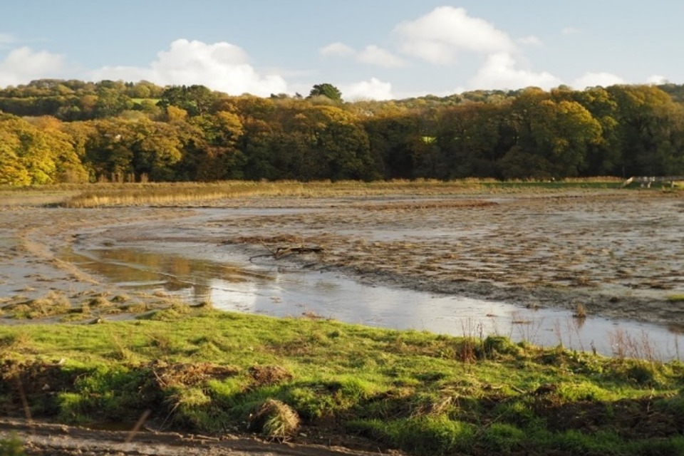
In 2021 the Environment Agency completed a project to reduce flood risk to the village of Calstock while creating a 11-hectare area of intertidal habitat. This project created new flood embankments set back from the river to protect the village and removed a section of the old flood bank in November 2021.
This allowed the Tamar to reconnect to pools and creeks which had been constructed to reconnect this section of the river with its floodplain and create important wildlife habitat.
The objective of the new habitat was to:
- increase biodiversity
- help adapt to the impacts of sea level rise and climate change
- help clean the Tamar Estuary by trapping sediment
The changes have also attracted a wider range of birds, fish and other wildlife which locals and visitors can come and see.
The new embankments
The Environment Agency built over 600 metres of new earth embankments set back from the river.
The embankments were built using local material dug from the creeks and pools in the inter-tidal area. These new embankments now protect properties and important infrastructure from flooding.
The North Spur in November 2022 (credit: Pete Thompson).
Intertidal habitat and flood resilience
As in many of our estuaries, climate change and rising sea levels in the Tamar are leading to coastal squeeze. This means the habitat is prevented from adapting and moving towards land by a man-made structure such as a wall or bank. This leads to a reduction in important habitat for flora and fauna and feeding areas for birdlife.
During low tides in November 2021, a gap or breach was made in the old flood bank at Calstock. Water from the estuary was allowed to flow into pools and creeks which were constructed as part of the habitat creation. This has allowed the vital intertidal habitat to develop, with benefits for:
- wildlife
- the wider community
- carbon sequestration (higher-level saltmarsh and silt deposits capture, secure and store carbon dioxide from the air. This process shows good potential for reducing the human carbon footprint in the area)
Changes to wildlife in the area
The Environment Agency monitoring and management plan is being implemented by the Environment Agency, Natural England and the Calstock Wetlands Management Partnership, who are volunteers.
This has been created to monitor wildlife using the area. Plymouth Marine Laboratories has been carrying out aerial imagery to monitor change over time and the capture of greenhouse gases and excess nutrients. Proving that nature can provide ways to limit some of the man-made impacts that negatively affect the river.
Links to the monitoring can be found on the National Landscapes website.
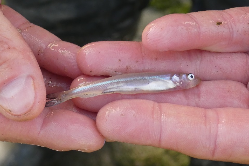
Photo of a juvenile European smelt (credit: Pete Thompson).
Fish monitoring surveys have found the protected species European smelt use the site for feeding as well as mullet and bass, highlighting the importance for a wider variety of species.
Since the breach there have been sightings of avocet and little egret which are two species that use Calstock and the other intertidal habitats and mudflats throughout the Tamar estuary.
In addition, there have been sightings of a number of waders, ducks and geese in the site that are of conservation importance. Numbers of teal, a species of duck, have increased from 80 in the winter of 2021/2022 to over 400 in the winter of 2023/2024 highlighting how key the habitat has become for overwintering species.
Over 30 bird species have been identified including:
- little egret
- kingfisher
- snipe
- teal
- green sandpiper
- reed bunting
- avocet
- water rail
The common sandpiper, whose numbers have declined in the UK were also spotted in the wetlands recently utilising the newly created habitat.
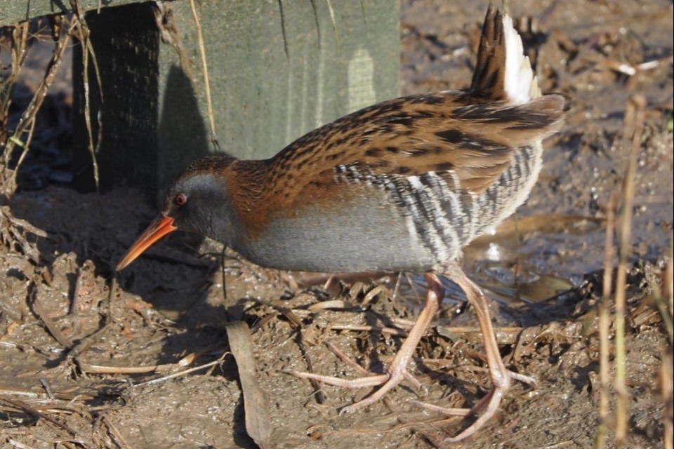
Photo of a water rail (credit: Pete Thompson).
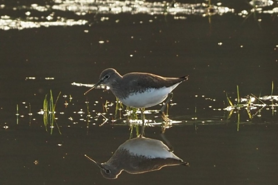
Photo of a green sandpiper (credit: Pete Thompson).
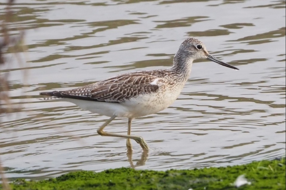
Photo of a greenshank (credit: Pete Thompson).
Working with the local community
The Environment Agency has supported the local community in having access to the former flood banks. This has involved the construction of a footbridge by Tamar Community Trust which links the two ends of the former flood defence embankment for walking.
The parish council has taken ownership of the former flood embankment and footbridge to ensure that the footway can continue to be used by local residents to get closer to nature. Tamar Community Trust is also leading the long-term management of the wetlands in consultation and cooperation with the Wetlands Management Group through a 99-year lease.
The Environment Agency has leased the field next to a local football pitch to the parish council on a peppercorn rent. This is to allow it to be managed by the community for the benefit of the community.
The Environment Agency thanks the community and partners for their continuing support. These include:
- Tamar Community Trust
- The Tamar Valley National Landscapes
- Calstock Parish Council
- Plymouth Marine Laboratory
Intertidal habitat projects in the Tamar estuary
Calstock is one of three intertidal habitat sites created in the Tamar Estuary in 2021 and 2023. The other two projects are South Hooe and Cotehele Quay which you can find more about on the National Trust website.
Contact
For further information email the Devon, Cornwall and Isles of Scilly customer enquiries mailbox at DCISEnquiries@environment-agency.gov.uk.