Strong winds expected in Southern England
Road users in the South West and South East are being advised to check the weather forecast and road conditions before travelling on Wednesday and Thursday with many areas expecting very windy weather.
The Met Office has issued an amber weather warning, with strong South Westerly winds expected to develop during Wednesday afternoon bringing strong winds to Cornwall by late afternoon before spreading along the South coast reaching Kent later in the evening.
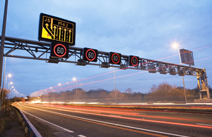
Gusts are expected to reach 55-65 mph inland in Cornwall, Devon, Dorset, Hampshire, Sussex, Kent and South Eastern parts of the M25.
Coastal routes, bridges and exposed routes over high ground could see gusts up to 75 mph and there will be a strong crosswind for East-West routes along the South coast, particularly affecting the A35, M27 and A27.
Bridges on the network, such as the Dartford Crossing on the M25 between Kent and Essex, may see restrictions while gusting winds pose a safety hazard.
Heavy rain overnight on Wednesday will further deteriorate driving conditions, with spray reducing visibility.
The wind will begin to ease first in the far SW with Kent seeing the strong winds ease latest.
Drivers of high-sided vehicles, towing caravans and those on motorbikes are advised to take extra care.
Highways Agency, South West Emergency Planner, Rob Llewellyn, said:
High winds can affect any section of road, especially exposed roads and high bridges. Be alert for sudden gusts of wind, and give high-sided vehicles, caravans, and motorbikes plenty of space.
We would urge road users to play their part by checking weather forecasts and traffic conditions before they set out and drive with extra care.
Based on latest weather forecasts the locations considered most at risk are:
South West
| Location | Expected top wind speeds | Expected times |
| A30/A38 Bodmin | 65-75 mph | 1800-0300 |
| M4 J22-J23 Severn Crossing | 65-75 mph | 1800-0300 |
| M48 J1-J2 Severn Crossing | 60-65 mph | 2100-0300 |
| M49 M4 J22 (at Severn crossing) to M5 J18 (at Avonmouth) | 60-65 mph | 2100-0300 |
| M5 J18-J19 Avonmouth Bridge | 60-65 mph | 2100-0300 |
| M5 J20-J23 Clevedon to Bridgwater | 60-65 mph | 2100-0300 |
| A35 Long Bredy duals | 65-75 mph | 1800-0300 |
| A38 - Tamar Bridge Plymouth to Saltash | 65-75 mph | 1800-0300 |
South East
| Location | Expected top wind speeds | Expected times |
| M27 J8-J9 Hedge End to Locks Heath | 65-75 mph | 2100-0400 |
| A27 Shoreham Flyover - near to Hove/Brighton | 65-75 mph | 2100-0400 |
| A2 Jubilee Way close to Dover | 65-75 mph | 2100-0600 |
| M2 J2-J3 Medway Viaduct | 60-70 mph | 2100-0600 |
| A249 Kings Ferry/Sheppey Crossing | 60-70 mph | 2100-0600 |
| A282 QE2 Bridge/Dartford Bridge | 60-65 mph | 2100-0600 |
| M20 – possibility of Operation Stack if there is ferry disruption on the Channel | 65-75 mph | 2100 onwards |
The Highways Agency, which operates and maintains motorways and some major A roads in England, is working closely with the Met Office to monitor weather conditions and maintain safe roads and reliable journeys.
Highways Agency traffic officers across the country will be monitoring weather and traffic conditions around the clock and will be on hand to quickly respond to incidents.
General enquiries
Members of the public should contact the Highways Agency Information Line on 0300 123 5000.
Media enquiries
Journalists should contact the Highways Agency press office on 0844 693 1448 and use the menu to speak to the most appropriate press officer.