New projects see UK space firms tackle global challenges
Improved disaster response in Commonwealth states and tropical disease control are among the goals of 10 new projects involving British space organisations, Science Minister Sam Gyimah announced today.
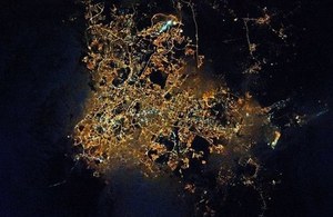
Malaysia pictured from space. Credit: ESA.
The Industrial Strategy highlights the importance of bringing together the UK’s world-class research with business investment to develop technologies and industries of the future that benefit society, as well as our economy.
International Partnership Programme
The UK Space Agency’s International Partnership Programme uses UK space expertise to deliver innovative solutions to real world problems across the globe. This helps some of the world’s poorest countries, while building effective partnerships that can lead to growth opportunities for British companies.
The successful projects, worth £38 million in total, are led by a diverse range or organisations from the UK’s growing space sector, from large companies such as Inmarsat and CGI, to start-ups such as Guildford-based Earth-i. The UK Space Agency and industry are working together to grow the UK’s share of the global space market to 10% by 2030.
Science Minister Sam Gyimah said:
“The UK’s space sector is going from strength to strength. It pioneers new technology and provides jobs for 40,000. Today I can announce that the space sector’s capabilities are being put to use to tackle some of the world’s biggest challenges.
“The UK Space Agency’s International Partnership Programme will help developing countries tackle big issues like disaster relief and disease control, while showcasing the services and technology on offer from our leading space businesses.”
The International Partnership Programme is part of the Department for Business, Energy and Industrial Strategy’s (BEIS) Global Challenges Research Fund (GCRF): a £1.5 billion fund from the UK Government, which supports cutting-edge research and innovation on global issues affecting developing countries.
There are 22 existing projects already delivering benefits, including a partnership between Inmarsat and the Philippine government to reduce the impact of natural disasters using satellite communications, which was called into action in December and January when tropical storms killed hundreds of people and displaced tens of thousands more to evacuation centres. The project used British technology and expertise to help relief workers get information in and out of the disaster zones which greatly increase the effectiveness of the response effort, helping them save lives and restore critical infrastructure.
Rupert Pearce, CEO of Inmarsat, said:
“Inmarsat was originally founded to save lives at sea and we are proud that, almost 40 years later, our robust, reliable satellite communication services are deployed throughout the world to assist following natural disasters and humanitarian crises, wherever they occur.
“With the invaluable support of the UK Space Agency, we have been able to pre-equip disaster response teams in the Philippines with vital satellite communications solutions. This meant that when two deadly cyclones hit the country over a two week period, resulting in loss of life and serious damage to terrestrial communications infrastructure, Philippine authorities were able to utilise Inmarsat’s mobile connectivity services to assess the damage and identify the needs of those regions most affected.”
All IPP projects are match-funded by consortium members and international partners to ensure maximum value for money. The programme is fully compliant with Official Development Assistance (ODA) with the Independent Commission for Aid Impact recently reporting that the UK Space Agency had developed robust procedures for ensuring ODA eligibility and was thorough in its ODA compliance screening.
The UK Space Agency is also funding five Business Applications Ambassadors to work with industry across the UK. The Agency already supports a network of business incubators and the new ambassadors will advise on business applications and other opportunities in the UK.
Full list of new projects:
1) British Geological Survey, Nottingham
Modelling Exposure Through Earth Observation Routines (METEOR): EO-based Exposure, Nepal and Tanzania Grant: £2.8 million
Target countries: Nepal and Tanzania (test countries), rolling out to all 48 Least Developed ODA countries
Theme: Disaster Management
At present, there is a poor understanding of population exposure in developing countries, which causes major challenges when making Disaster Risk Management decisions. METEOR takes a step-change in the application of Earth Observation exposure data by developing and delivering more accurate levels of population exposure to natural hazards. Providing new consistent data to governments, town planners and insurance providers will promote welfare and economic development in these countries and better enable them to respond to the hazards when they do occur.
2) Satellite Applications Catapult, Harwell: Space Enabled Monitoring of Gold Mining
Grant: £3.3 million
Target country: South America
Theme: Mining
This project is about improving detection and efficiency in monitoring gold mining in remote forested areas in South America. The project will make use of freely available Synthetic Aperture Radar (SAR) data, and incorporate machine-learning techniques to show suspected areas of mining activity, in a user-friendly web portal. The project will support the promotion of safe and secure working environments for all workers, and a reduction in the health-related effects from the high rates of mercury contamination associated with informal mining.
3) EARTH-i Ltd, Guildford: ACCORD
Grant: £2.7 million
Target countries: Kenya and Rwanda
Theme: Agriculture
Coffee is the second most traded commodity globally, with revenues directly benefitting farmers in developing countries. Despite this, in Kenya and Rwanda 67% and 80% of people respectively live in poverty, including most smallholder coffee farmers. Unpredictable weather, pests, diseases, nutrient depletion and other factors limit earning potential by hitting coffee quality and quantity. ACCORD will deliver advice from satellite Earth Observation to help smallholder coffee farmers make significant improvements to crop quality and yield, providing them with access to timely, geo-targeted advice through a simple mobile application. This will allow smallholder farmers to achieve higher incomes for their work, improving quality of life for their families.
4) Rothamsted Research, Harpenden: EcoProMIS
Grant: £3.9 million
Target Country: Colombia
Theme: Agriculture
The EcoProMIS project aims to help Colombian rice and oil palm farmers to improve productivity and stabilise incomes, allowing them to compete globally whilst responding to climate change and producing responsibly. The project uses satellite Earth Observation alongside environmental and crop data to research the impact of crop and ecosystem management on biodiversity, greenhouse gas emissions and productivity. The outcome will be a partnership of farmers, research institutes and industry experts that creates comprehensive sets of crop and ecosystem data. This data will be made freely available for the Colombian partners to improve the environmental, technical and financial efficiency of their processes. It will also provide information to insurance firms, government food processors and further beneficiaries to create income for sustainable knowledge.
5) HR Wallingford, Wallingford: An integrated dengue early warning system driven by Earth Observations in Vietnam
Grant: £4.1 million
Target Country: Vietnam
Theme: Health
This work will provide a tool that enables advance warning of likely dengue outbreaks, allowing public health authorities to mobilise resources to those most in need. The project will also provide forecasts of dengue fever under a range of climate change scenarios. The system will link Earth Observation data with climate forecasting and a land-surface model to predict for the first time the impacts of various elements (such as water availability, land-use, climate), on the likelihood of future dengue epidemics. The dengue forecasting tool will also include a water assessment module, delivering the additional benefit of improving water management in Vietnam’s transboundary river basins.
6) Janus TCD, Stourbridge: Improved Situational Awareness In Fisheries (ISAIF)
Grant: £5.5 million
Target Country: The Philippines
Theme: Illegal Fishing
The ISAIF project will use satellite technology to help the Philippine government tackle Illegal, Unreported and Unregulated (IUU) fishing in its waters. This project aims to halt the decline of a fisheries sector that employs more than 4 million people. The project will use a wide variety of data sources, including satellite data to understand the location, time and behaviour of specific vessels at sea. This will be combined with a satellite navigation application with an authentication tool through which Philippine fisherfolk confirm their compliance, creating a new digital barrier to IUU fishers within the supply chain. Outcomes will include better monitoring and enforcement of IUU by the Philippine government, improved safety, security and economic productivity for Philippine fisherfolk, benefits to the Philippine economy, and an improvement in the international reputation of Philippine fisheries.
7) CGI, Leatherhead: Peatland Assessment in SE Asia by Satellite (PASSES)
Grant: £2 million
Target Countries: Indonesia, Malaysia
Theme: Forestry
Tropical forest fires affect over 20 million people in South East Asia, leading to significant deteriorations in public health and premature mortalities as well as contributing to global CO2 emissions and other negative environmental impacts. Many fires occur over drained peatland areas. This project will use satellite observations and measurements to map peat condition, even when under a forest canopy. By monitoring water levels and improving hydrology in the peatland areas, the risk of fire can be dramatically reduced. By using freely available observations from satellites through the EU Copernicus programme and use of emerging industrial hosted processing capabilities, PASSES will prove that peatland monitoring is a cost effective way to reduce forest fires.
8) eOsphere Limited, Harwell: SIBELIUs: Improved resilience for Mongolian herding communities using satellite derived services
Grant: £1.6 million
Target Country: Mongolia
Theme: Disaster Management / Insurance
Mongolia is a large country with around 30% of its population dependant on livestock herding who are exposed to extreme weather events (dzuds). Dzuds are increasingly exacerbated by climate change and are highly damaging to Mongolia’s economy and devastating for the poorest herders. A typical dzud can impact tens of thousands of herders, many of who will lose all their livestock leaving them in extreme poverty, with associated impacts for the wider economy. The SIBELIUs project will provide greater dzud-resilience for herders by providing the Mongolian Research Institute of Meteorology, Hydrology and Environment with new sources of satellite data, plus a geo-spatial database for distributing new and upgraded environmental products to key stakeholders supporting herding communities.
9) United Nations Institute for Training and Research (UNITAR): CommonSensing
Grant: £9.6 million
Target Countries: Fiji, The Solomon Islands, Vanuatu
The overall aim of CommonSensing is to improve resilience towards climate change, including disaster risk reduction, and contribute to sustainable development in three selected Commonwealth Small Island Developing States (SIDS): Fiji, the Solomon Islands and Vanuatu. The project will combine earth observation data to provide stakeholders with access to important information regarding disaster risks (including disaster risk planning, food security, climate risk and other environmental concerns). This information will be accessible to beneficiaries through a web portal and mobile applications. CommonSensing project will create long-term investment loops, define priorities for future climate funds proposals and ensure a sustainable service-platform, running three years after IPP project end.
10) HR Wallingford, Wallingford: Minimising the risk of tailings dams failures through the use of remote sensing data
Grant: £2.7 million
Target Country: Peru
Theme: Mining
Tailing dams are earth embankments used to store toxic mine waste and effluent which can be more than 100m high. Their rate of failure is high, due to poor design regulations and less rigorous construction methods than for normal water-retaining dams, especially in low-income countries. This project will use Earth Observation and Global Navigation Satellite System technologies to allow for more effective monitoring of the dams and therefore quicker action can be taken to avoid the tailings dams failures. The project will help to reduce damage to ecosystem services downstream of mines upon which many vulnerable communities rely for both their source of water and their livelihoods.