Milestone for managing seas in South of England reached
Government adopts new framework for marine activities around the south coast of England
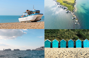
South marine plan area
The Government has now adopted England’s South Marine Plan, which brings a new approach to managing the seas between Kent and Devon.
The new marine plan provides a policy framework which will be used to help inform decision-making on what activities take place in the marine environment and where how the marine environment is developed, protected and improved in the next 20 years. It will inform and guide decisions by regulators managing the development of industry in marine and coastal areas, while conserving and enhancing the environment and recognising leisure uses.
The marine plan, produced by the Marine Management Organisation (MMO) on behalf of the Department for Environment, Food and Rural Affairs, is the culmination of around 5 years of engagement with business, charities, representative organisations and individuals.
The plan will help business realise the economic benefits available from the Marine Plan area whilst ensuring the marine environment remains protected. Covering an area of approximately 1,700 kilometres of coastline and over 21,000 square kilometres of sea, the plan stretches from Folkestone in Kent to the River Dart in Devon. This is a very dynamic marine area incorporating 9 world heritage sites and some of the busiest shipping channels in Europe.
The MMO is now working with Local Authorities in the area to ensure successful implementation of the new Plan.
Environment Minister Thérèse Coffey said:
The South Marine Plan is a significant milestone in our ambition to create healthy and biologically diverse seas and oceans, as outlined in our 25 Year Environment Plan.
Stretching from Kent to Devon, this is one of the most complex areas of the English coast and this plan will allow us to safeguard our sea life while supporting a more sustainable marine economy.
John Tuckett, Chief Executive Officer at the Marine Management Organisation, said:
This is a significant milestone for one of the most complex and used areas of the English coastline.
The South Marine Plan will help ensure that when activities take place, they happen in the best location and in the right way within the marine environment. We are now working closely with decision makers and stakeholders along the coast to ensure that the Plan is understood and used effectively.
By 2021 all English marine area will have marine plans in place. The South Marine Plan is the second to be adopted following the introduction of the first English marine plan established in the East of England in 2014.
Notes to editors
short animation film to explain marine planning
Further background on marine planning:
- There are 11 English marine plan areas, including inshore and offshore areas. Work continues to produce plans for the South East, South West, North East and North West, the target for adoption of the remaining plans is before March 2021.
- Marine planning addresses the key issues for the marine area, including the coast, estuaries and tidal waters, as well as developments that impact on these areas. The plans will include a vision, objectives and detailed policies on how these objectives will be achieved.
- Marine plans are used by public authorities as part of the decision making process for all new activities and developments in or affecting the marine area.
- Marine plans build on the requirements of the Marine and Coastal Access Act and the Marine Policy Statement.
More information on marine plans is available elsewhere on GOV.UK
How will marine plans be used?
The plan is brought into effect through its use in decision-making. All public bodies are legally required to make all authorisation and enforcement decisions which are likely to affect the marine areas in accordance with marine plans, unless an exception states otherwise.
Such decisions vary widely and include The Crown Estate leasing the seabed for renewable energy, Environment Agency permitting of flood and coastal defence works and water discharges, Local Planning Authorities (LPAs) determining planning permissions, to Inshore Fisheries and Conservation Authorities (IFCAs) making fisheries byelaws.
The MMO will implement the adopted marine plans across all decision-making functions, including:
- Marine licensing
- Marine compliance and enforcement
- Fisheries management and effort control
- European Fisheries Funding
- Coastal operations
The MMO is working to support other relevant authorities to adopt/implement the South Marine Plan in their decision-making processes.
How will you enforce the plans? If it’s a legal framework, is there a means to making sure people abide and what is the consequence if they don’t?
The plans aren’t an enforcement tool as such, more a policy framework for the future use of the sea. (It’s not a law change in that people aren’t being expected to change currently occurring activity to comply with the plan.)
Will the plans result in activities being banned?
The plans are not a list of prohibited activities, but a strategic vision for the sustainable use of shared marine environment seeking to maximise opportunity and encouraging co-existence between many differing marine activities.