Ground-breaking satellite projects will transform society
A scheme to use satellites to support the roll out of charging points for Electric Vehicles is one of eight new projects announced by the Science Minister Sam Gyimah today.
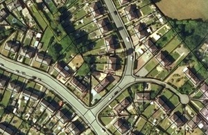
Ordnance Survey MasterMap.
The electric vehicle charging point project, led by Energeo Ltd working with Bournemouth Borough Council, will combine satellite imagery, Open Data, and Machine Learning to deliver an interactive map based user interface. This will help the council identify charge point requirements via visualisation of different features and influences on EV roll out, such as existing charge points, residential driveway availability and size, and footpath width and potential obstructions.
The eight new projects are part of the UK Space Agency’s Space for Smarter Government Programme, which demonstrates the potential of using satellite technology to solve challenges faced by the public sector.
Satellite data and applications which use space have the potential to change the way the public sector works, leading to better services and lower costs. This in turn could help boost the growth of the UK space sector, which is already worth £13.7 billion to the economy and provides around 40,000 jobs.
The announcement comes on the day the Space Industry Act received Royal Assent, which will unlock an exciting era of British space innovation, exploration and investment. The Act will enable the first commercial space launch from UK soil in history, creating the potential for hundreds of highly-skilled jobs and bringing in billions of pounds for the economy.
Science Minister Sam Gyimah said:
“These projects demonstrate the potential of satellite technology to benefit life on Earth with innovative solutions to challenges ranging from monitoring plastic waste in the sea to supporting the roll out of charge points for electric cars.
“As set out in our Industrial Strategy, the UK Space Agency is working together with industry to ensure the UK thrives in the commercial space age. The Space for Smarter Government Programme is transforming the way the public sector works. It will stimulate innovation and growth, while helping the public sector save money and improve decision making.”
The Environment Agency will collaborate on two projects, one of which deploys satellites and drones in the battle against marine waste and the other will use satellite data to monitor flood defences in the Thames Estuary.
Dr John Kupiec, Environment Agency’s Innovation Manager, said:
“The Environment Agency is delighted to support the development of these innovative projects that will help us work towards protecting the environment and promoting sustainable development.
“The Government’s 25 Year Plan to Improve the Environment highlighted the problem of plastics in the environment – particularly in marine and coastal environments. By using Earth Observation and other novel technologies we hope to accomplish our common goals in reducing plastic and other waste pollution.”
The UK Space Agency is providing training to policymakers as well as access to data, wider expertise and market capability as part of the programme. Working alongside public sector partners, academia and industry can help bring new satellite applications to market to meet UK needs.
The full list of projects, which have received a combined total of more than £700,000 in funding, can be found below:
Project title
City Level Energy Analysis for Electric Vehicle Charging Points
Funding
£59,898
End user
Bournemouth Borough Council
Lead organisation
EnergEO Limited
Energeo’s CLEAN EV service will utilise geospatial Big Data (such as satellite imagery), Open Data, and Machine Learning in conjunction with strategic textual information. It will deliver an interactive, web based tool, designed to support roll out of Electric Vehicle charge point (EVCP) infrastructure in urban environments via intuitive visualisation, contextualisation and analysis of data in a map based user interface.
Public sector end users will be able to efficiently identify charge point requirements via visualisation of different features and influences on EV roll out, such as existing charge points, residential driveway availability and size, and footpath width and potential obstructions, in order to provide an accurate overview of current and potential EVCP preparedness. In addition, users will be able to identify specific features manually through the map interface, or run queries in order to model pre-determined scenarios that will support the strategic decision making process.
Project title
Transport modelling based on PNT data
Funding
£59,950
End user
Sedgemoor District Council, Somerset
Lead organisation
City Science
This project takes a range of position, navigation and timing (PNT) data and assesses the feasibility of its use to provide accurate and informative outputs within a transport planning context. Using PNT data, the project will investigate issues such as the scheduling and impact of HGV deliveries, the associated impact on congestion, bus timetable reliability and the distribution of journeys at different times of day. It will do this by integrating PNT data with traffic simulation and modelling models.
The outputs will be a data-based understanding of existing and future pinch points across a range of transport modes that are robust, fit-for-purpose and meet the needs of the local authority.
Project title
Urban healthy living using satellite enabled air pollution monitoring and mitigation
Funding
£123,582.09
End user
Cherwell District Council, Oxfordshire
Lead organisation
Geospatial Insight Ltd
This project addresses how air pollution exposure affects wide swathes of public sector policy and programmes. Management and mitigation of adverse air pollution exposure by integrating space-enabled technologies with other public-sector initiatives offers prospects for smarter, more efficient operations, risk reduction and enhanced policy delivery in many key areas, notably healthcare and urban air quality management.
Geospatial Insight Ltd will lead a team of innovative SMEs to work in partnership with leading public authority stakeholders to demonstrate beneficial disruptive interventions in primary and secondary healthcare provision and urban planning through the management of ambient air pollution.
Project title
Quantifying Congested Maritime Environments
Funding
£60,000
End user
United Kingdom Hydrographic Office (UKHO)
Lead organisation
SCISYS UK Ltd
Improved understanding of patterns of life in congested maritime environments will allow greater situational awareness for users of maritime waterways. The well-established Automatic Identification System (AIS) can determine movements of large vessels, but smaller vessels without AIS are less well understood and remain difficult to quantify. Some vessels in this category are visible from space using radar and optical satellite imagery, which may also capture tidal and seasonal changes.
SCISYS’s novel approach involves automatically mining through archives of satellite data to build up a picture of spatial and temporal activity, taking variations in data availability into account. The main advantage is that this approach locates all objects of a certain size, irrespective of their type or if they are broadcasting an AIS signal, thereby delivering value-add information to existing maritime products and services. The United Kingdom Hydrographic Office will partner SCISYS for this feasibility study.
Project title
Space Derived Condition Assessment tool for CNI Structural Risk Management
Funding
£172,974
End user
Environment Agency
Lead organisation
Geomatic Ventures Limited
This project aims to provide a basis for the regular remote assessment of structural condition for Critical National Infrastructure (CNI) asset owners such as power stations, railways, roads, gas storage facilities, runways, flood defences and water treatment works. It will provide early warning indicators of potential engineering failures through absolute motion vector mapping using a combination of satellite based radar with satellite navigation.
The project uses satellite based remote sensing to provide initial wide area, medium resolution screening and identify relevant site criticalities. Using national threshold standards it will target higher resolution deformation studies. An asset risk index will be developed so that the remote sensing techniques can be applied on soft and hard targets and used to inform asset condition across a range of asset types.
Project title
GeoInt Service for Marine Litter
Funding
£60,000
End user
Environment Agency
Lead organisation
ARGANS Ltd
The GeoInt Service for Marine Litter is a platform developed by ARGANS Ltd, aiming to integrate big data sources about marine litter from satellites, drones and citizen science initiatives on a single platform. The goal is to provide synoptic information to the public, voluntary and private sectors with an interest and decision-making capability to support policy-making, cleaning, prevention operations and long-term monitoring.
Local, regional and national authorities, NGOs, foundations, conservation societies, waste management companies and industry especially those focused on the circular economy will benefit from this service. ARGANS Ltd has received end user support from the Environment Agency, Cornwall Council, and European Space Agency.
Project title
AI Satellite Pluvial flood forecasting
Funding
£129,922
End user
Greater London Authority
Lead organisation
Ambiental Environmental Assessment Ltd
This project aims to help the public sector to increase the uptake of satellite and Earth Observation data via sustainable ‘live’ services relating to surface water flood forecasting, and associated dynamic mapping of changing patterns of green space in urban areas.
The goal is to enable smarter, more efficient operations, reduce risk/cost and enhance the quality of decision-making within the public sector in real-time. A novel aspect of the project involves utilising Artificial Intelligence (AI) to enhance situational awareness and provide actionable intelligence.
Project title
EO-derived soil moisture estimation
Funding
£55,900
End user
Network Rail
Lead organisation
CGG NPA Satellite Mapping
This project will improve the understanding of soil moisture evaluation from Earth Observation (EO) data. Soil moisture can have significant impacts on asset management within the rail sector. The occurrence of earthwork failures have been shown to correspond with ground (soil) saturation and weather conditions reported at the time of failure. NPA’s EO experts believe that soil moisture estimation algorithms developed for use with Sentinel-1 data could facilitate the remote estimation of soil moisture. If successful, this capability should improve Network Rail’s ability to identify the most at-risk parts of its network. It is hoped that this solution will also benefit other public sector organisations concerned with asset management. In addition to working with Network Rail as a public sector end user, NPA will also receive support from the National Physical Laboratory (NPL) and British Geological Survey (BGS).
For more information about the work of SSGP and to view other case studies, please visit the Space for Smarter Government Programme website, or contact the team at ssgp@ukspaceagency.bis.gsi.gov.uk