Geovation reveals next wave of GeoTech and PropTech businesses
Find out about the new members of the Geovation Programme and how past winners have used the funding and resources.
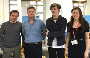
Some of the winners, from Mothive and Pocket Pals.
Seven exciting start-ups will join the Geovation Programme and receive the strategic backing of Ordnance Survey (OS) and HM Land Registry (HMLR). The Programme, which acts as an accelerator course to new GeoTech and PropTech businesses, will see each of the start-ups receive up to £20,000 in grant funding and a range of resources and services to help them develop their business.
Alex Wrottesley, Head of Geovation, says:
Entries for the Programme were again of a very high standard. This is an exceptional group joining us. The Programme is designed to give them the best possible support to help propel them to the next level. We offer a founder-friendly environment, great mentors, high-quality workshop content and, almost uniquely, a dedicated software development team in-house, who work hand in hand with our companies to build and release their first products. This is something very few accelerators can offer and it means the businesses joining us can move faster and further than they otherwise would have been able to. We can’t wait to get started with these new teams.
The GeoTech businesses accepted onto the Programme
Mothive is an automated agronomy service to help farm managers maximise efficiency, reduce waste and improve the predictability and control of crops.
Pocket Pals is a mobile animation game to encourage young people and families to engage with and visit the real wildlife local to them.
Trik is a 3D mapping and reporting system to deliver drone-collected data into higher quality, digital, structural inspections available on a mobile tablet.
The PropTech businesses accepted on the Programme
Skyscape uses artificial intelligence to analyse rooftops and identify opportunities to maximise utilisation and address urban challenges. Its rooftop data analytics platform enables asset managers to efficiently identify opportunities for utilising rooftop space, where value of existing and future stock can be increased.
ThirdFort is a security enhancement tool to help property solicitors more efficiently process property transactions.
Fruumi is a friendly and efficient end-to-end shared accommodation platform that empowers landlords to let out their property at lower risk and cost.
Hipla is a platform to help buyers evidence their own buyer position, and for owners and estate agents to qualify buyers, giving better transparency earlier in the process, whilst enabling opportunities for selling additional services and attracting sellers.
About the programme
Since opening in the summer of 2016, the Geovation Hub has become home to more than 900 GeoTech and PropTech start-ups. Its Programme provides access to data, to experienced software developers, and gives businesses geospatial expertise from OS and land and property insight from HMLR, as well as business mentorship and coaching to help prepare for presenting to investors. The Programme to date has supported 65 technology start-ups, which has seen £17M raised in investment funding.
Orla Shields is the founder of GetRentr, a PropTech company using artificial intelligence to track all UK property licensing regulations and consultations in real-time to ensure property portfolios are compliant. After a successful application, Orla’s company was selected to join the Geovation Programme. In the six months that have followed, Orla and GetRentr have raised over £500,000 in funding and are currently working with letting agents and landlords via a partnership with the National Landlord Association. GetRentr is also about to launch a partnership with ARLA, the largest association of lettings agents in the UK.
Orla says of Geovation:
Geovation has been life changing. The grant money has helped us do things we couldn’t have done while we were waiting to secure our investment. Free office space in Clerkenwell is a major benefit for any business - early stage or not. It’s great environment, with numerous other inspiring start-ups in a similar field. Geovation’s network and connections with major people in this industry and in the government is priceless to us. The team is very pro-active, and their support and experience is really helpful and always available. One of the best benefits has been the ability to use OS/HMLR data. This gives us the option to reach out to more people who are looking to invest and be strategic with their portfolios. It has also helped us predict where regulations will be implemented. Overall, the culture at Geovation is one of collaboration and support.
Jillian Kowalchuk, whose safety app, Safe & The City, launched in March this year and already has thousands of users, was another accepted onto the Geovation Programme 6 months ago. Jillian says:
Geovation is filled with world-class minds and inspiring businesses. I have received a lot of help, including one-to-one support from the Programme Manager and the Head of the programme, development and UX support, workshops, coaching and learning materials to inform best practices, connections to other start-ups, organisations and corporates to raise our profile and access to OS contacts and PR support. It is an amazing community to learn from on a daily basis.
Contact
For further information, examples of businesses, interviews, and images, contact Keegan Wilson at Ordnance Survey:
- by email keegan.wilson@os.uk
- by phone 02380 055332
Notes to editors
About Geovation
Geovation is an Ordnance Survey Initiative in association with HM Land Registry, which is dedicated to supporting open innovation and collaboration using location and property data. Location is at the heart of many of the most successful digital products and services. Land and property is the foundation of our national economy.
About Ordnance Survey
Ordnance Survey is Great Britain’s mapping service for government, business and citizens. Their geospatial data serves the national interest by enabling a safe, healthy and prosperous society.
About HM Land Registry
-
HM Land Registry is a government department created in 1862. It operates as an executive agency and a trading fund and its running costs are covered by the fees paid by the users of its services. Its ambition is to become the world’s leading land registry for speed, simplicity and an open approach to data.
-
HM Land Registry safeguards land and property ownership worth in excess of £4 trillion, including around £1 trillion of mortgages. The Land Register contains more than 25 million titles, which show evidence of ownership, for some 85% of the land mass in England and Wales.
-
For more information about HM Land Registry, visit gov.uk/land-registry.
-
Follow us on Twitter @HMLandRegistry, our blog, LinkedIn and Facebook.
Press Office
Trafalgar House
1 Bedford Park
Croydon
CR0 2AQ
Email HMLRPressOffice@landregistry.gov.uk
Phone (Monday to Friday 8:30am to 5:30pm) 0300 006 3365
Mobile (5:30pm to 8:30am weekdays, all weekend and public holidays) 07864 689 344