Geospatial Commission-funded tool demonstrates potential for AI to transform decisions about land use
The Geospatial Commission and The Alan Turing Institute are exploring how artificial intelligence can be applied to support decisions about the UK’s land.
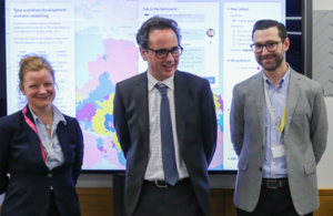
Jean Innes, Chief Executive of The Alan Turing Institute; Viscount Camrose, Minister for Artificial Intelligence; and Daniel Arribas-Bel, Deputy Director of Urban Analytics at The Alan Turing Institute
- The UK is facing complex decisions about how to use its land to achieve policy objectives around economic growth, net zero and biodiversity, and food and energy security
- artificial intelligence has the potential to make geospatial data easier to access and interpret when making land use decisions
- the Geospatial Commission has partnered with The Alan Turing Institute to explore the application of artificial intelligence in land use decision-making
The Geospatial Commission, part of the Department for Science, Innovation and Technology (DSIT), has partnered with The Alan Turing Institute to explore the role that artificial intelligence (AI) can play in long-term decisions about how to use land.
The UK is facing significant and competing pressures for its land. Advances in spatial data science and technologies, such as AI, can bring to life the opportunities and trade-offs surrounding land use change. Data and images can be interpreted more efficiently and scenarios can be tested. Visualisation tools can help to bring choices to life.
The government has already invested more than £3.5 billion in AI over the course of the last decade to help realise the technology’s transformative potential across the economy. This includes the Chancellor recently announcing a doubling of investment in The Turing as part of the Spring Budget. The £100 million package over five-years will build on The Turing’s work to-date to help address national and international challenges in areas, such as health, the environment and sustainability alongside defence and security.
Viscount Camrose, Minister for Artificial Intelligence, visited The Turing yesterday to explore the application of geospatial AI to enhance land use decision making. The Turing provided a demonstration of their AI-powered tool, which could support local authority planners in deciding how to use their land and unlock opportunities for multifunctional land use.
Viscount Camrose, Minister for Artificial Intelligence, said:
We face growing pressures on our limited supply of land, from the need for new housing to tackling challenges like climate change and food security.
By harnessing innovative technologies like AI, we can support more effective long-term decisions about our land and ensure we are maximising its use and so I welcome this ongoing collaboration between the Geospatial Commission and The Alan Turing Institute.
The Geospatial Commission has been in partnership with The Turing on land use since 2022. This led to the development of a prototype tool in June 2023, which leveraged data science and AI to visualise different future scenarios for land use in collaboration with Newcastle City Council.
The partnership is now further developing the prototype tool, incorporating national satellite data and vision foundation models for improved accuracy and analysis via AI. It is also incorporating a large language model approach, which will make the tool more accessible for non-technical users. The underlying model will be available for public download at the conclusion of the project later this spring.
Jean Innes, Chief Executive Officer, The Alan Turing Institute, said:
The way we use land will be more crucial than ever in the years ahead as the UK targets economic growth and prosperity whilst ensuring we protect the environment and adapt to climate change.
It is exciting to see the partnership between the Geospatial Commission and The Turing develop, augmenting current scenario modelling tools with new geospatial AI capability, applying satellite data and large language model technology to help more cities and regions make effective decisions about land use.
This partnership is an important component of the Geospatial Commission’s Land Use Programme, which is exploring how spatial data and analysis can improve our understanding of how land can be better used to balance multiple demands and deliver national policy priorities.
The Geospatial Commission published Finding Common Ground in May 2023 as part of the Land Use Programme. The report set out key recommendations for how the UK’s data capabilities can be enhanced to support land use decision making with a more integrated understanding of urban and rural needs.