Environment Agency completes £3 million upgrade to reservoir flood mapping
New upgraded flood maps for all reservoirs in England provide a more accurate picture of flood risk
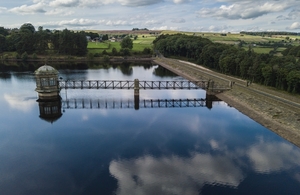
reservoir from above with fields in background
The Environment Agency has released new upgraded flood maps for all reservoirs in England to provide a more accurate picture of flood risk in the very unlikely event of a reservoir failure.
The £3 million project has reviewed, updated and improved the reservoir flood maps for 1,865 large raised reservoirs in England.
The new maps, which can be viewed on the ‘Check Your Long Term Flood Risk’ page and the Defra Data Services Platform, have made use of the most up-to-date ground level information, new modelling techniques and improved knowledge of how quickly water would flow from a reservoir failure.
They are primarily for use by Civil Contingency Responders, such as the emergency services, local authorities and the Environment Agency, helping them to put in place plans for warning and evacuation.
John Russon, FCRM Director at the Environment Agency said:
We have an excellent safety record for reservoirs in England. These new maps mean we can more accurately predict what would happen in the unlikely event of a reservoir failing. This enables us to work better with partner organisations to warn and inform people if we think there is a risk of a reservoir breaching.
For the first time the maps show the maximum flood extent both in the case of ‘dry-day’, where reservoir flooding took place with river levels at normal levels and a ‘wet-day’, where reservoir flooding takes place alongside wider river flooding.
Ian Scholefield from United Utilities said:
This is a great piece of work and will help Panel Engineers and reservoir owners identify key risk areas posed by large raised reservoirs and recommend and implement proportionate measures to reduce the probability of reservoir failure to protect downstream communities.
In addition this will also allow emergency responders, reservoir owners and Panel Engineers develop on and off site plans to help all parties prepare to manage the impacts during those very rare incidents that may pose a risk to loss of life and or significant property or environmental damage.
The new maps will also help the undertakers of large raised reservoirs prepare on-site flood plans, which are now required to assure public safety and prepare reservoir undertakers for potential reservoir failure emergencies.