Discover more about £5 million project to defend against flood and reconnect the River Avon to the ‘heart of Bath’
Members of the public are invited to find out more about Bath & North East Somerset Council’s plans to prepare the natural environment on the River Avon for regeneration projects and reconnect the river to the heart of Bath.

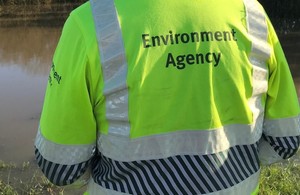
Bath & North East Somerset Council and the Environment Agency are working together on a major infrastructure project which will provide flood defences for parts of Bath’s city centre and begin to build a positive relationship between the city centre and the River Avon.
The Bath Quays Waterside Project will put in place essential flood mitigation and defence works to the north and south banks of the river between Churchill Bridge and Midland Bridge that address the negative impacts of climate change. In summary, these interventions will:
• Reduce existing and future flood risk to the Lower Bristol Road and 60 properties on the South side of the river through the provision of new flood defences; • Provide the flood mitigation to enable the redevelopment of the Bath Quays and Manvers Street sites forming the first step towards the realisation of the Bath City Riverside Enterprise Area and the Council’s ‘Innovation Quays’ project.
While the project was started as a flood mitigation and defence project, it is also a major opportunity to significantly enhance the riverside – creating better access and a more beautiful and enjoyable environment for local people and visitors to the city.
The Bath Quays Waterside Project will support the delivery of around 2,500 new homes, 650,000 square feet of new workspace and 9,000 new jobs for local people as part of the Bath City Riverside Enterprise Area. It will overcome one of the major stumbling blocks to unlocking the potential of brownfield sites along the River Avon – the possibility of flooding.
The Council and Environment Agency are funding these essential works with a combination of Flood Defence Grant and Revolving Infrastructure funding made available by West of England Local Enterprise Partnership.
Ed Lockington, from the Environment Agency, said:
We welcome working in partnership on this important piece of work and are pleased to work with Bath & North East Somerset Council on this project, which will reduce existing flood risk in Bath and help provide exciting redevelopment opportunities.
What are the specific plans?
• Significantly widening the north bank at the lower tow-path level (up to 15m wide) between Churchill Bridge and Green Park to move water through this area more quickly in flood conditions;
This will require that Green Park Road is diverted away from the riverside northwards to link up with Corn Street creating the major opportunity to open up the riverside to the city.
This part of the plan offers the potential to transform the riverside creating upper and lower level river promenades, a defined cycle route, cafes, public art and ecology, a riverside public space offering opportunities for outdoor performances and events, greater opportunities to hold more activities on the river eg boat races. This environment would provide an attractive and playful waterfront for Bath that can be used and enjoyed all year round by local people;
There are currently no plans to alter Green Park itself, other than some landscape improvements at the river’s edge;
• Trees along the southern verge of Green Park Road and along the new road alignment will be removed and replaced with new planting.
• Raising river walls on the south side of the river between Churchill Bridge and Midland Bridge;
• Improving flood defences on existing buildings fronting onto the river along Lower Bristol Road;
• Improving surface water sewer and pumping station for Lower Bristol Road;
• Timescale for start is 2015.
Safeguarding wildlife and trees
The Council’s responsibility to safeguard wildlife and trees that could be affected by the plans is being taken seriously. A full series of surveys have been undertaken in respect of wildlife and ecology, including surveys of trees and bird species using the trees, as well as bat and reptile surveys. Expert opinion has also been sought from the Environment Agency, Natural England and the private sector. The scheme represents an opportunity to enhance the river corridor for ecology and will consider the creation of new habitats.
The removal of parts of the existing Green Park Road is likely to will require the removal of mature trees along the edge of the upper bank at North Quays – this is not something the Council takes lightly. These are mainly Poplar trees from the 1970s that were planted to screen Green Park Road from the opposite side of the river and are reaching the end of their natural life. The new scheme will reinstate mature trees and landscaping which will ultimately offer higher ecological and amenity value.
Ends