Vivid Economics (Peru) Land-use planning
Remote mapping and socio-economic valuation tools to support planning and implementation in land-use interventions in Peru

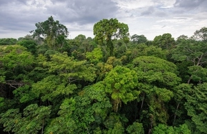
Amazon rainforest in Tambopata reserve, Peru.
Project Title
Remote mapping and socio-economic valuation tools to support planning and implementation in land-use interventions in Peru
Delivery team
Vivid Economics (UK, project lead), RSAC (UK); MDA (Peru); Peruvian government (MINAM, Serfor-MINAGRI, CIAM)
Project overview
The project addresses two of Peru’s most acute development challenges: reducing the rural population in poverty (currently 3 million), and preventing deforestation from its current rate of 250,000 hectares per year.
The two challenges are closely linked in a number of ways. Unregulated land use is a major cause of both, facilitating encroachment on forests by the subsistence farmers who are responsible for 75% of losses, while also stemming flows of investment that could improve their productivity and incomes. However, solutions to the problems often require balancing trade-offs between them: for example, new infrastructure that can improve livelihoods might also accelerate deforestation.
The overall objective of this project is to contribute to efforts to reduce poverty and protect forests by developing satellite based data tools that help policy-makers to understand and address these linkages.
The tools developed by the project, and the engagement with government in the adoption and application of the tools, will assist decision making in four key areas of policy activity:
- Land-use (“zoning”) regulation
- Infrastructure provision
- Land permitting
- Sustainable production and irrigation
The project tools will support these aims by providing three layers of information:
- Land use inventory that classifies and differentiates physical surface cover types. This will be developed using newly available data from the Copernicus Sentinel satellite that offers higher resolution and revisit frequency than Landsat, which has been used for mapping in the past, supplemented by even higher resolution information from RapidEYE and SPOT.
- Economic-ecosystem valuation tool that improves zoning rules and regulations, prioritises planned investments, and focuses enforcement and incentive mechanisms to improve effectiveness. This will integrate the land-use inventory with other economic information to map the value of land under different uses and the risk land faces of unauthorised exploitation.
- Plot level mapping and technical specifications to improve titling, enforcement of land-use rules, supporting programmes and technical assistance. This will map areas identified as high-risk in greater detail using UAV surveys, providing information on forest thinning needed to enforce restrictions on deforestation and support certification of sustainable production.