Scout missions
Scout missions can prove new concepts using small satellites, which can then be scaled up in larger missions.
The Scout missions are an element of ESA’s Earth Observation programme that demonstrate innovative science concepts using agile small satellites, enabling fast deployment and validation of new technologies.
The UK is leading the development of the first Scout mission, HydroGNSS, leveraging national strengths in small satellite engineering and Earth Observation science. Scheduled for launch in late 2025 with SpaceX, HydroGNSS will support climate monitoring and environmental resilience by delivering vital data more quickly and cost-effectively.
HydroGNSS
HydroGNSS is the first ESA Scout mission, led by the UK and built by SSTL, launching November 2025. It will use small satellites and GNSS-Reflectometry to deliver rapid, affordable measurements of key hydrological climate variables such as soil moisture, permafrost, inundation, biomass, wind speed, and sea ice extent - supporting ongoing climate science, environmental resilience, and future scalable constellations.
Scout missions can prove new Earth Observation concepts using small satellites, which can then be scaled up in larger missions. These are a component of the European Space Agency’s Earth Observation Future EO programme.
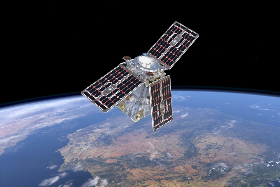
Artist's impression of HydroGNSS in orbit. Credit: ESA/ATG Medialab.
Key features
- Mission: HydroGNSS is the first ESA Scout mission, designed to measure hydrological climate variables using small satellites.
- Launch: The mission is scheduled to launch in November 2025, on a SpaceX rocket.
- Instrument: HydroGNSS uses GNSS-Reflectometry to remotely sense soil moisture, permafrost, inundation, biomass, wind speed, and sea ice extent.
- Accuracy: HydroGNSS is designed to deliver climate data with a sensitivity of 0.7–3.8 dB per 10% change in geophysical parameters and a spatial resolution of 2–7 km.
- Mission Life: Planned operational life of three years and possible extension up to five or six years
- UK Role: The UK leads the mission, with SSTL designing, building, and operating the satellites, supported by national and European partners.
The HydroGNSS Scout-class mission consists of two satellites. The purpose is to measure parameters linked to Essential Climate Variables (ECVs) - key indicators that are used to describe the Earth’s changing climate on a global scale. Collectively, there are 55 ECVs which provide empirical evidence to support climate science and better predict future change. Of these, around 60% can be addressed by satellite data.
Using Global Navigation Satellite System Reflectometry (GNSS-R), HydroGNSS will remotely sense hydrological climate variables including soil moisture, permafrost freeze-thaw state, inundation, above-ground forest biomass, and wind speed over the ocean and sea ice extent.
These measurements support climate and weather modelling, agricultural planning, and flood preparedness.
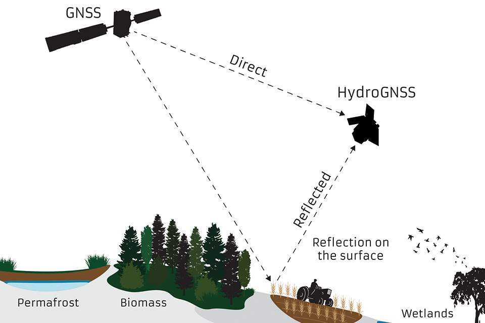
Diagram: GNSS satellite signal direct and reflected to HydroGNSS satellite, studying permafrost, biomass, soil moisture and wetlands.
The two satellites weigh around 65kg each, similar in mass and size to a household washing machine. The mission is funded by ESA’s Scout programme and progress to date follows early-stage development funding via the UK’s Centre for Earth Observation Instrumentation to accelerate the maturation of critical technologies.
HydroGNSS paves the way for an affordable future constellation that can offer much more frequent, responsive measurements than is possible with traditional remote sensing satellite systems. This offers a new ability to monitor very dynamic phenomena, such as diurnal soil moisture changes and freeze and thaw cycles of permafrost, and helps to fill the gaps in our monitoring of the Earth’s vital signs for the future.
UK involvement
Funded by the UK Space Agency with £26 million and the European Space Agency. Led by Surrey Satellite Technology Ltd (SSTL), working closely with partners at Sapienza, Tor Vergata and IFAC-CNR in Italy, FMI in Finland, ICE/IEEC in Spain, National Oceanographic Centre (NOC) in UK, and University of Nottingham to tackle the scientific and technological challenges involved. The mission and satellite are designed, built and operated in the UK by Surrey Satellite Technology Ltd.
CubeMAP
Key features
The Scout CubeMAP mission will be a constellation of multiple separate CubeSats.
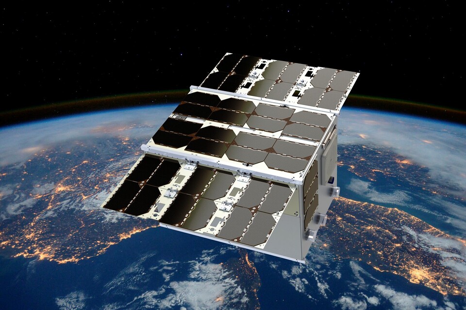
Artist's impression of CubeMAP in orbit. Credit: CubeMAP consortium
Its goal is to study, understand, and quantify processes in the tropical upper troposphere and stratosphere (UTS), particularly in the context of climate change and increased emissions in the tropics. The mission will provide insights on the composition of the UTS, study its variability, and its effects on climate and vice-versa.
In particular, the constellation will make observations in tropical and sub-tropical latitudes to observe aerosols and gases such as:
- water vapour
- carbon dioxide
- methane
- nitrous oxide
All of these play a key role in the greenhouse effect and climate change.
The mission is packed with novelty and innovation: a novel concept of measurement from a constellation is used to profile the atmosphere, for which the sun, the atmosphere and the satellite are aligned; and new instrument technologies enable miniaturisation and the use of nanosatellites.
The mission comprises three 12-litre cubesats, each carrying thermal infrared spectrometers, as well as a visible near-infrared hyperspectral solar disk imager as a secondary instrument.
UK involvement
The UK is the initiator and the scientific and payload lead of the mission. With the contract now signed, GomSpace in Denmark will lead an industrial consortium to build CubeMAP. The consortium includes Rutherford Appleton Laboratory (RAL) in the UK, GomSpace in Luxembourg and in Sweden, Enpulsion in Austria, Hyperion in the Netherlands and Kongsberg Satellite Services (KSAT) in Norway.
Updates to this page
Last updated 6 November 2025 Show all updates-
Updated HydroGNSS content.
-
First published.