UK takes over leadership of International Charter Space and Major Disasters
The UK Space Agency's six-month leadership begins this week.
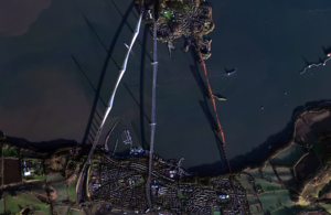
The Forth Bridges connecting Fife and Edinburgh in Scotland. Credit: Vision-1 © Airbus Defence and Space Limited 2023.
The UK Space Agency is taking over the leadership of the International Charter Space and Major Disasters (The Charter), which provides data from satellites to aid disaster response around the world.
The UK Space Agency’s six-month leadership will begin with the 49th Board Meeting of the Charter in Edinburgh this week (24 – 28 April 2023), attended by space agencies and organisations from across the globe.
The Charter has 17 members and 270 contributing satellites, supporting people in need in 131 countries. This mobilises space agencies and satellite operators across the globe and benefits from their knowledge and satellites through a single access point which operates 24 hours a day, 7 days a week and at no cost to the user.
Dr Paul Bate, Chief Executive of the UK Space Agency, said:
All too often we hear reports of the devastating and far-reaching consequences of natural disasters on communities across the globe. Satellites play an important role in the response, with Earth observation data used worldwide to map, monitor and mitigate impacts and, ultimately, to save lives.
That is why the UK is a proud member of the International Charter Space and Major Disasters, which has been activated more than 800 times since November 2000.
As we assume the leadership of the Charter we look forward to working with our fellow members to drive forward this vital humanitarian service.
Since it launched, the Charter has been activated over 815 times to date for natural and man-made disasters such as cyclones, floods, landslides, earthquakes and oil spills.
UK Government minister for Scotland, John Lamont, said:
I would like to welcome the members of the International Charter Space and Major Disasters to Edinburgh as the UK begins our six-month leadership.
The Charter is a fantastic example of how the international community can work together to help with natural disasters around the world. Here in Scotland, we have seen the benefits of this group with the satellite imagery of the flooding in Aberdeenshire last year which helped local agencies deal with the issue.
Weather-related disasters are the most common cause for a Charter activation. On average, the Charter is activated 42 times per year, although since 2020 this has risen to an annual average of 50. This included an activation for flooding in Scotland in November 2022.
What is the Charter?
Formed on 20 October 2000 by the European Space Agency (ESA), French Space Agency (CNES) and the Canadian Space Agency (CSA), with the UK joining in 2005, the Charter is a worldwide collaboration, making satellite data available to help with disaster management.
It helps us respond to major natural and human-made disasters, with the aim of saving lives and livelihoods. Information and maps derived from satellite data sourced via the Charter assists the coordination of resources and expertise for rapid response in major disaster situations, helping civil protection authorities and the international humanitarian community.
The Charter can be activated by authorised users from over 80 countries and the UN, as a cooperating body. All countries can ask an authorised country to activate the Charter on their behalf, meaning the Charter can be used by any country in need, anywhere in the world. Any country can also apply to become an Authorised User under the Charter’s universal access initiative.
What happens when disaster strikes?
When a disaster strikes, an Authorised User (AU) activates the Charter, kick-starting an international effort. In some cases, co-operating bodies and organisations may request further data. Next, an On-Duty Operator, who is available 24 hours a day, verifies the activation and forwards it to an Emergency On-Call Officer (ECO). The ECO then prepares by identifying available satellites and which of those would be the best ones to use based on the disaster type and circumstances. This plan is submitted to the relevant satellite operators, who task their satellites accordingly.
Then, a Project Manager (PM), an expert in data handling, is assigned by the Executive Secretariat to assist the AU. The PM coordinates the delivery of maps from the Value-Added Providers - they take the data provided by member agencies and interpret this, assessing what they see from the satellites; for example, in a flood they can monitor and track the change in flood extent and water levels. These maps are then given to the end-user to plan their disaster management and relief efforts.
The Charter and the UK
Since 2005 the UK has contributed satellite imagery and operations to the Charter through the DMC Constellation and high-resolution Vision-1 satellites, operated by Airbus Defence and Space Limited. The UK team at Airbus performs Emergency on-Call Officer duties and jumps into action to task these UK missions and provide disaster response imagery whenever required.
The UK has activated the Charter on multiple occasions, the last time as recent as November 2022 for flooding in Scotland, with torrential rail causing roads and rail travel to be impacted, with school closures and power cuts affecting areas in Aberdeenshire.
The satellite imagery of the area provided by the Canadian Space Agency’s RADARSAT RCM assisted the Scottish Environment Protection Agency in determining flood extent and the height of the water levels over large areas, resulting in the issuing of relevant warnings as well as planning and preparation for any rescues.
The Charter is an invaluable international tool that frequently provides lifesaving information and data. So spread the word and be assured that, when the next disaster hits, there are globally connected teams working together and using satellites to save lives.