Advice to road users in Surrey and London this weekend
Road users planning to travel through Surrey and London during the Prudential RideLondon cycling events this Sunday (10 August) are strongly advised to leave extra time and plan their journeys.
The route of RideLondon has been amended slightly in 2014 from previous years, requiring the closure of the entry slip roads of the A3 at Esher Common from 5am until approximately 3.30pm.
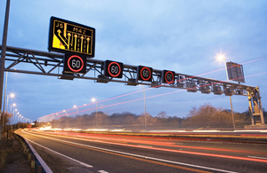
While no other closures are planned on the roads managed by the Highways Agency, many of the local roads in London and parts of Surrey will be closed while the cycling events take place. This means there may be more traffic on other roads, particularly the Highways Agency major roads such as the M25 and M4.
Steve Bush, Highways Agency Emergency Planner said:
We know from last year’s event, that roads in parts of Surrey and London will either be closed or busy on the day of these cycling events, and that traffic that normally uses the local roads may end up using major routes such as the M25.
We will be monitoring the traffic on our roads and working with the event organisers to help keep road users moving during the weekend. We are asking drivers to plan ahead of their journey in this area, whether it is your normal journey or going on holiday, and to allow extra time.
Garrett Emmerson, Chief Operating Officer of Surface Transport at TfL, said:
The return of a bigger, better, Prudential RideLondon will once again show that London is the UK’s capital city for cycling. Londoners made the most of the Tour de France’s return to the capital earlier this month, and I’m sure that they’ll make the most of the opportunity to see more elite riders out on our roads. Road closures are necessary to facilitate this great traffic-free event so we are asking everyone to plan their travel to ensure they can continue to get around and enjoy the events and all London has to offer.
Additional Highways Agency traffic officers and incident support units will be ready to deal with any incidents as quickly as possible and patrols will be positioned at key locations to ensure a swift response.
Drivers can use a range of Highways Agency services to check real-time traffic conditions - they include an iPhone app, mobile website and regular updates on our Twitter feed at @HAtraffic_seast.
Full details of the events, including route maps, can be found on the event website.
In 2012, the Roads Minister asked the Highways Agency to investigate cycle provision hotspots on the Agency’s road network. Working closely with Sustrans, the charity which works to encourage sustainable transport, and using information from The Times ‘Cities Fit for Cycling’ campaign, the Agency identified 100 potential locations. Feasibility studies were carried out on the 20 highest priority sites and, following liaison with the Cyclist’s Touring Club and British Cycling, a list of 13 schemes across the country was drawn up to be delivered this year.
The Agency has also developed a new approach to developing cycling schemes which sees cycling improvements assessed separately from schemes for motorised vehicles. By separating out the cycling schemes the Agency guarantees that the highest priority locations will be considered for the construction of future cycling schemes.
General enquiries
Members of the public should contact the Highways Agency Information Line on 0300 123 5000.
Media enquiries
Journalists should contact the Highways Agency press office on 0844 693 1448 and use the menu to speak to the most appropriate press officer.