RHEA (Uganda) Drought & Flood Forecasting
Drought and Flood Mitigation Service in Uganda.

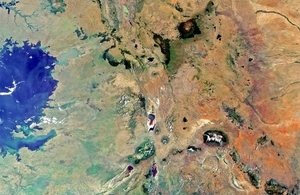
Kenya, Tanzania and Uganda pictured from space by Envisat. Credit: ESA.
Target Country
Uganda
Project Lead
RHEA
Project consortium
Environment Systems, Pixalytics, Databasix, AA International, AgriTechTalk International, HR Wallingford, UK Met Office, Mercy Corps, Oxford Policy Management.
International partners
Uganda Government Ministries, Kakira Sugar Company.
Project summary
The Drought and Flood Mitigation Service (DFMS) will provide the people of Uganda with practical information that will help them respond to the effects of climate change. The aim is to use satellite and ground-based data combined with drought and flood models, to help people respond to effects on agriculture. Information will be distributed by national, local government and commercial operators to farmers and relevant people such as Non-Government Organisations (NGO’s). Through better forecasts, local people can improve their lives and better protect key assets such as livestock and crops.
The focus is on improved climate modelling and its impact on agriculture enabled by the development of an innovative, open-source, integrated platform that is designed to assimilate diverse data sources ranging from satellite and meteorological data, as well as community/mobile sources which are obtained in the field.
The adaptable, easy-to-use Environment Early Warning Platform (EWP) uses cloud technologies for flexible deployment and processing, and is designed to encourage wide take up and a local development community around it.
Benefits include:
- A better ability to forecast and mitigate droughts and floods on a local actionable scale.
- NGOs will be able to target resources saving time, money and lives.
- Local stakeholders can improve their lives and better protect key assets such as livestock and crops. Once proven, the system will be adaptable globally for any similar area. The project will also generate evidence of use enabling further sustainable development through user buy-in from government, the independent sector and commercialisation of information dissemination.
Objectives
- Provide Uganda with an improved forecasting, disaster preparedness and mitigation ability, using satellite data combined with ground information sources enabling a holistic hazard and impact picture.
- Reduced risk of flood and drought impacts on the livelihoods of pilot communities by delivering the Drought and Flood Mitigation Service (DFMS) platform to the Ugandan Government, NGO sector and Commercial service providers to better support citizens, communities and users.
- Engage emerging networks of small holder farmers producing staple and cash crops for sale in real-time data collection and analysis, using apps and associated tool kits
- Develop an innovative cloud based technical platform providing support to local stakeholders and industry connections with small-scale farmers, and commercial agribusinesses, offering potential for further capacity building in other regions and impact sectors such as health.