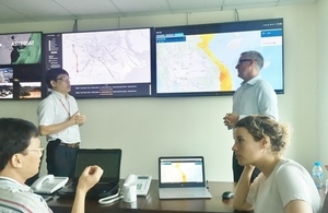
Recovery and Protection in Disaster (RAPID) for Vietnam
Our aim is to aid the Vietnamese in increasing their social and economic resilience to natural disaster events using satellites and IT.

Vietnam Office
Project title
Recovery and Protection In Disaster (RAPID) for Vietnam
Target Country
Vietnam
Project Lead
Stevenson Astrosat Ltd
Project consortium
Telespazio Vega
Local partner
Longhai Space Tech, Vietnam
Project summary
The project aim is to aid the Vietnamese in increasing their social and economic resilience to natural disaster events through the use of satellite and information technology. This project will provide Vietnam with a centralised disaster response platform (RAPID) fit for its needs, which fuses satellite and non-satellite information to allow Vietnamese responses to be optimised during disasters. It will also embed RAPID in active operations in a sustainable way by training 40 in-country Vietnamese trainers and rolling it out to at least 5 of the Key Municipalities for a series of back to back trials.
In addressing the needs of the Government, multiple government agencies will be benefitting from the services to be rendered by the RAPID system through continued cycle of operational development, deployment, trialing and review within 4 government agencies and throughout 5 provinces.
The project will also demonstrate and prove RAPID’s effectiveness on disaster command response. This measure will be a practical evaluation of how RAPID has improved first response activities in saving lives and protecting property with respect to Vietnam’s own goals as well as to UN suitability goal 1.5 (specifically 1.5.1, 1.5.2 and 1.5.3).
Objectives
To better resource and task first responders to disasters through the rollout of Astrosats’ Recovery And Protection In Disaster (RAPID) tool as a centralised space driven situational awareness and decision making system to fulfill the government’s needs. Specific objectives:
- Increase technological and operational prediction of typhoon land fall – location, severity and timing for all of Vietnam.
- For 5 Key provinces, provide mapping of key “at-risk” critical infrastructure with updated live Space and Ground data feeds fed into the system.
- Enhance flood extent mapping timeliness and effectiveness by providing updated flood maps no more than 12 hours after a typhoon strikes.
- Using Space-Based capability provide integrated asset tracking for Live Humanitarian Assistance and Disaster Relief (HADR) ground resources for 4 deployments.
- Demonstrate through field trials with a shadow team in live disaster scenario to prove RAPID increases operational first responder response.