UK and Ontario to share knowledge and technology behind the National Underground Asset Register
UK and Ontario sign a collaboration agreement at the Geospatial Summit to share the knowledge and technology behind the National Underground Asset Register.
- UK and Government of Ontario, Canada sign a collaboration agreement to share the knowledge and technology behind the UK’s National Underground Asset Register (NUAR)
- NUAR is a new digital map of underground pipes and cables that will revolutionise the way we install, maintain, operate and repair the infrastructure buried beneath our feet
- Ontario Minister of Infrastructure meets UK Minister for Intellectual Property, at international Geospatial Summit, to deepen UK-Ontario research and technology ties
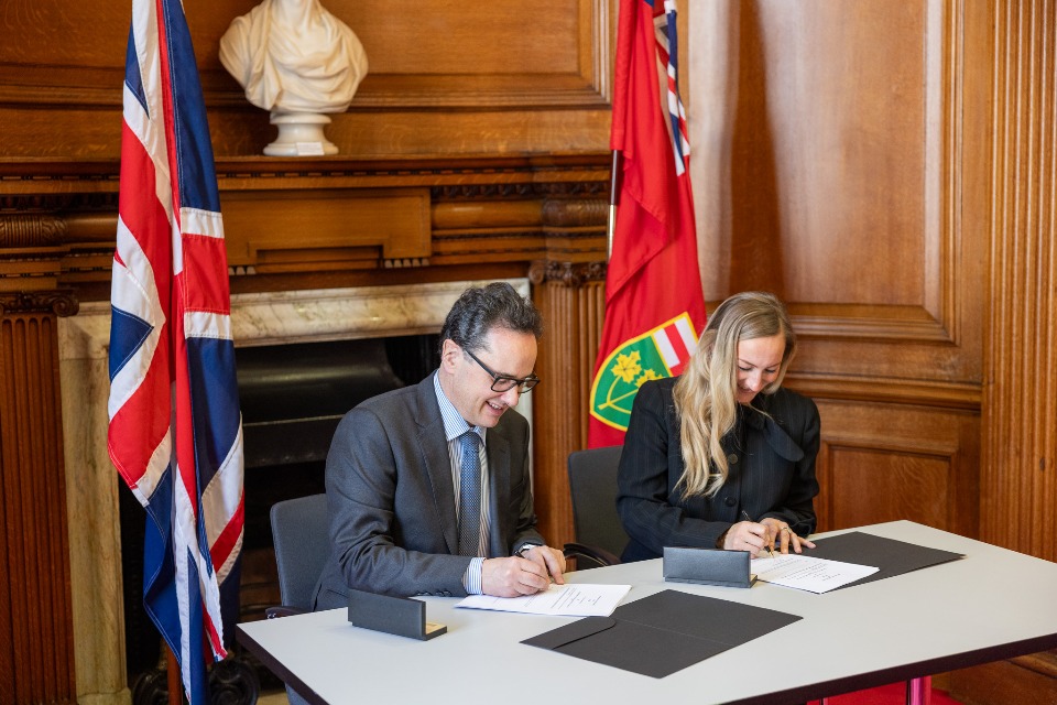
UK Minister for Intellectual Property, Viscount Camrose, and Government of Ontario Minister of Infrastructure, Kinga Surma, have signed a Memorandum of Understanding (MoU) to share the knowledge and technology behind the National Underground Asset Register (NUAR) at the Geospatial Summit in London today (Tuesday 26 March).
NUAR is a new digital map of underground pipes and cables that will revolutionise the way we install, maintain, operate and repair the pipes and cables buried beneath our feet. Once operational, NUAR is envisaged to deliver £490 million per year (circa £5 billion over a decade) of economic growth through increased efficiency, reduced asset strikes (when underground pipes and cables are accidentally damaged) and reduced disruptions for the public and businesses.
NUAR underpins the government’s priority to get the economy growing; expediting projects like new roads, new houses and broadband roll-out.
Today’s agreement paves the way for the Geospatial Commission to share best practice and technology from NUAR with Infrastructure Ontario and the parties will collaborate to improve worker safety, reduce asset strikes and improve the accuracy of geospatial infrastructure data - using UK technology and knowledge to support Canadian infrastructure.
Viscount Camrose, Minister for Intellectual Property said:
I am delighted that the Ontario government has recognised the excellent work that that has been done in the UK by the Geospatial Commission in developing the National Underground Asset Register, and the significant value that the work could bring to Ontario’s infrastructure and economy. This agreement both strengthens the longstanding UK and Ontario relationship and shows the strength of the geospatial sector in the UK.
The Honourable Kinga Surma, Ontario Minister of Infrastructure said:
The Ontario and UK governments have always been great partners, including sharing our collective knowledge and experience in the infrastructure sector. With this agreement, we will continue to learn from and collaborate with the Geospatial Commission, so that we can speed-up the delivery of key infrastructure projects in Ontario. I look forward to strengthening this partnership, as our governments explore and implement innovative solutions that support the modern infrastructure needs of our growing communities.
Geospatial Summit
The MoU was signed at the Geospatial Summit, which is taking place today and tomorrow. Viscount Camrose and Minister Kinga Surma opened the Summit with speeches thanking the attendees for coming together to discuss how new and emerging geospatial technology can support global and local resilience.
Over 60 national and international delegates are coming together from the policy, data and geospatial tech communities.
The main areas of discussion are on the role that geospatial technology can play in responding to and supporting those impacted by various resilience challenges. The Summit aims to provide a common understanding of how, why and where geospatial technology innovation is having a significant impact on resilience activities.