Coding process: 2B Coding Plan
The analysis will feed into a plan that shows the areas of the authority to which the code will apply along with the distribution of the area types.
The plan also shows major development sites based on local plan allocations that will be subject to the masterplanning exercise in Step 2C.
The existing built-up area to be covered by the code needs to be identified as an area type or a mixture of area types as illustrated in Figure 10.
Some places will include only a few area types, and some may include examples of all ten types. A limited number of area types should be identified to avoid the design code being too complex.
Area types can include other uses, such as a small factory or school within a suburban area type. The principle being that, if that site came up for development, then it would be appropriate to be guided by the identified area type.
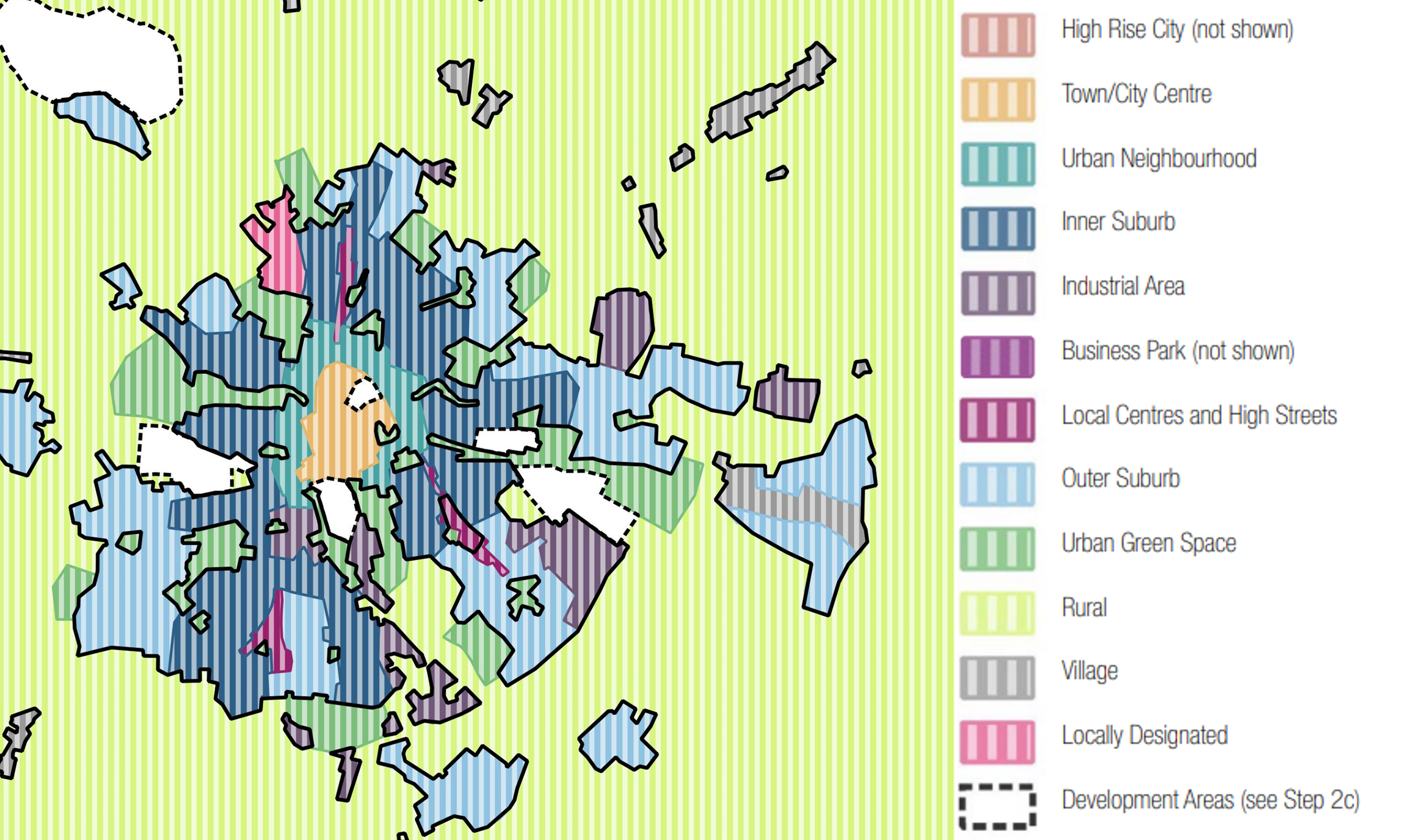
Figure 9. Coding Plan: This plan shows the area to be covered by the code and divides this up into a series of area types as described opposite. Most places will not include all of these area types, and some may include types that fall outside all of these examples.
[Alt text: This is an illustrative map of a fictional mid-sized town, with different areas coloured according to the area type that has been assigned. The map has been produced using a set of example area types, developed for this document. They include the following types. Descriptions are given for these in the following text]
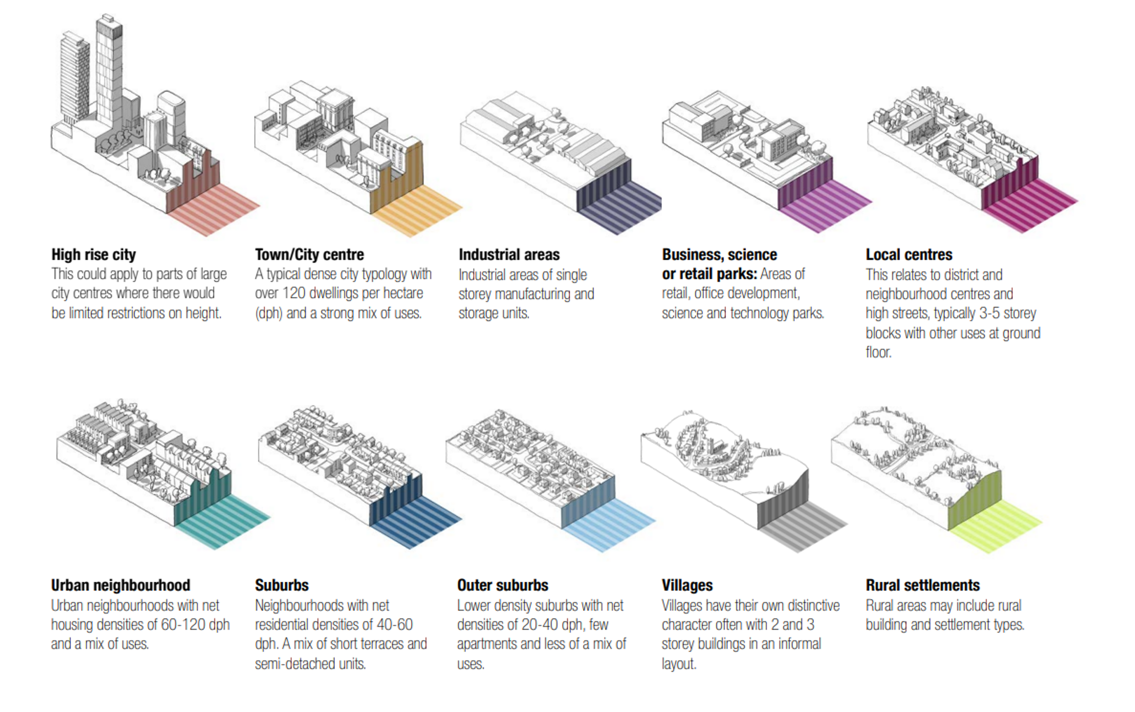
Figure 10. Example Area Types
High rise city.
This could apply to parts of large city centres where there would be no or limited restrictions on height.
Town/City centre.
A typical dense city typology with over 120 dwellings per hectare (dph) and a strong mix of uses.
Industrial areas.
Industrial areas of single storey manufacturing and storage units.
Business, science or retail parks.
Areas of retail, office development, science and technology parks.
Local centres.
This relates to district and neighbourhood centres and high streets, typically 3 to 5 storey blocks with other uses at ground floor.
Urban neighbourhood.
Urban neighbourhoods with net housing densities of 60 to 120 dph and a mix of uses.
Suburbs.
Neighbourhoods with net residential densities of 40 to 60 dph. A mix of short terraces and semi-detached units.
Outer suburbs.
Lower density suburbs with net densities of 20 to 40 dph, few apartments and less of a mix of uses.
Villages.
Villages have their own distinctive character often with 2 and 3 storey buildings in an informal layout.
Rural settlements.
Rural areas may include rural building and settlement types.