Coding process: 1B Baseline
Design codes need to be based on an analysis of the area covered. The purpose of the analysis is to understand the area and inform a vision that will, in turn, form the basis for the code.
Local planning authorities will need to have an understanding of their area informed by up-to-date evidence such as characterisation studies or site analysis, with input from the community, to support design coding. Local planning authorities may already hold this information, so it is possible that they will not need to carry out further analysis for the purpose of producing a design code. The analysis could include:
- Topographical, geology, ecology, river and waterways, flood risk.
- Landscape character including wider area.
- Open space and green infrastructure.
- Local character.
- Heritage and culture assets, including conservation areas.
- Land use, economic uses.
- Built form, density, massing.
- Community infrastructure and schools.
- Public transport accessibility.
- Road/street hierarchy.
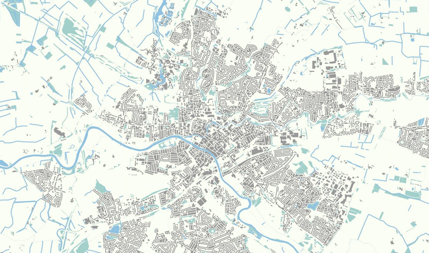
Figure 3. Figure Ground Plan: A set of analysis plans can help understand the local area and inform area types described on the following pages.
This analysis will feed into the identification of the ‘area types’ described in the next two steps as well as providing a baseline on issues such as street hierarchy, open space provision, public transport and community facilities that will inform elements of the code.
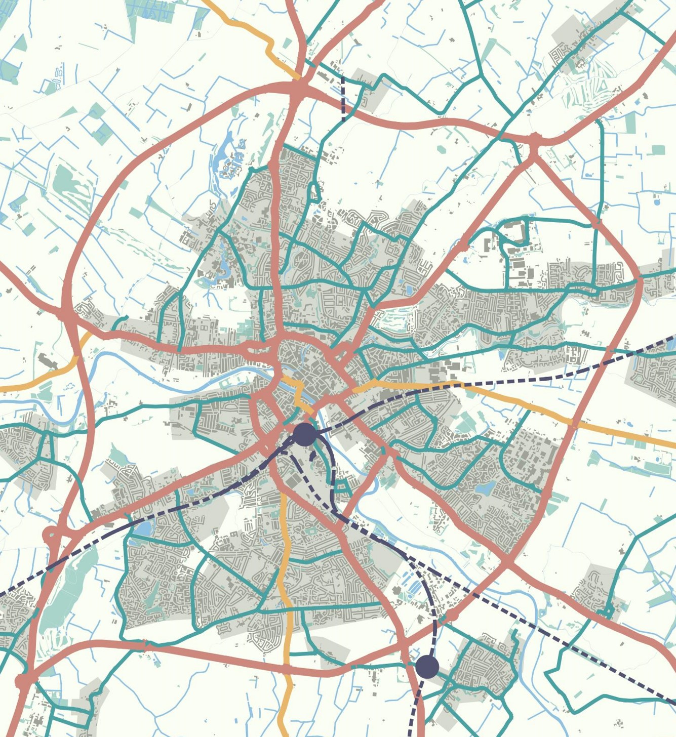
Figure 4. Street Hierarchy: Parts of the design code relate to the character of different street types. This would be facilitated by classifying all of the streets of the local area on the basis of a street hierarchy. This can be done by identifying primary streets and secondary streets, the remainder being local streets.
![]()
Figure 5. Transport Accessibility: Parts of the design code may allow an increase in densities or building heights in areas of high public transport accessibility. If this is the case, it will be important to have a plan showing public transport accessibility such as a public transport accessibility level plan or equivalent.
[Alt text: Transport Accessibility. The illustration shows a transport accessibility plan of a fictional mid-sized town. Bus stops are illustrated by a dark blue point, surrounded by a blob indicating an 800 meter walking distance. Train stations are illustrated with a black point, surrounded by a larger red blob. This indicates the larger distance people are willing to travel to by walking and cycling to reach a train station. ]
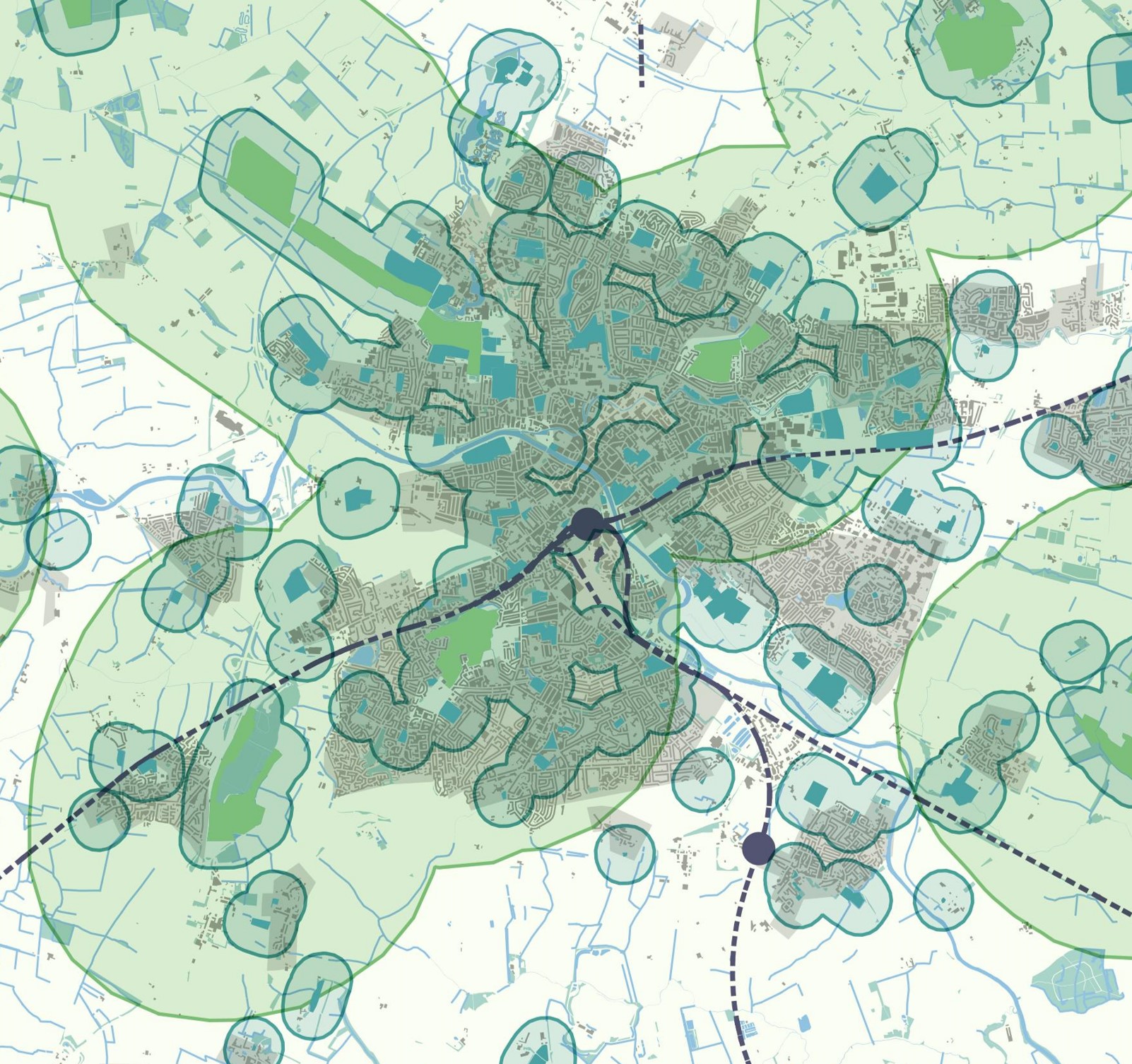
Figure 6. Open Space Provision: The Nature section of the design code relates to open space provision, ecology, green and blue environments and their resilience. There may be value in having an authority wide plan showing each type of open space and natural designations and their relevant proximity zones.
[Alt text: Open Space Provision. The illustration shows an open space plan of a fictional mid-sized town. Large green spaces are shown in light green and smaller green spaces are shown in dark green. Blobs drawn around the green spaces illustrate accessible natural green space standards, which state, for example, that people should have access to green space of a certain size within 5 minutes walk of their home.]
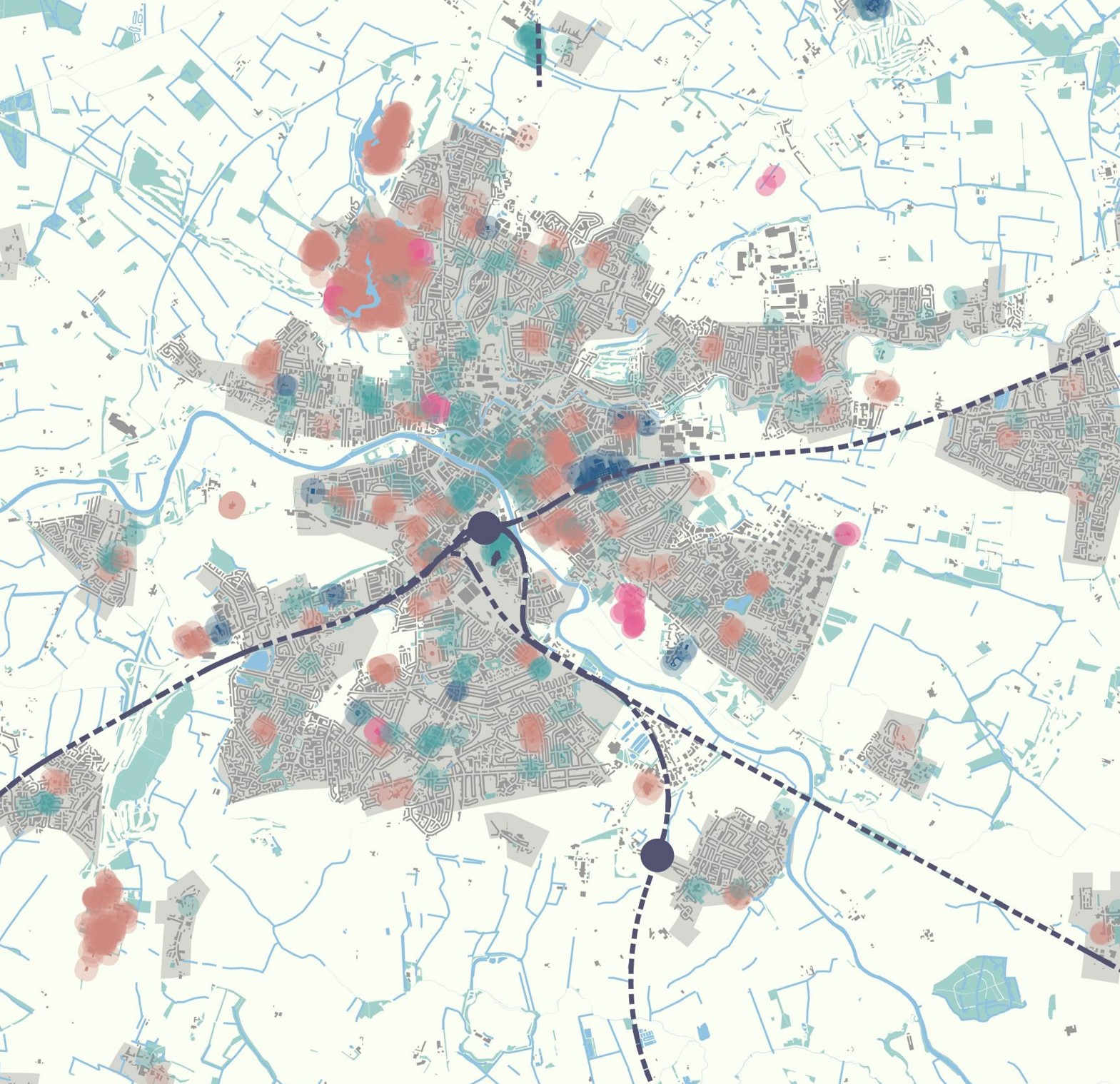
Figure 7. Land Use Pattern: The use section of the design code relates to land use pattern, including cultural spaces, schools and other community facilities and again it may be useful to have an authority-wide plan showing the location of existing facilities.